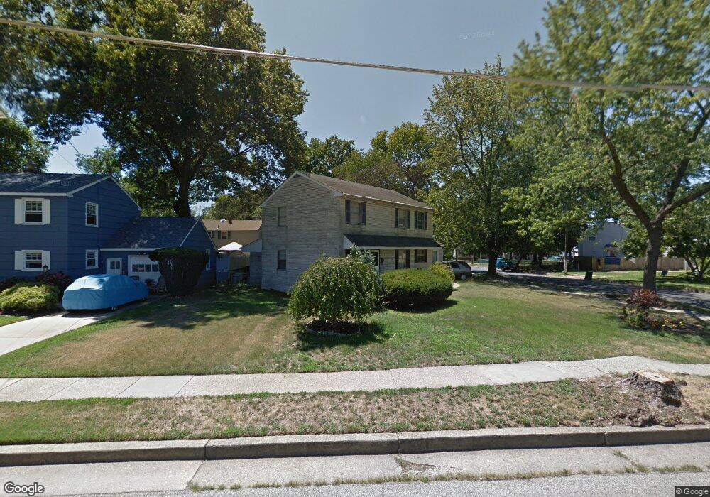
5000 Walnut Ave Pennsauken, NJ 08109
Estimated Value: $332,199 - $369,000
--
Bed
--
Bath
1,600
Sq Ft
$216/Sq Ft
Est. Value
About This Home
This home is located at 5000 Walnut Ave, Pennsauken, NJ 08109 and is currently estimated at $346,300, approximately $216 per square foot. 5000 Walnut Ave is a home located in Camden County with nearby schools including Pennsauken High School, St. Peter Elementary School, and St. Cecilia School.
Ownership History
Date
Name
Owned For
Owner Type
Purchase Details
Closed on
Jul 18, 2003
Sold by
Perry Dennis Scott
Bought by
Paluszewski Christopher and Paluszewski Regina
Current Estimated Value
Home Financials for this Owner
Home Financials are based on the most recent Mortgage that was taken out on this home.
Original Mortgage
$88,800
Outstanding Balance
$37,810
Interest Rate
5.28%
Estimated Equity
$308,490
Purchase Details
Closed on
Mar 17, 1995
Sold by
Miller William H
Bought by
Perry Dennis Scott and Cataldi Nicole Lucille
Home Financials for this Owner
Home Financials are based on the most recent Mortgage that was taken out on this home.
Original Mortgage
$99,000
Interest Rate
8.89%
Create a Home Valuation Report for This Property
The Home Valuation Report is an in-depth analysis detailing your home's value as well as a comparison with similar homes in the area
Home Values in the Area
Average Home Value in this Area
Purchase History
| Date | Buyer | Sale Price | Title Company |
|---|---|---|---|
| Paluszewski Christopher | $111,000 | -- | |
| Perry Dennis Scott | $99,000 | -- |
Source: Public Records
Mortgage History
| Date | Status | Borrower | Loan Amount |
|---|---|---|---|
| Open | Paluszewski Christopher | $88,800 | |
| Previous Owner | Perry Dennis Scott | $99,000 |
Source: Public Records
Tax History Compared to Growth
Tax History
| Year | Tax Paid | Tax Assessment Tax Assessment Total Assessment is a certain percentage of the fair market value that is determined by local assessors to be the total taxable value of land and additions on the property. | Land | Improvement |
|---|---|---|---|---|
| 2025 | $6,502 | $276,900 | $63,900 | $213,000 |
| 2024 | $6,376 | $149,400 | $48,500 | $100,900 |
| 2023 | $6,376 | $149,400 | $48,500 | $100,900 |
| 2022 | $5,765 | $149,400 | $48,500 | $100,900 |
| 2021 | $5,921 | $149,400 | $48,500 | $100,900 |
| 2020 | $5,304 | $149,400 | $48,500 | $100,900 |
| 2019 | $5,365 | $149,400 | $48,500 | $100,900 |
| 2018 | $5,393 | $149,400 | $48,500 | $100,900 |
| 2017 | $5,404 | $149,400 | $48,500 | $100,900 |
| 2016 | $5,307 | $149,400 | $48,500 | $100,900 |
| 2015 | $5,465 | $149,400 | $48,500 | $100,900 |
| 2014 | $5,506 | $99,000 | $27,200 | $71,800 |
Source: Public Records
Map
Nearby Homes
- 5532 Whitman Terrace
- 3241 N 48th St
- 3300 Springfield Ave
- 3204 Merchantville Ave
- 5745 Cedar Ave
- 320 W Maple Ave
- 2446 46th St
- 6116 Rogers Ave
- 5507 Wayne Ave
- 220 Volans St
- 21 Alexander Ave
- 2154 Browning Rd
- 41 Alexander Ave
- 2404 42nd St
- 15 W Walnut Ave
- 2254 Hollinshed Ave
- 116 N Centre St
- 6151 Harvey Ave
- 6134 Grant Ave
- 2232 42nd St
- 5010 Walnut Ave
- 3300 Browning Rd
- 3306 Browning Rd
- 5016 Walnut Ave
- 5030 Whitman Terrace
- 5011 Walnut Ave
- 3314 Browning Rd
- 3236 Browning Rd
- 5015 Whitman Terrace
- 5021 Whitman Terrace
- 5021 Walnut Ave
- 5022 Walnut Ave
- 5027 Whitman Terrace
- 3322 Browning Rd
- 5040 Whitman Terrace
- 5033 Whitman Terrace
- 3230 Browning Rd
- 3257 Browning Rd
- 5031 Walnut Ave
- 5028 Walnut Ave