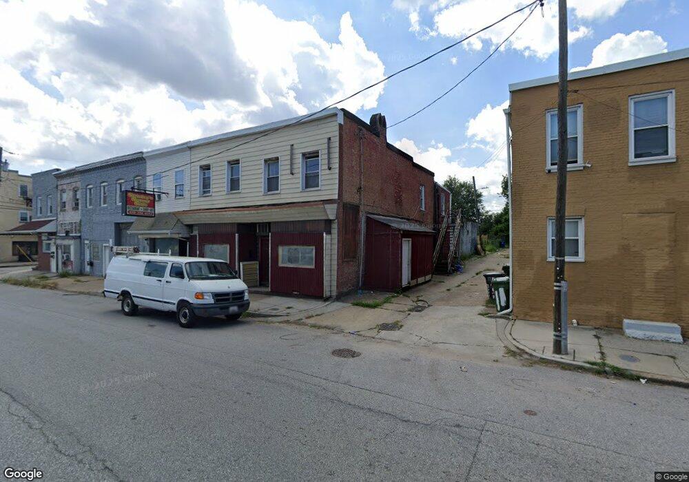
5002 Curtis Ave Baltimore, MD 21226
Curtis Bay NeighborhoodEstimated Value: $196,144
Studio
--
Bath
4,468
Sq Ft
$44/Sq Ft
Est. Value
About This Home
This home is located at 5002 Curtis Ave, Baltimore, MD 21226 and is currently estimated at $196,144, approximately $43 per square foot. 5002 Curtis Ave is a home located in Baltimore City with nearby schools including Curtis Bay Elementary School, Booker T. Washington Middle School, and Benjamin Franklin High School.
Ownership History
Date
Name
Owned For
Owner Type
Purchase Details
Closed on
Nov 1, 2007
Sold by
Perry Roger
Bought by
Fitzsimmons Samuel D
Current Estimated Value
Purchase Details
Closed on
Dec 18, 2000
Sold by
Listman Charles K
Bought by
Perry Roger and Walsh Lisa
Purchase Details
Closed on
Jun 24, 1994
Sold by
Mazzetta E S
Bought by
Listman Charles K
Home Financials for this Owner
Home Financials are based on the most recent Mortgage that was taken out on this home.
Original Mortgage
$60,000
Interest Rate
8.74%
Mortgage Type
Commercial
Create a Home Valuation Report for This Property
The Home Valuation Report is an in-depth analysis detailing your home's value as well as a comparison with similar homes in the area
Home Values in the Area
Average Home Value in this Area
Purchase History
| Date | Buyer | Sale Price | Title Company |
|---|---|---|---|
| Fitzsimmons Samuel D | $105,000 | -- | |
| Perry Roger | $45,000 | -- | |
| Listman Charles K | $94,000 | -- |
Source: Public Records
Mortgage History
| Date | Status | Borrower | Loan Amount |
|---|---|---|---|
| Previous Owner | Listman Charles K | $60,000 |
Source: Public Records
Tax History
| Year | Tax Paid | Tax Assessment Tax Assessment Total Assessment is a certain percentage of the fair market value that is determined by local assessors to be the total taxable value of land and additions on the property. | Land | Improvement |
|---|---|---|---|---|
| 2025 | $2,737 | $123,167 | -- | -- |
| 2024 | $2,737 | $116,533 | -- | -- |
| 2023 | $2,594 | $109,900 | $20,900 | $89,000 |
| 2022 | $2,561 | $108,533 | $0 | $0 |
| 2021 | $2,529 | $107,167 | $0 | $0 |
| 2020 | $2,257 | $105,800 | $20,900 | $84,900 |
| 2019 | $2,218 | $104,633 | $0 | $0 |
| 2018 | $2,230 | $103,467 | $0 | $0 |
| 2017 | $2,237 | $102,300 | $0 | $0 |
| 2016 | $2,326 | $97,767 | $0 | $0 |
| 2015 | $2,326 | $93,233 | $0 | $0 |
| 2014 | $2,326 | $88,700 | $0 | $0 |
Source: Public Records
Map
Nearby Homes
- 1631 Ceddox St
- 1601 Ceddox St
- 1601 Cereal St
- 1501 Church St
- 4703 Pennington Ave
- 4616 Curtis Ave
- 4613 Pennington Ave
- 4529 Pennington Ave
- 4525 Pennington Ave
- 4415 Fairhaven Ave
- 1626 Hazel St
- 1509 Locust St
- 4222 Grace Ct
- 4211 Grace Ct
- 4203 Morrison Ct
- 4116 Morrison Ct
- 4115 Morrison Ct
- 4030 Pennington Ave
- 1616 Plum St
- 1326 Tompkins St
- 5006 Curtis Ave
- 5008 Curtis Ave
- 5012 Curtis Ave
- 5014 Curtis Ave
- 1649 Ceddox St
- 1647 Ceddox St
- 1630 Benhill Ave
- 1645 Ceddox St
- 1651 Ceddox St
- 1643 Ceddox St
- 1641 Ceddox St
- 1628 Benhill Ave
- 1639 Ceddox St
- 1637 Ceddox St
- 1626 Benhill Ave
- 1635 Ceddox St
- 1624 Benhill Ave
- 1633 Ceddox St
- 1629 Ceddox St
- 1620 Benhill Ave
Your Personal Tour Guide
Ask me questions while you tour the home.