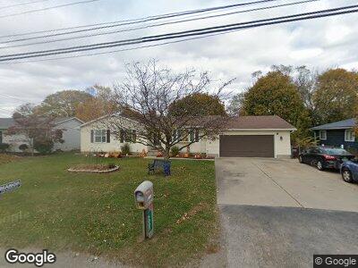
5002 W Albain Rd Monroe, MI 48161
Estimated Value: $223,000 - $265,000
3
Beds
3
Baths
1,304
Sq Ft
$187/Sq Ft
Est. Value
About This Home
This home is located at 5002 W Albain Rd, Monroe, MI 48161 and is currently estimated at $243,459, approximately $186 per square foot. 5002 W Albain Rd is a home located in Monroe County with nearby schools including Monroe High School, Pathway Christian School - PERMANENTLY CLOSED, and St Mary's Catholic Elementary School.
Ownership History
Date
Name
Owned For
Owner Type
Purchase Details
Closed on
Sep 26, 2016
Sold by
Browman Bruce and Browman Heather
Bought by
Knight Dennis K
Current Estimated Value
Home Financials for this Owner
Home Financials are based on the most recent Mortgage that was taken out on this home.
Original Mortgage
$126,000
Interest Rate
3.43%
Mortgage Type
New Conventional
Purchase Details
Closed on
Apr 18, 1997
Sold by
Desloover Edward J
Bought by
Mason Patricia A
Create a Home Valuation Report for This Property
The Home Valuation Report is an in-depth analysis detailing your home's value as well as a comparison with similar homes in the area
Home Values in the Area
Average Home Value in this Area
Purchase History
| Date | Buyer | Sale Price | Title Company |
|---|---|---|---|
| Knight Dennis K | $153,000 | First American Title | |
| Mason Patricia A | $126,500 | -- |
Source: Public Records
Mortgage History
| Date | Status | Borrower | Loan Amount |
|---|---|---|---|
| Open | Knight Dennis K | $118,500 | |
| Closed | Knight Dennis K | $126,000 | |
| Previous Owner | Broman Bruce | $126,800 | |
| Previous Owner | Broman Bruce | $146,800 | |
| Previous Owner | Broman Bruce | $16,000 | |
| Previous Owner | Mason Bobby Lee | $75,000 |
Source: Public Records
Tax History Compared to Growth
Tax History
| Year | Tax Paid | Tax Assessment Tax Assessment Total Assessment is a certain percentage of the fair market value that is determined by local assessors to be the total taxable value of land and additions on the property. | Land | Improvement |
|---|---|---|---|---|
| 2024 | $919 | $101,650 | $0 | $0 |
| 2023 | $875 | $80,100 | $0 | $0 |
| 2022 | $2,236 | $80,100 | $0 | $0 |
| 2021 | $2,162 | $80,150 | $0 | $0 |
| 2020 | $2,133 | $74,450 | $0 | $0 |
| 2019 | $781 | $74,450 | $0 | $0 |
| 2018 | $1,804 | $68,500 | $0 | $0 |
| 2017 | $1,716 | $68,500 | $0 | $0 |
| 2016 | $1,439 | $64,850 | $0 | $0 |
| 2015 | $2,397 | $56,950 | $0 | $0 |
| 2014 | $2,528 | $56,950 | $0 | $0 |
| 2013 | -- | $53,600 | $0 | $0 |
Source: Public Records
Map
Nearby Homes
- 14922 Wildwood Dr
- 14938 Nobil Dr
- 4923 Skylark Dr
- 4911 Skylark Dr
- 4887 Skylark Dr
- 5370 E Albain Rd
- 14392 Canterberry
- 15080 Peach Tree Ln
- 15058 Poplar Dr
- 335 Blackthorn Trail
- 4853 Southpointe Pkwy
- 0 Southpointe Pkwy Unit 50111716
- 4893 Southpointe Pkwy
- 0 S Telegraph Rd Unit 50171785
- 5206 Southpointe Pkwy
- 5399 E Dunbar Rd
- 7800 E Dunbar Rd
- 0 S Telegragph Unit 50120372
- 0 Plum Creek Dr
- 15486 Dayton Rd
- 5002 W Albain Rd
- 5004 W Albain Rd
- 4996 W Albain Rd
- 4990 W Albain Rd
- 5006 W Albain Rd
- 5010 W Albain Rd
- 5014 W Albain Rd
- 14925 Wildwood Dr
- 14943 Wildwood Dr
- 4941 W Albain Rd
- 14931 Wildwood Dr
- 5009 W Albain Rd
- 5018 W Albain Rd
- 14591 Lincoln Rd
- 14587 Lincoln Rd
- 14916 Wildwood Dr
- 5022 W Albain Rd
- 14583 Lincoln Rd
- 14594 Lincoln Rd
- 4991 Kay Dr