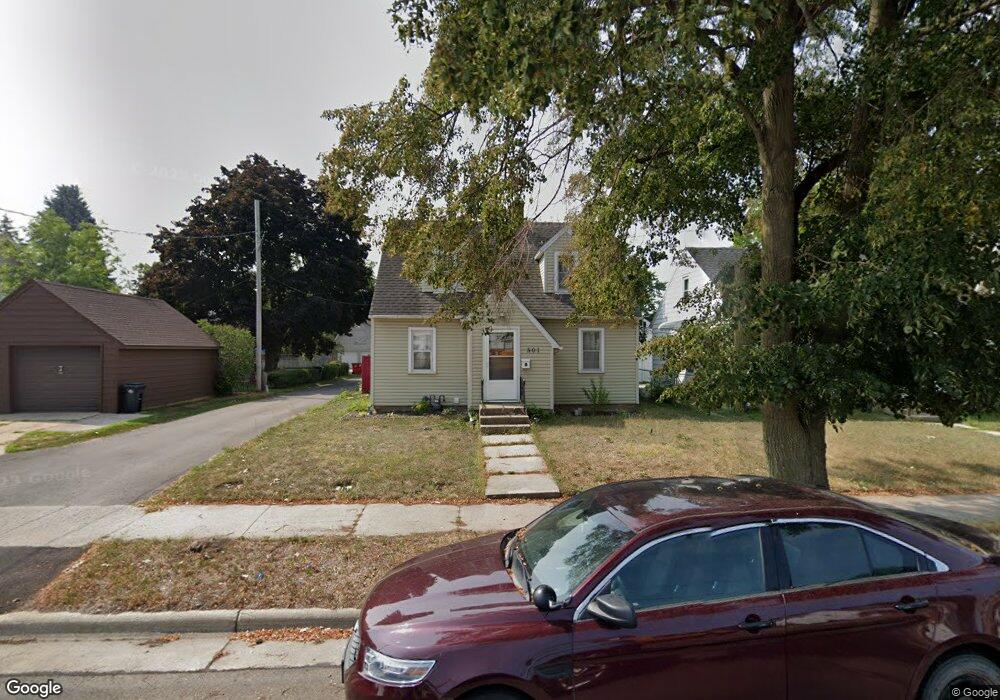
501 9th Ave SW Austin, MN 55912
Estimated Value: $128,000 - $162,000
3
Beds
2
Baths
1,074
Sq Ft
$135/Sq Ft
Est. Value
About This Home
This home is located at 501 9th Ave SW, Austin, MN 55912 and is currently estimated at $145,155, approximately $135 per square foot. 501 9th Ave SW is a home located in Mower County with nearby schools including Southgate Elementary School, Ellis Middle School, and I.J. Holton Intermediate School.
Ownership History
Date
Name
Owned For
Owner Type
Purchase Details
Closed on
Jul 7, 2020
Sold by
Hollerud Mark J and Hollerud Andrea
Bought by
Bernard Josiah and Morrison Jayden
Current Estimated Value
Home Financials for this Owner
Home Financials are based on the most recent Mortgage that was taken out on this home.
Original Mortgage
$101,850
Outstanding Balance
$90,481
Interest Rate
3.2%
Mortgage Type
New Conventional
Estimated Equity
$54,674
Purchase Details
Closed on
Oct 19, 2009
Sold by
Leidall Kermit L
Bought by
Hollerud Mark J
Home Financials for this Owner
Home Financials are based on the most recent Mortgage that was taken out on this home.
Original Mortgage
$55,378
Interest Rate
5.37%
Mortgage Type
FHA
Purchase Details
Closed on
Jul 21, 2009
Sold by
Hollerud Arthur F and Hollerud Sharon K
Bought by
Leidall Kermit L
Create a Home Valuation Report for This Property
The Home Valuation Report is an in-depth analysis detailing your home's value as well as a comparison with similar homes in the area
Home Values in the Area
Average Home Value in this Area
Purchase History
| Date | Buyer | Sale Price | Title Company |
|---|---|---|---|
| Bernard Josiah | $105,000 | Rochester Title | |
| Hollerud Mark J | $56,400 | None Available | |
| Leidall Kermit L | -- | None Available |
Source: Public Records
Mortgage History
| Date | Status | Borrower | Loan Amount |
|---|---|---|---|
| Open | Bernard Josiah | $101,850 | |
| Previous Owner | Hollerud Mark J | $55,378 |
Source: Public Records
Tax History Compared to Growth
Tax History
| Year | Tax Paid | Tax Assessment Tax Assessment Total Assessment is a certain percentage of the fair market value that is determined by local assessors to be the total taxable value of land and additions on the property. | Land | Improvement |
|---|---|---|---|---|
| 2025 | $1,146 | $123,000 | $18,800 | $104,200 |
| 2024 | $1,146 | $112,200 | $18,800 | $93,400 |
| 2023 | $1,038 | $105,200 | $18,800 | $86,400 |
| 2022 | $758 | $98,500 | $18,800 | $79,700 |
| 2021 | $730 | $76,600 | $14,900 | $61,700 |
| 2020 | $1,096 | $72,100 | $12,900 | $59,200 |
| 2018 | $423 | $67,300 | $12,900 | $54,400 |
| 2017 | $846 | $0 | $0 | $0 |
| 2016 | $806 | $0 | $0 | $0 |
| 2015 | $538 | $0 | $0 | $0 |
| 2012 | $538 | $0 | $0 | $0 |
Source: Public Records
Map
Nearby Homes
- 506 9th Ave SW
- 607 10th Ave SW
- 402 11th Ave SW
- 815 11th Ave SW
- 611 13th Ave SW
- 807 6th Ave SW
- 804 13th Ave SW
- 1008 9th Ave SW
- 605 4th Ave SW
- 800 5th Ave SW
- 309 3rd Ave SW
- 309 5th St SW
- 902 4th Ave SW
- 107 3rd Ave SW
- 404 S Main St
- 304 2nd Ave SW
- 304 9th St SW
- 1207 15th Ave SW
- 1103 2nd Ave SW
- 1009 1st Ave SW
- 503 9th Ave SW
- 505 9th Ave SW
- 515 9th Ave SW
- 1006 4th St SW
- 605 605 9th-Avenue-sw
- 1008 4th St SW
- 908 4th St SW
- 512 10th Ave SW
- 512 9th Ave SW
- 607 607 9th-Avenue-sw
- 906 4th St SW
- 514 9th Ave SW
- 600 10th Ave SW
- 514 9th Ave SW
- 904 4th St SW
- 602 10th Ave SW
- 602 602 10th-Avenue-sw
- 602 9th Ave SW
- 1100 4th St SW
- 607 9th Ave SW