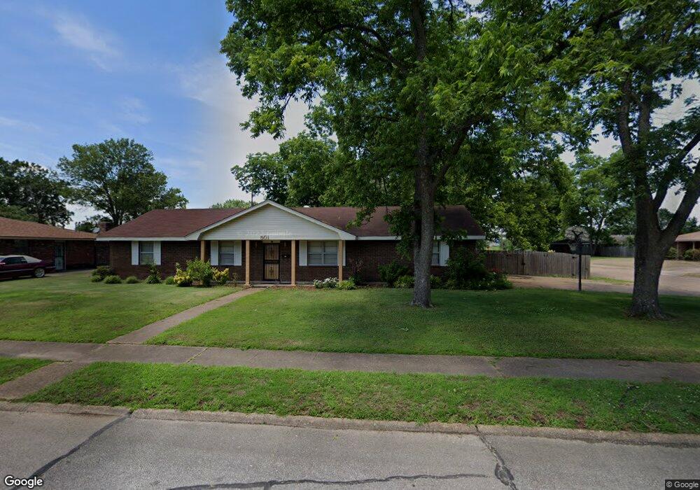
501 Colgate Dr West Memphis, AR 72301
Estimated Value: $104,000 - $167,000
3
Beds
2
Baths
1,348
Sq Ft
$104/Sq Ft
Est. Value
About This Home
This home is located at 501 Colgate Dr, West Memphis, AR 72301 and is currently estimated at $140,696, approximately $104 per square foot. 501 Colgate Dr is a home located in Crittenden County with nearby schools including Faulk Elementary School, Wonder Junior High School, and The Academies of West Memphis Charter School.
Ownership History
Date
Name
Owned For
Owner Type
Purchase Details
Closed on
Dec 7, 2021
Sold by
Stokes Edna
Bought by
Wilson James and Wilson Dorothy
Current Estimated Value
Home Financials for this Owner
Home Financials are based on the most recent Mortgage that was taken out on this home.
Original Mortgage
$109,250
Outstanding Balance
$100,305
Interest Rate
2.98%
Mortgage Type
New Conventional
Estimated Equity
$40,391
Purchase Details
Closed on
Jan 31, 1995
Sold by
Not Provided
Bought by
Stokes Edna
Purchase Details
Closed on
Dec 1, 1987
Bought by
Nin Liu Wai
Create a Home Valuation Report for This Property
The Home Valuation Report is an in-depth analysis detailing your home's value as well as a comparison with similar homes in the area
Home Values in the Area
Average Home Value in this Area
Purchase History
| Date | Buyer | Sale Price | Title Company |
|---|---|---|---|
| Wilson James | $115,000 | None Available | |
| Stokes Edna | $68,000 | -- | |
| Nin Liu Wai | $57,000 | -- |
Source: Public Records
Mortgage History
| Date | Status | Borrower | Loan Amount |
|---|---|---|---|
| Open | Wilson James | $109,250 |
Source: Public Records
Tax History Compared to Growth
Tax History
| Year | Tax Paid | Tax Assessment Tax Assessment Total Assessment is a certain percentage of the fair market value that is determined by local assessors to be the total taxable value of land and additions on the property. | Land | Improvement |
|---|---|---|---|---|
| 2024 | $822 | $17,020 | $3,200 | $13,820 |
| 2023 | $397 | $17,020 | $3,200 | $13,820 |
| 2022 | $447 | $17,020 | $3,200 | $13,820 |
| 2021 | $447 | $17,020 | $3,200 | $13,820 |
| 2020 | $771 | $17,020 | $3,200 | $13,820 |
| 2019 | $639 | $16,900 | $3,200 | $13,700 |
| 2018 | $339 | $16,900 | $3,200 | $13,700 |
| 2017 | $339 | $16,900 | $3,200 | $13,700 |
| 2016 | $339 | $16,900 | $3,200 | $13,700 |
| 2015 | $346 | $16,900 | $3,200 | $13,700 |
| 2014 | $406 | $18,370 | $3,200 | $15,170 |
Source: Public Records
Map
Nearby Homes
- 503 Tulane Dr
- 501 Oxford St
- 402 Oxford St
- 522 Lois Marie Cove
- 765 Dogwood Cove
- 715 Foxwood St
- 811 Maple Dr
- 806 W Walnut Dr
- 819 Walnut Dr
- 912 Mimosa Dr
- 1003 Mimosa Dr
- 920 Mimosa Dr
- 237 W Jefferson Ave
- 503 W Oliver Ave
- 905 Foxwood Cir
- 917 Foxwood Cir
- 323 W Oliver Ave
- 908 Winchell St
- 501 W Cooper Ave
- 511 W Cooper Ave
- 303 Princeton St
- 401 Princeton St
- 302 Princeton St
- 503 Colgate Dr
- 304 Princeton St
- 306 Princeton St
- 502 Colgate Dr
- 400 Princeton St
- 505 Colgate Dr
- 504 Colgate Dr
- 512 Auburn Ave
- 403 Princeton St
- 402 Princeton St
- 409 Tulane Dr
- 514 Auburn Ave
- 411 Tulane Dr
- 512 Colgate Dr
- 507 Colgate Dr
- 502 Auburn Ave
- 413 Tulane Dr