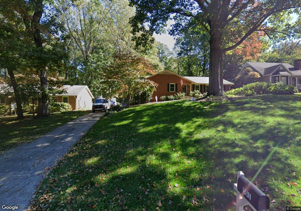
501 Commonwealth Dr Winston Salem, NC 27104
Stonebridge-Rollinghills NeighborhoodEstimated Value: $301,000 - $339,000
10
Beds
4
Baths
3,276
Sq Ft
$99/Sq Ft
Est. Value
About This Home
This home is located at 501 Commonwealth Dr, Winston Salem, NC 27104 and is currently estimated at $325,902, approximately $99 per square foot. 501 Commonwealth Dr is a home located in Forsyth County with nearby schools including Meadowlark Elementary School, Meadowlark Middle School, and Ronald W. Reagan High School.
Ownership History
Date
Name
Owned For
Owner Type
Purchase Details
Closed on
Sep 11, 2003
Sold by
Mickey Michael M and Mickey Kimberly M
Bought by
Nelson Christopher A and Nelson Kimberly S Lane
Current Estimated Value
Home Financials for this Owner
Home Financials are based on the most recent Mortgage that was taken out on this home.
Original Mortgage
$139,740
Outstanding Balance
$64,303
Interest Rate
6.24%
Mortgage Type
VA
Estimated Equity
$261,599
Create a Home Valuation Report for This Property
The Home Valuation Report is an in-depth analysis detailing your home's value as well as a comparison with similar homes in the area
Home Values in the Area
Average Home Value in this Area
Purchase History
| Date | Buyer | Sale Price | Title Company |
|---|---|---|---|
| Nelson Christopher A | $137,000 | -- |
Source: Public Records
Mortgage History
| Date | Status | Borrower | Loan Amount |
|---|---|---|---|
| Open | Nelson Christopher A | $139,740 |
Source: Public Records
Tax History Compared to Growth
Tax History
| Year | Tax Paid | Tax Assessment Tax Assessment Total Assessment is a certain percentage of the fair market value that is determined by local assessors to be the total taxable value of land and additions on the property. | Land | Improvement |
|---|---|---|---|---|
| 2025 | $3,189 | $372,300 | $64,000 | $308,300 |
| 2024 | $2,368 | $227,300 | $36,100 | $191,200 |
| 2023 | $2,368 | $176,900 | $36,100 | $140,800 |
| 2022 | $2,324 | $176,900 | $36,100 | $140,800 |
| 2021 | $2,282 | $176,900 | $36,100 | $140,800 |
| 2020 | $2,207 | $159,800 | $25,500 | $134,300 |
| 2019 | $2,223 | $159,800 | $25,500 | $134,300 |
| 2018 | $2,111 | $159,800 | $25,500 | $134,300 |
| 2016 | $1,969 | $149,610 | $27,200 | $122,410 |
| 2015 | $1,939 | $149,610 | $27,200 | $122,410 |
| 2014 | $1,880 | $149,610 | $27,200 | $122,410 |
Source: Public Records
Map
Nearby Homes
- 5040 Whitewood Ln
- 5034 Whitewood Ln
- 5028 Whitewood Ln
- 132 Carrisbrooke Ln
- 5025 Mereworth Ct
- 142 Cedar Lake Trail Unit 142
- 305 Rockmont Dr
- 147 Cedar Lake Trail
- 5410 Stone Crossing Dr
- 435 Burkes Crossing Dr
- 5200 Mountain View Rd
- 5440 Stone Crossing Dr
- 203 Lamplighter Cir
- 298 Lamplighter Cir
- 300 Lamplighter Cir
- 117 Chrisfield Cir
- 139 Lamplighter Cir
- 107 Chrisfield Cir
- 313 Lamplighter Cir
- 127 Lamplighter Cir
- 507 Commonwealth Dr
- 325 Commonwealth Dr
- 139 Pebble Ridge Ln
- 319 Commonwealth Dr
- 500 Commonwealth Dr
- 527 Commonwealth Dr
- 5000 Stockdale Place
- 510 Commonwealth Dr
- 315 Commonwealth Dr
- 148 Carrisbrooke Ln
- 152 Carrisbrooke Ln
- 137 Pebble Ridge Ln
- 137 Pebble Ridge Ln Unit 22B
- 135 Pebble Ridge Ln Unit 21C
- 526 Commonwealth Dr
- 5010 Stockdale Place
- 144 Carrisbrooke Ln
- 537 Commonwealth Dr
- 156 Carrisbrooke Ln
- 311 Commonwealth Dr