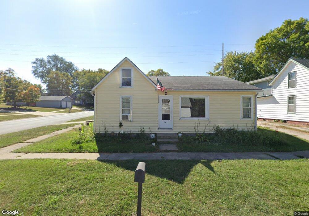
501 Cyclone Ave Harlan, IA 51537
Estimated Value: $80,668 - $130,000
3
Beds
1
Bath
944
Sq Ft
$112/Sq Ft
Est. Value
About This Home
This home is located at 501 Cyclone Ave, Harlan, IA 51537 and is currently estimated at $105,417, approximately $111 per square foot. 501 Cyclone Ave is a home located in Shelby County with nearby schools including Harlan Primary School, Harlan Intermediate School, and Harlan Community Middle School.
Ownership History
Date
Name
Owned For
Owner Type
Purchase Details
Closed on
Jun 14, 2022
Sold by
Robert Barlow
Bought by
Slater Anne
Current Estimated Value
Purchase Details
Closed on
Jan 6, 2022
Sold by
New Century Home Equity Loan Trust
Bought by
Barlow Robert
Purchase Details
Closed on
Nov 18, 2018
Sold by
Floyd J Richardson Revocable Trust
Bought by
Barlow Donald Robert
Purchase Details
Closed on
Jul 31, 2008
Sold by
Vestal Glen R and Vestal Marie E
Bought by
Richardson Floyd J and The Floyd J Richardson Revocable Trust
Create a Home Valuation Report for This Property
The Home Valuation Report is an in-depth analysis detailing your home's value as well as a comparison with similar homes in the area
Home Values in the Area
Average Home Value in this Area
Purchase History
| Date | Buyer | Sale Price | Title Company |
|---|---|---|---|
| Slater Anne | $105,000 | None Listed On Document | |
| Barlow Robert | -- | New Title Company Name | |
| Barlow Donald Robert | -- | -- | |
| Richardson Floyd J | $30,000 | None Available |
Source: Public Records
Tax History Compared to Growth
Tax History
| Year | Tax Paid | Tax Assessment Tax Assessment Total Assessment is a certain percentage of the fair market value that is determined by local assessors to be the total taxable value of land and additions on the property. | Land | Improvement |
|---|---|---|---|---|
| 2025 | $958 | $58,726 | $5,500 | $53,226 |
| 2024 | $958 | $51,186 | $5,500 | $45,686 |
| 2023 | $854 | $51,186 | $5,500 | $45,686 |
| 2022 | $854 | $41,013 | $5,500 | $35,513 |
| 2021 | $800 | $41,013 | $5,500 | $35,513 |
| 2020 | $788 | $38,363 | $5,500 | $32,863 |
| 2019 | $740 | $35,233 | $0 | $0 |
| 2018 | $722 | $35,233 | $0 | $0 |
| 2017 | $722 | $35,233 | $0 | $0 |
| 2016 | $694 | $33,256 | $0 | $0 |
| 2015 | $694 | $32,347 | $0 | $0 |
| 2014 | $674 | $32,347 | $0 | $0 |
Source: Public Records
Map
Nearby Homes