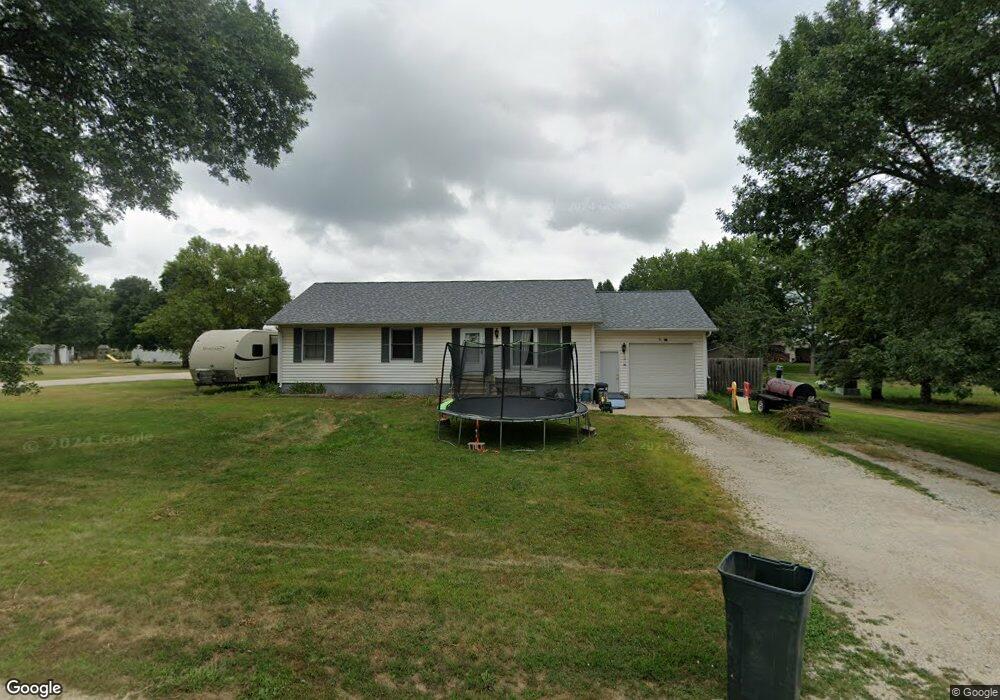
501 E Hoffman St Graettinger, IA 51342
Estimated Value: $134,000 - $161,000
Studio
--
Bath
1,344
Sq Ft
$110/Sq Ft
Est. Value
About This Home
This home is located at 501 E Hoffman St, Graettinger, IA 51342 and is currently estimated at $148,368, approximately $110 per square foot. 501 E Hoffman St is a home located in Palo Alto County with nearby schools including Graettinger-Terril High School, Graettinger-Terril Elementary School, and Graettinger-Terril Middle School.
Ownership History
Date
Name
Owned For
Owner Type
Purchase Details
Closed on
Jun 2, 2017
Sold by
Clark Ryan E and Woodyard Michelle D
Bought by
Hoffman Nathan K
Current Estimated Value
Home Financials for this Owner
Home Financials are based on the most recent Mortgage that was taken out on this home.
Original Mortgage
$66,400
Outstanding Balance
$55,098
Interest Rate
4.02%
Mortgage Type
New Conventional
Estimated Equity
$93,270
Purchase Details
Closed on
Apr 23, 2007
Sold by
Johnson Jarad A and Johnson Stacey L
Bought by
Dalen Alvin M and Dalen Bonnie J
Home Financials for this Owner
Home Financials are based on the most recent Mortgage that was taken out on this home.
Original Mortgage
$64,000
Interest Rate
6.2%
Mortgage Type
New Conventional
Create a Home Valuation Report for This Property
The Home Valuation Report is an in-depth analysis detailing your home's value as well as a comparison with similar homes in the area
Purchase History
| Date | Buyer | Sale Price | Title Company |
|---|---|---|---|
| Hoffman Nathan K | -- | None Available | |
| Dalen Alvin M | $80,000 | None Available |
Source: Public Records
Mortgage History
| Date | Status | Borrower | Loan Amount |
|---|---|---|---|
| Open | Hoffman Nathan K | $66,400 | |
| Previous Owner | Dalen Alvin M | $64,000 |
Source: Public Records
Tax History
| Year | Tax Paid | Tax Assessment Tax Assessment Total Assessment is a certain percentage of the fair market value that is determined by local assessors to be the total taxable value of land and additions on the property. | Land | Improvement |
|---|---|---|---|---|
| 2025 | $1,750 | $139,190 | $13,460 | $125,730 |
| 2024 | $1,750 | $116,390 | $8,980 | $107,410 |
| 2023 | $1,650 | $116,390 | $8,980 | $107,410 |
| 2022 | $1,630 | $92,430 | $8,980 | $83,450 |
| 2021 | $1,470 | $92,430 | $8,980 | $83,450 |
| 2020 | $1,470 | $81,330 | $8,980 | $72,350 |
Source: Public Records
Map
Nearby Homes
- 402 N Van Gordon Ave
- 0 N Cedar Ave
- 203 N Cedar Ave
- 303 N Lincoln Ave
- 601 W Robins Ave
- 609 S Cedar Ave
- 280th Street
- 2680 460th Ave
- 2261 410th Ave
- 2295 455th Ave
- 314 Saint James Ave
- 208 N 3rd St
- 34824 Cy Hawk Ave
- 2071 395th Ave
- 103 Nolan Dr
- 117 Nolan Dr
- Ford Rd Rockport Addition
- 304 Ford Rd
- 318 Ford Rd
- 3286 355th Ave
- 404 N Maple Ave
- 505 E Hoffman St
- 306 N Maple Ave
- 405 E Hoffman St
- 305 N Elder Ave
- 403 N Maple Ave
- 405 N Elder Ave
- 305 N Maple Ave
- 405 N Maple Ave
- 408 N Maple Ave
- 409 N Elder Ave
- 303 N Elder Ave
- 402 N Elder Ave
- 304 N Maple Ave
- 407 N Elder Ave
- 303 N Maple Ave
- 401 E Hoffman St
- 402 E Hoffman St
- 501 E Des Moines St
- 402 N Walnut Ave
Your Personal Tour Guide
Ask me questions while you tour the home.