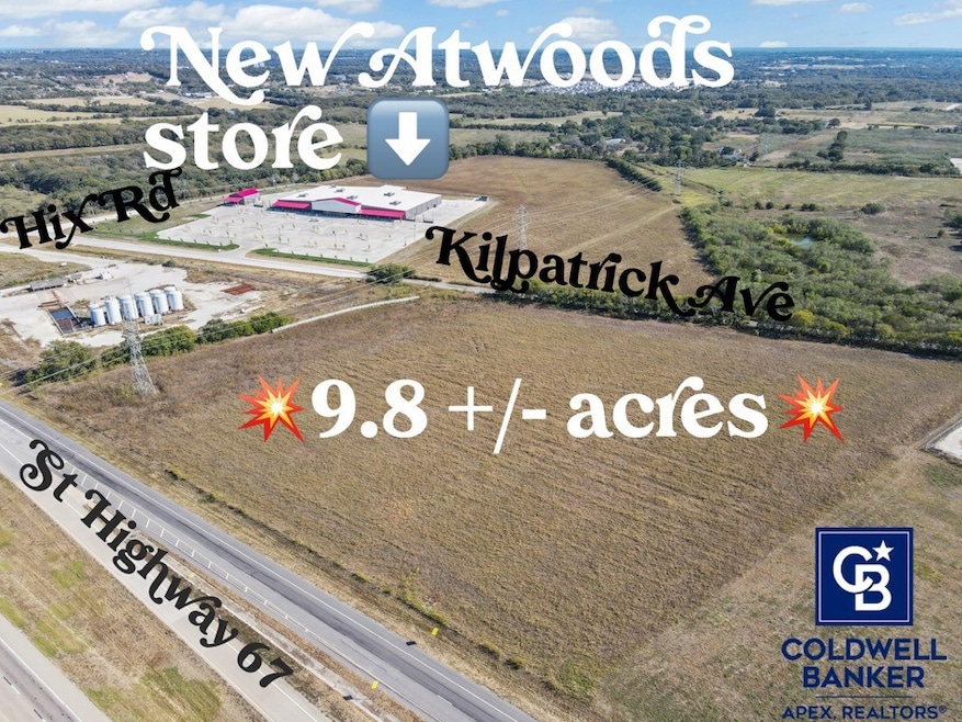
501 Hix Rd Cleburne, TX 76031
Estimated payment $9,131/month
About This Lot
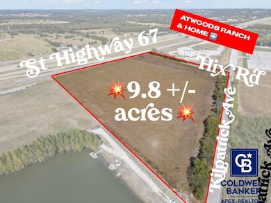
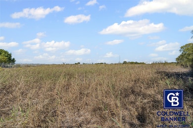
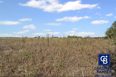
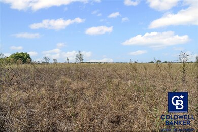
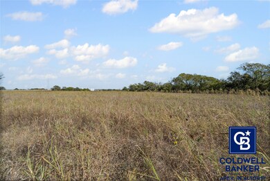
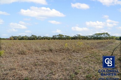
COMMERCIAL DEVELOPMENT OPPORTUNITY. Frontage on Highway 67 access road and frontage on Kilpatrick St. Prime location on the south side of of Hwy. 67 loop (E. Katherine Raines Pkwy.) and on the north side of Kilpatrick St. just east of Chisholm Trail Parkway and west of Hwy. 174 (N. Main St.) in Cleburne. Located just northwest of a new Atwood's Ranch & Home Goods store that is under construction. The subject property is located within the city limits and is currently zoned Interim Holding District (IH) and lies within the Freeway Overlay District. This property is included in the City’s Zoning Realignment Project and is proposed to be rezoned to the Agricultural District (AG) by the end of this year. According to the Future Land Use Plan for the City of Cleburne, this property is designated within the Major Corridor District. Please see the description of this district in supplemental documents, along with the recommended zoning districts that align with its intent. There is an existing 8” water line on the south side of Kilpatrick. Property is currently utilized for agricultural purposes and is relatively flat. This area of Cleburne is poised for substantial growth. Conveniently located with easy access to Chisholm Trail Parkway, Hwy 174 (Main St.), Hwy 67, and Nolan River Road.
Listing Agent
Coldwell Banker Apex, REALTORS Cleburne Brokerage Phone: (214) 546-6414 Listed on: 10/27/2025

Co-Listing Agent
Coldwell Banker Apex, REALTORS Cleburne Brokerage Phone: (214) 546-6414
Property Details
Property Type
- Land
Est. Annual Taxes
- $2,796
Lot Details
- 9.83 Acre Lot
- Lot Dimensions are 746x700x686x552
- Interior Lot
- Cleared Lot
- Zoning described as Not zoned. Not in city limits.
Schools
- Marti Elementary School
- Cleburne High School
Farming
- Agricultural
Community Details
- Tract 9 Subdivision
Listing and Financial Details
- Assessor Parcel Number 126056600230
Map
Home Values in the Area
Average Home Value in this Area
Tax History
| Year | Tax Paid | Tax Assessment Tax Assessment Total Assessment is a certain percentage of the fair market value that is determined by local assessors to be the total taxable value of land and additions on the property. | Land | Improvement |
|---|---|---|---|---|
| 2025 | $2,796 | $125,388 | $30,000 | $95,388 |
| 2024 | $2,796 | $125,388 | $30,000 | $95,388 |
| 2023 | $2,790 | $125,388 | $30,000 | $95,388 |
| 2022 | $2,788 | $111,388 | $16,000 | $95,388 |
| 2021 | $2,906 | $0 | $0 | $0 |
| 2020 | $3,087 | $0 | $0 | $0 |
| 2019 | $3,104 | $0 | $0 | $0 |
| 2018 | $2,823 | $0 | $0 | $0 |
| 2017 | $2,811 | $0 | $0 | $0 |
| 2016 | $2,811 | $0 | $0 | $0 |
| 2015 | $708 | $0 | $0 | $0 |
| 2014 | $708 | $0 | $0 | $0 |
Property History
| Date | Event | Price | List to Sale | Price per Sq Ft |
|---|---|---|---|---|
| 10/27/2025 10/27/25 | For Sale | $1,700,000 | -- | -- |
Purchase History
| Date | Type | Sale Price | Title Company |
|---|---|---|---|
| Warranty Deed | -- | Alamo Title Company | |
| Special Warranty Deed | -- | Corporation Service Company |
Source: North Texas Real Estate Information Systems (NTREIS)
MLS Number: 21090037
APN: 126-0124-20030
Disclaimer: Certain information contained herein is derived from information provided by parties other than Homes.com. All information provided is deemed reliable, but is not guaranteed to be accurate and should be independently verified.
![]() Listing information provided in part by the North Texas Real Estate Information Systems, Inc, for personal, non-commercial use by viewers of this site and may not be reproduced or redistributed. All information is deemed reliable but not guaranteed. Copyright © NTREIS 2025. All rights reserved
Listing information provided in part by the North Texas Real Estate Information Systems, Inc, for personal, non-commercial use by viewers of this site and may not be reproduced or redistributed. All information is deemed reliable but not guaranteed. Copyright © NTREIS 2025. All rights reserved
- 206 Hix Rd
- 1205 Boone St
- 311 Elmo St
- 309 Elmo St
- 305 Elmo St Unit 303
- 1103 Chase Ave
- 303 Eastland St
- 301 Eastland St
- 806 Barber Ave
- 208 Erie St
- 633 Quail Meadows Dr
- 86 Tremont St
- 616 Mayfield Dr
- TBD Crane Ave
- 211 Huron St
- 821 Sugartree Dr
- 1510 N Wilhite St
- 856 Towngreen Dr
- 548 Quail Meadows Dr
- Jackson Plan at Villages of Mayfield - Liberty Series
- 613 Mayfield Dr
- 221 Huron St
- 845 Sugartree Dr
- 122 Ramsey Ave Unit 124
- 122 Ramsey Ave Unit 122
- 1012 N Robinson St
- 1003 N Main St
- 1706 Redwood Dr Unit 1706
- 1708 Redwood Dr Unit 1706
- 226 Seclusion Dr
- 206 Royal St
- 413 Rose Ave
- 400 Phillips St
- 313 County Road 805a
- 115 Cleburne Station Pkwy
- 531 Euclid St
- 501 Sally Ln Unit B
- 314 N Anglin St
- 705 Madison St
- 100 E Vaughn Rd