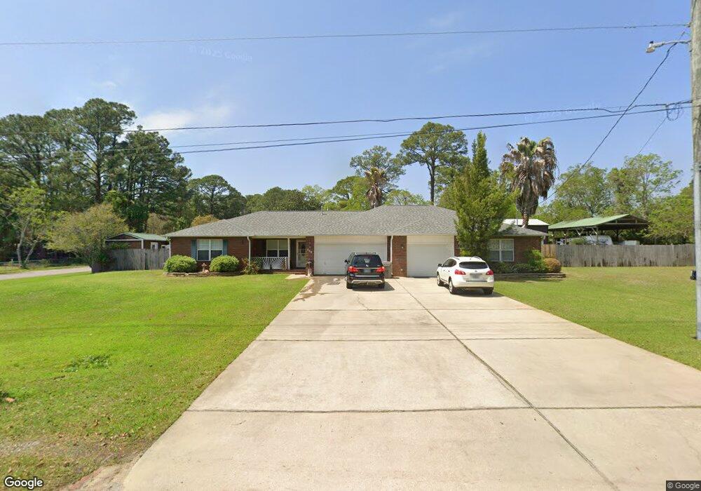
501 Lownde Ave Pensacola, FL 32507
Warrington NeighborhoodEstimated Value: $394,427 - $501,000
--
Bed
2
Baths
2,464
Sq Ft
$179/Sq Ft
Est. Value
About This Home
This home is located at 501 Lownde Ave, Pensacola, FL 32507 and is currently estimated at $441,357, approximately $179 per square foot. 501 Lownde Ave is a home located in Escambia County with nearby schools including Navy Point Elementary School, Jim C. Bailey Middle School, and Escambia High School.
Ownership History
Date
Name
Owned For
Owner Type
Purchase Details
Closed on
Feb 20, 2002
Sold by
Jablonski Alfred H
Bought by
Lowe Christi Michelle
Current Estimated Value
Purchase Details
Closed on
Aug 2, 2000
Sold by
Hallmark Quality Homes Inc
Bought by
Lowe Christi M
Home Financials for this Owner
Home Financials are based on the most recent Mortgage that was taken out on this home.
Original Mortgage
$87,810
Interest Rate
8.12%
Mortgage Type
FHA
Purchase Details
Closed on
May 10, 2000
Sold by
Lucas Andrew Leo and Lucas Andrew Leo
Bought by
Hallmark Quality Homes Inc
Create a Home Valuation Report for This Property
The Home Valuation Report is an in-depth analysis detailing your home's value as well as a comparison with similar homes in the area
Home Values in the Area
Average Home Value in this Area
Purchase History
| Date | Buyer | Sale Price | Title Company |
|---|---|---|---|
| Lowe Christi Michelle | $11,000 | -- | |
| Lowe Christi M | $89,000 | -- | |
| Hallmark Quality Homes Inc | $15,000 | -- |
Source: Public Records
Mortgage History
| Date | Status | Borrower | Loan Amount |
|---|---|---|---|
| Previous Owner | Lowe Christi M | $87,810 |
Source: Public Records
Tax History Compared to Growth
Tax History
| Year | Tax Paid | Tax Assessment Tax Assessment Total Assessment is a certain percentage of the fair market value that is determined by local assessors to be the total taxable value of land and additions on the property. | Land | Improvement |
|---|---|---|---|---|
| 2024 | $1,855 | $176,348 | -- | -- |
| 2023 | $1,855 | $170,707 | $0 | $0 |
| 2022 | $1,759 | $162,136 | $0 | $0 |
| 2021 | $1,754 | $157,414 | $0 | $0 |
| 2020 | $1,707 | $155,241 | $0 | $0 |
| 2019 | $1,674 | $151,751 | $0 | $0 |
| 2018 | $1,670 | $148,922 | $0 | $0 |
| 2017 | $1,664 | $145,859 | $0 | $0 |
| 2016 | $1,650 | $142,859 | $0 | $0 |
| 2015 | $1,638 | $141,866 | $0 | $0 |
| 2014 | $1,631 | $140,741 | $0 | $0 |
Source: Public Records
Map
Nearby Homes
- 110 Cousineau Rd
- 507 Polk Ave
- 1804 Grundy St
- 100 BLK Cousineau Rd
- 700 Mills Ave
- 729 Lownde Ave
- 20 NW Gilliland Rd
- 714 Paulding Ave
- 6 Cousineau Rd
- 210 Berry Rd
- 327 Gibbs Rd
- 406 NW Syrcle Dr
- 601 W Sunset Ave
- 1310 Leeway Dr
- 1308 Leeway Dr
- 1306 Leeway Dr
- 1304 Leeway Dr
- 1302 Leeway Dr
- 1300 Leeway Dr
- 411 Greve Rd