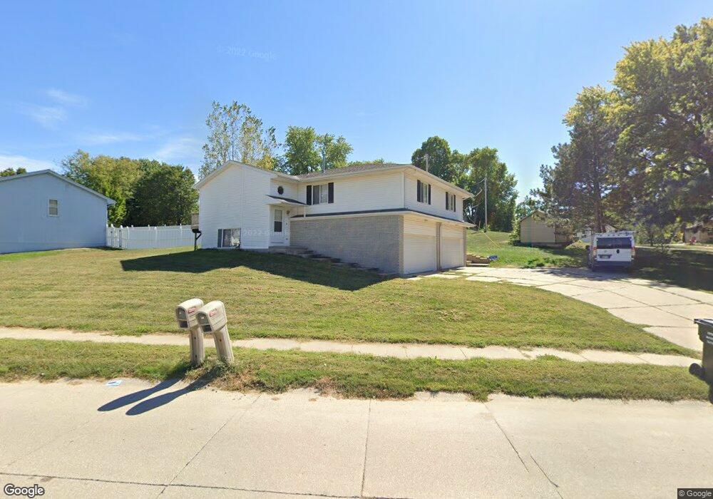
501 Michael Dr Unit 505 Gretna, NE 68028
Estimated Value: $331,419 - $377,000
4
Beds
2
Baths
1,926
Sq Ft
$182/Sq Ft
Est. Value
About This Home
This home is located at 501 Michael Dr Unit 505, Gretna, NE 68028 and is currently estimated at $349,855, approximately $181 per square foot. 501 Michael Dr Unit 505 is a home located in Sarpy County with nearby schools including Gretna Elementary School, Gretna Middle School, and Gretna High School.
Ownership History
Date
Name
Owned For
Owner Type
Purchase Details
Closed on
Jul 3, 2017
Sold by
Sackett Bruce K and Sackett Bridget A
Bought by
Milroy Elaine and Milroy Dennis
Current Estimated Value
Home Financials for this Owner
Home Financials are based on the most recent Mortgage that was taken out on this home.
Original Mortgage
$159,375
Outstanding Balance
$132,486
Interest Rate
3.91%
Mortgage Type
Future Advance Clause Open End Mortgage
Estimated Equity
$217,369
Create a Home Valuation Report for This Property
The Home Valuation Report is an in-depth analysis detailing your home's value as well as a comparison with similar homes in the area
Home Values in the Area
Average Home Value in this Area
Purchase History
| Date | Buyer | Sale Price | Title Company |
|---|---|---|---|
| Milroy Elaine | $213,000 | Ambassador Title Services |
Source: Public Records
Mortgage History
| Date | Status | Borrower | Loan Amount |
|---|---|---|---|
| Open | Milroy Elaine | $159,375 |
Source: Public Records
Tax History Compared to Growth
Tax History
| Year | Tax Paid | Tax Assessment Tax Assessment Total Assessment is a certain percentage of the fair market value that is determined by local assessors to be the total taxable value of land and additions on the property. | Land | Improvement |
|---|---|---|---|---|
| 2025 | $4,476 | $266,787 | $45,000 | $221,787 |
| 2024 | $5,307 | $252,480 | $45,000 | $207,480 |
| 2023 | $5,307 | $246,917 | $45,000 | $201,917 |
| 2022 | $5,083 | $222,734 | $45,000 | $177,734 |
| 2021 | $4,920 | $218,024 | $45,000 | $173,024 |
| 2020 | $4,729 | $210,797 | $45,000 | $165,797 |
| 2019 | $4,583 | $204,522 | $45,000 | $159,522 |
| 2018 | $4,393 | $196,934 | $34,000 | $162,934 |
| 2017 | $4,051 | $181,381 | $34,000 | $147,381 |
| 2016 | $4,028 | $180,838 | $19,000 | $161,838 |
| 2015 | $3,881 | $175,711 | $19,000 | $156,711 |
| 2014 | $3,871 | $176,763 | $19,000 | $157,763 |
| 2012 | -- | $178,873 | $19,000 | $159,873 |
Source: Public Records
Map
Nearby Homes
- 347 Michael Dr
- 11303 S 210th Ave
- 710 Pawnee Dr
- 213 Highland Dr
- Lot 136 W Gruenther Rd
- Lot 80 W Gruenther Rd
- Lot 71 W Gruenther Rd
- Lot 127 W Gruenther Rd
- Lot 111 W Gruenther Rd
- TBD Lot 64 W Gruenther Rd
- 21733 Parkview Dr
- 21710 Parkview Dr
- 21603 Parkview Dr
- 20919 Mcclellan Cir
- 21906 Amber Dr
- 21702 Amber Dr
- 21726 Amber Dr
- 21719 Amber Dr
- 21715 Amber Dr
- 21605 Hackberry Dr
- 505 Michael Dr
- 445 Michael Dr
- 515 Michael Dr
- 422 Chippewa Dr
- 439 Michael Dr
- 433 Michael Dr
- 442 Michael Dr
- 438 Highland Dr
- 418 Chippewa Dr
- 438 Michael Dr
- 425 Michael Dr
- 432 Highland Dr
- 414 Chippewa Dr
- 432 Michael Dr
- 419 Chippewa Dr
- 426 Highland Dr
- 421 Michael Dr
- 410 Chippewa Dr
- 426 Michael Dr
- 422 Highland Dr