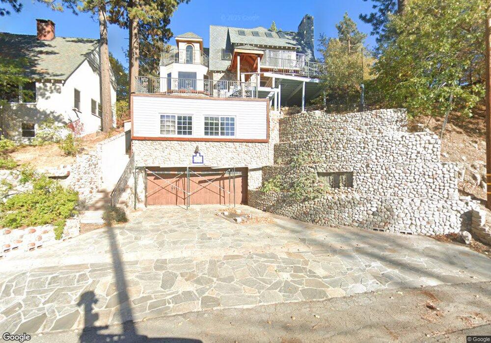
501 N State Highway 173 Lake Arrowhead, CA 92352
Estimated Value: $719,000 - $1,009,543
3
Beds
2
Baths
1,940
Sq Ft
$410/Sq Ft
Est. Value
About This Home
This home is located at 501 N State Highway 173, Lake Arrowhead, CA 92352 and is currently estimated at $795,886, approximately $410 per square foot. 501 N State Highway 173 is a home located in San Bernardino County with nearby schools including Lake Arrowhead Elementary School, Mary P. Henck Intermediate School, and Rim Of The World Senior High School.
Ownership History
Date
Name
Owned For
Owner Type
Purchase Details
Closed on
Jan 19, 2012
Sold by
Hulburd Richard M
Bought by
Mohr Howard Charles and Aslan Michelle
Current Estimated Value
Purchase Details
Closed on
Oct 24, 2009
Sold by
Hulburd Richard M
Bought by
Hulburd Richard M and Alice & Richard Hulburd Trust
Purchase Details
Closed on
Apr 30, 1998
Sold by
Jean Hulburd Richard M and Jean Alice
Bought by
Hulburd Richard M and Hulburd Alice J
Purchase Details
Closed on
Jun 29, 1996
Sold by
Hulburd Richard M
Bought by
Hulburd Richard M and Hulburd Alice D
Home Financials for this Owner
Home Financials are based on the most recent Mortgage that was taken out on this home.
Original Mortgage
$180,000
Interest Rate
8.01%
Create a Home Valuation Report for This Property
The Home Valuation Report is an in-depth analysis detailing your home's value as well as a comparison with similar homes in the area
Home Values in the Area
Average Home Value in this Area
Purchase History
| Date | Buyer | Sale Price | Title Company |
|---|---|---|---|
| Mohr Howard Charles | $241,500 | First American Title | |
| Hulburd Richard M | -- | None Available | |
| Hulburd Richard M | -- | -- | |
| Hulburd Richard M | -- | Fidelity National Title Ins |
Source: Public Records
Mortgage History
| Date | Status | Borrower | Loan Amount |
|---|---|---|---|
| Previous Owner | Hulburd Richard M | $180,000 |
Source: Public Records
Tax History Compared to Growth
Tax History
| Year | Tax Paid | Tax Assessment Tax Assessment Total Assessment is a certain percentage of the fair market value that is determined by local assessors to be the total taxable value of land and additions on the property. | Land | Improvement |
|---|---|---|---|---|
| 2025 | $3,709 | $324,151 | $76,758 | $247,393 |
| 2024 | $3,709 | $317,795 | $75,253 | $242,542 |
| 2023 | $3,672 | $311,563 | $73,777 | $237,786 |
| 2022 | $3,598 | $305,454 | $72,330 | $233,124 |
| 2021 | $3,558 | $299,465 | $70,912 | $228,553 |
| 2020 | $3,557 | $296,394 | $70,185 | $226,209 |
| 2019 | $3,468 | $290,583 | $68,809 | $221,774 |
| 2018 | $3,470 | $284,885 | $67,460 | $217,425 |
| 2017 | $3,411 | $279,299 | $66,137 | $213,162 |
| 2016 | $2,983 | $239,106 | $64,840 | $174,266 |
| 2015 | $2,964 | $236,482 | $63,866 | $172,616 |
| 2014 | $2,902 | $230,156 | $62,615 | $167,541 |
Source: Public Records
Map
Nearby Homes
- 496 State Highway 173
- 496 California 173
- 514 N Emerald Dr
- 537 Canyon View Dr
- 485 California 173
- 479 California 173
- 458 California 173
- 28956 Palisades Dr
- 28918 Palisades Dr
- 28919 Palisades Dr
- 347 Emerald Dr
- 28898 Palisades Dr
- 29186 Arrowhead Dr
- 28989 Palisades Dr
- 28844 Cedar Dr
- 29038 Terrace
- 29196 Lake Brook Ave
- 385 Spruce Dr
- 28886 Cedar Dr
- 28810 Cedar Dr
- 507 State Hwy
- 506 Emerald Dr
- 485 State Highway 173
- 514 Emerald Ave
- 0 Craighill Dr Unit EV18172925
- 0 Craighill Dr Unit EV18144472
- 0 Craighill Dr Unit EV15245964
- 0 Craighill Dr Unit EV17136516
- 0 Craighill Dr Unit CRRW2181335
- 0 Craighill Dr Unit CRRW2181139
- 0 Craighill Dr Unit CREV18144472
- 0 Craighill Dr Unit CREV18172925
- 0 Craighill Dr Unit SR23048221
- 0 Craighill Dr Unit RW2170935
- 0 Craighill Dr Unit RW2181139
- 0 Craighill Dr Unit RW2181335
- 0 Craighill Dr Unit RW2181138
- 0 Meadow Dr Unit IV17250149
- 0 Meadow Dr Unit IV19156667
- 0 Meadow Dr Unit IV19008100