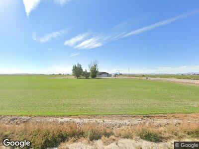
Estimated Value: $433,000 - $507,119
5
Beds
3
Baths
3,330
Sq Ft
$139/Sq Ft
Est. Value
About This Home
This home is located at 5010 S 4000 W, Delta, UT 84624 and is currently estimated at $463,280, approximately $139 per square foot. 5010 S 4000 W is a home located in Millard County.
Ownership History
Date
Name
Owned For
Owner Type
Purchase Details
Closed on
Jul 18, 2018
Sold by
Bassett Phillip N and Bassett Kristina K
Bought by
Strate Devin H and Strate Amy M
Current Estimated Value
Home Financials for this Owner
Home Financials are based on the most recent Mortgage that was taken out on this home.
Original Mortgage
$238,107
Interest Rate
5.5%
Mortgage Type
FHA
Purchase Details
Closed on
Oct 29, 2013
Sold by
Bassett Phillip N
Bought by
Bassett Phillip N and Bassett Kristina K
Home Financials for this Owner
Home Financials are based on the most recent Mortgage that was taken out on this home.
Original Mortgage
$187,775
Interest Rate
4.27%
Mortgage Type
VA
Purchase Details
Closed on
Feb 22, 2010
Sold by
Jensen Dale H and Jensen Maruilyn P
Bought by
Jensen Dale H and Jensen Marilyn P
Create a Home Valuation Report for This Property
The Home Valuation Report is an in-depth analysis detailing your home's value as well as a comparison with similar homes in the area
Home Values in the Area
Average Home Value in this Area
Purchase History
| Date | Buyer | Sale Price | Title Company |
|---|---|---|---|
| Strate Devin H | -- | First American Title | |
| Bassett Phillip N | -- | Juab Title & Abstract Compan | |
| Bassett Phillip N | -- | -- | |
| Jensen Dale H | -- | -- |
Source: Public Records
Mortgage History
| Date | Status | Borrower | Loan Amount |
|---|---|---|---|
| Open | Strate Devin H | $237,246 | |
| Closed | Strate Devin H | $237,595 | |
| Closed | Strate Devin H | $238,107 | |
| Previous Owner | Bassett Phillip N | $187,713 | |
| Previous Owner | Bassett Phillip N | $196,161 | |
| Previous Owner | Bassett Phillip N | $187,775 |
Source: Public Records
Tax History Compared to Growth
Tax History
| Year | Tax Paid | Tax Assessment Tax Assessment Total Assessment is a certain percentage of the fair market value that is determined by local assessors to be the total taxable value of land and additions on the property. | Land | Improvement |
|---|---|---|---|---|
| 2024 | $3,399 | $273,447 | $15,625 | $257,822 |
| 2023 | $3,399 | $273,447 | $15,625 | $257,822 |
| 2022 | $2,003 | $176,697 | $14,330 | $162,367 |
| 2021 | $1,510 | $128,230 | $12,680 | $115,550 |
| 2020 | $1,452 | $124,743 | $12,680 | $112,063 |
| 2019 | $1,352 | $117,272 | $12,680 | $104,592 |
| 2018 | $1,098 | $97,826 | $12,600 | $85,226 |
| 2017 | $1,061 | $90,467 | $9,300 | $81,167 |
| 2016 | $1,014 | $90,467 | $9,300 | $81,167 |
| 2015 | $1,014 | $90,467 | $9,300 | $81,167 |
| 2014 | -- | $90,467 | $9,300 | $81,167 |
| 2013 | -- | $77,528 | $9,300 | $68,228 |
Source: Public Records
Map
Nearby Homes
- 3380 W 4500 S
- 3770 S 4000 Rd W
- 6020 W 4500 Rd S
- 6275 S 3000 Rd W
- 6177 S 3000 Rd W
- 6500 W 2000 S
- 45 W Center St
- 205 W Center St
- 47 S 350 W
- 90 S 550 St W Unit 8,9,10
- 595 W Center St Unit 16 &15
- 545 N Main St
- 290 W 750 N
- 549 E 4500 S
- 700 Acres
- 700 Acres Hwy 6 & Main St (Hwy 50)
- 6000 N 10000 W
- 6200 S 3000 W
- 472 200 S Unit 6
- 460 200 S Unit 4
