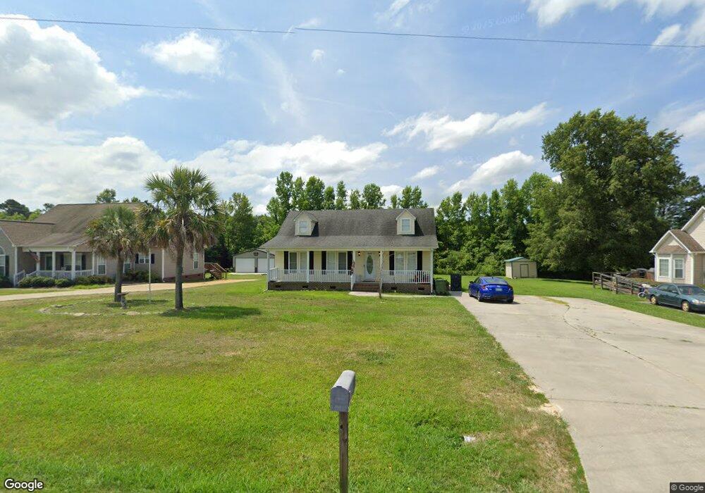
5013 Sedgefield Dr Lancaster, SC 29720
Estimated Value: $226,099 - $271,000
2
Beds
2
Baths
1,364
Sq Ft
$177/Sq Ft
Est. Value
About This Home
This home is located at 5013 Sedgefield Dr, Lancaster, SC 29720 and is currently estimated at $242,025, approximately $177 per square foot. 5013 Sedgefield Dr is a home located in Lancaster County with nearby schools including McDonald Green Elementary School, South Middle School, and Lancaster High School.
Ownership History
Date
Name
Owned For
Owner Type
Purchase Details
Closed on
Oct 15, 2013
Sold by
The United States Department Of Housing
Bought by
Morris Holly Renee
Current Estimated Value
Purchase Details
Closed on
Jul 9, 2013
Sold by
Citimortgage Inc
Bought by
The Secretary Of Housing & Urban Develop
Purchase Details
Closed on
Jun 11, 2013
Sold by
Carr Christina L and Carr Michael A
Bought by
Citimortgage Inc
Purchase Details
Closed on
Jan 30, 2001
Sold by
Williams Michael G
Bought by
Carr Christina L
Create a Home Valuation Report for This Property
The Home Valuation Report is an in-depth analysis detailing your home's value as well as a comparison with similar homes in the area
Home Values in the Area
Average Home Value in this Area
Purchase History
| Date | Buyer | Sale Price | Title Company |
|---|---|---|---|
| Morris Holly Renee | $47,100 | -- | |
| The Secretary Of Housing & Urban Develop | -- | -- | |
| Citimortgage Inc | $114,799 | -- | |
| Carr Christina L | $115,000 | -- |
Source: Public Records
Tax History
| Year | Tax Paid | Tax Assessment Tax Assessment Total Assessment is a certain percentage of the fair market value that is determined by local assessors to be the total taxable value of land and additions on the property. | Land | Improvement |
|---|---|---|---|---|
| 2024 | $2,373 | $7,164 | $1,080 | $6,084 |
| 2023 | $2,370 | $7,164 | $1,080 | $6,084 |
| 2022 | $728 | $7,164 | $1,080 | $6,084 |
| 2021 | $713 | $4,776 | $720 | $4,056 |
| 2020 | $648 | $4,232 | $720 | $3,512 |
| 2019 | $1,430 | $4,232 | $720 | $3,512 |
| 2018 | $1,376 | $4,232 | $720 | $3,512 |
| 2017 | $634 | $0 | $0 | $0 |
| 2016 | $1,914 | $0 | $0 | $0 |
| 2015 | $1,724 | $0 | $0 | $0 |
| 2014 | $1,724 | $0 | $0 | $0 |
| 2013 | $1,724 | $0 | $0 | $0 |
Source: Public Records
Map
Nearby Homes
- 1976 McIlwain Rd
- 5142 Sedgefield Dr
- 5114 Sedgefield Dr
- 2599 State Road S-29-503
- 1139 Merribrook Ln
- 1182 Merribrook Ln
- 1186 Merribrook Ln
- 2908 Woodland Way
- Lot 24 Avalon Ln Unit 24
- 2644 Downey Dr
- 2417 Lynwood Dr
- 2795 Cane Mill Rd
- 2375 Ellison Cir
- 1411 Foxbrook Cir
- 2826 Drew Dr
- 2694 Pineview Dr
- 0 Watson Dr Unit 39
- 2697 State Road S-29-369
- TBD Sunnyside Dr Unit 14 & 15
- 2570 Pineview Dr
- 5009 Sedgefield Dr
- 5017 Sedgefield Dr
- 5005 Sedgefield Dr
- 5021 Sedgefield Dr
- 5012 Sedgefield Dr
- 5020 Sedgefield Dr
- 5024 Sedgefield Dr
- 5025 Sedgefield Dr
- 6008 Sawgrass Ln
- 1962 McIlwain Rd
- 1954 McIlwain Rd
- 5029 Sedgefield Dr
- 1988 McIlwain Rd
- 6012 Sawgrass Ln
- 5028 Sedgefield Dr
- 1946 McIlwain Rd
- 5146 Sedgefield Dr
- 5033 Sedgefield Dr
- 1940 McIlwain Rd
- 5032 Sedgefield Dr
Your Personal Tour Guide
Ask me questions while you tour the home.