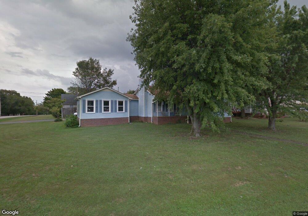
5015 Brookside Dr Columbia, TN 38401
Estimated Value: $313,075
--
Bed
2
Baths
1,391
Sq Ft
$225/Sq Ft
Est. Value
About This Home
This home is located at 5015 Brookside Dr, Columbia, TN 38401 and is currently priced at $313,075, approximately $225 per square foot. 5015 Brookside Dr is a home located in Maury County with nearby schools including J.E. Woodard Elementary School, Whitthorne Middle School, and Columbia Central High School.
Ownership History
Date
Name
Owned For
Owner Type
Purchase Details
Closed on
May 25, 2001
Sold by
Leber Robert L and Leber Joanne
Bought by
Cleghorn Larry M and Cleghorn Barbara W
Current Estimated Value
Home Financials for this Owner
Home Financials are based on the most recent Mortgage that was taken out on this home.
Original Mortgage
$97,050
Interest Rate
7.02%
Mortgage Type
FHA
Purchase Details
Closed on
Jul 25, 1991
Bought by
Leber Robert L and Leber Joanne
Purchase Details
Closed on
Dec 14, 1988
Bought by
Davis Hilda Ruth
Purchase Details
Closed on
Jul 22, 1988
Bought by
First Federal Savings & Loan Assoc Of Co
Purchase Details
Closed on
Feb 16, 1988
Bought by
Ridgewood Homes Inc
Purchase Details
Closed on
Dec 31, 1986
Bought by
Hairston Hairston F and Hairston Beth B
Create a Home Valuation Report for This Property
The Home Valuation Report is an in-depth analysis detailing your home's value as well as a comparison with similar homes in the area
Home Values in the Area
Average Home Value in this Area
Purchase History
| Date | Buyer | Sale Price | Title Company |
|---|---|---|---|
| Cleghorn Larry M | $97,900 | Columbia Land | |
| Leber Robert L | $79,900 | -- | |
| Davis Hilda Ruth | $78,900 | -- | |
| First Federal Savings & Loan Assoc Of Co | $51,900 | -- | |
| Ridgewood Homes Inc | -- | -- | |
| Hairston Hairston F | -- | -- |
Source: Public Records
Mortgage History
| Date | Status | Borrower | Loan Amount |
|---|---|---|---|
| Open | Hairston Hairston F | $96,283 | |
| Closed | Cleghorn Larry M | $97,050 |
Source: Public Records
Tax History Compared to Growth
Tax History
| Year | Tax Paid | Tax Assessment Tax Assessment Total Assessment is a certain percentage of the fair market value that is determined by local assessors to be the total taxable value of land and additions on the property. | Land | Improvement |
|---|---|---|---|---|
| 2022 | $1,532 | $56,025 | $12,500 | $43,525 |
Source: Public Records
Map
Nearby Homes
- 3005 Westwood Dr
- 4007 Westwood Dr
- 6005 Cayce Ln
- 6009 Hays Dr
- 1701 Jamie Dr
- 1620 Baucom Dr
- 3006 Sheddan Dr
- 1612 Jamie Dr
- 2910 Brookside Dr
- 5013 Hays Dr
- 231 Overlook Place
- 5011 Hays Dr
- 4002 Trotwood Ave
- 526 Woods Dr
- 6152 Worthington Rd
- 6157 Worthington Rd
- 4007 Hays Dr
- 6158 Worthington Rd
- 6161 Worthington Rd
- 1621 Lillian Cir
- 5017 Brookside Dr
- 5000 Hairston Ct
- 5002 Hairston Ct
- 5028 Brookside Dr
- 5030 Brookside Dr
- 5022 Brookside Dr
- 5019 Brookside Dr
- 5024 Brookside Dr
- 5020 Brookside Dr
- 5004 Hairston Ct
- 5032 Brookside Dr
- 5026 Brookside Dr
- 5018 Brookside Dr
- 5001 Hairston Ct
- 5021 Brookside Dr
- 5006 Hairston Ct
- 5034 Brookside Dr
- 6108 Cayce Ln
- 5016 Brookside Dr
- 6112 Cayce Ln