Estimated Value: $236,000 - $289,000
3
Beds
2
Baths
1,354
Sq Ft
$198/Sq Ft
Est. Value
About This Home
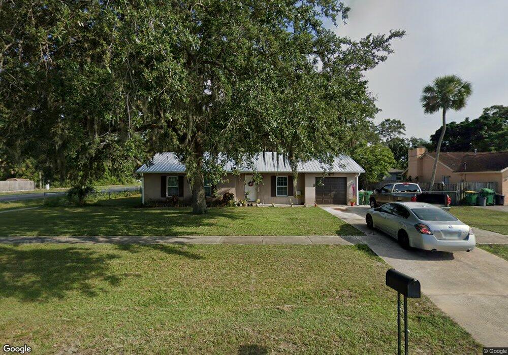
This home is located at 5015 Falcon Blvd, Cocoa, FL 32927 and is currently estimated at $268,461, approximately $198 per square foot. 5015 Falcon Blvd is a home located in Brevard County with nearby schools including Atlantis Elementary School, Space Coast Junior/Senior High School, and Sculptor Charter School.
Ownership History
Date
Name
Owned For
Owner Type
Purchase Details
Closed on
Jun 3, 2019
Sold by
Newton Allan G and Newton Valerie A
Bought by
Newton Jessica Lynn
Current Estimated Value
Home Financials for this Owner
Home Financials are based on the most recent Mortgage that was taken out on this home.
Original Mortgage
$122,608
Outstanding Balance
$108,903
Interest Rate
4.62%
Mortgage Type
FHA
Estimated Equity
$159,558
Create a Home Valuation Report for This Property
The Home Valuation Report is an in-depth analysis detailing your home's value as well as a comparison with similar homes in the area
Home Values in the Area
Average Home Value in this Area
Purchase History
| Date | Buyer | Sale Price | Title Company |
|---|---|---|---|
| Newton Jessica Lynn | $130,000 | Nationallink |
Source: Public Records
Mortgage History
| Date | Status | Borrower | Loan Amount |
|---|---|---|---|
| Open | Newton Jessica Lynn | $122,608 |
Source: Public Records
Tax History
| Year | Tax Paid | Tax Assessment Tax Assessment Total Assessment is a certain percentage of the fair market value that is determined by local assessors to be the total taxable value of land and additions on the property. | Land | Improvement |
|---|---|---|---|---|
| 2025 | $1,919 | $154,500 | -- | -- |
| 2024 | $1,884 | $150,150 | -- | -- |
| 2023 | $1,884 | $145,860 | $0 | $0 |
| 2022 | $1,757 | $141,620 | $0 | $0 |
| 2021 | $1,783 | $137,500 | $0 | $0 |
| 2020 | $1,753 | $135,610 | $40,000 | $95,610 |
| 2019 | $2,198 | $131,130 | $35,000 | $96,130 |
| 2018 | $2,082 | $119,550 | $27,000 | $92,550 |
| 2017 | $1,965 | $104,750 | $24,000 | $80,750 |
| 2016 | $795 | $56,450 | $18,000 | $38,450 |
| 2015 | $801 | $56,060 | $15,000 | $41,060 |
| 2014 | $805 | $55,620 | $11,000 | $44,620 |
Source: Public Records
Map
Nearby Homes
- 7155 Export Ave
- 5200 Frisco St
- 7245 Grissom Pkwy
- 5080 Mayflower St
- 7275 Durban Ave
- 5150 Melody St
- 5165 Patricia St
- 5155 Mayflower St
- 4824 Curtis Blvd
- 6990 Camden Ave
- 0 Cinnamon Fern Blvd
- 7310 Joshua Place
- 4760 Ivan St
- 4625 Curtis Blvd
- 7456 Camio Ave
- 6990 Bryant Rd
- 5095 Hogan Place
- 7545 Fringe Place
- 6820 Caliph Ave
- 6620 Grissom Pkwy
- 5025 Falcon Blvd
- 5020 Patricia St
- 7150 Grissom Pkwy
- 4991 Falcon Blvd
- 5035 Falcon Blvd
- 5030 Patricia St
- 7160 Grissom Pkwy
- 4983 Falcon Blvd
- 5040 Patricia St
- 7165 Export Ave
- 4988 Patricia St
- 5015 Patricia St
- 5025 Patricia St
- 5055 Falcon Blvd
- 4990 Falcon Blvd
- 5050 Patricia St
- 7045 Grissom Pkwy
- 4975 Falcon Blvd
- 7170 Grissom Pkwy
- 7150 Export Ave
Your Personal Tour Guide
Ask me questions while you tour the home.