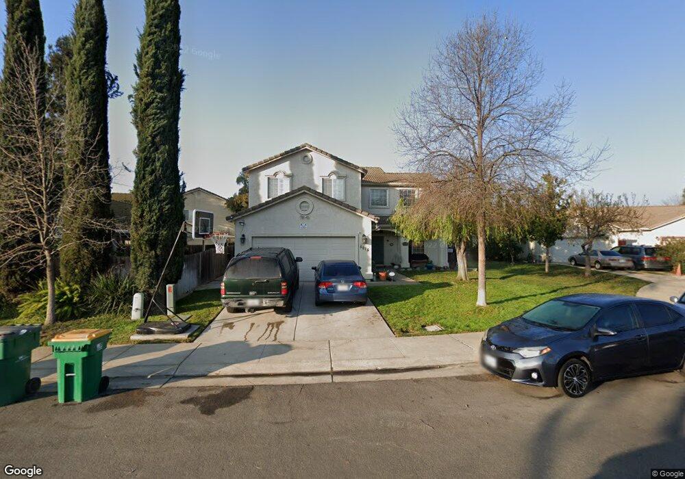
5015 Wild Grape Dr Stockton, CA 95212
Estimated Value: $470,000 - $545,798
4
Beds
3
Baths
2,168
Sq Ft
$233/Sq Ft
Est. Value
About This Home
This home is located at 5015 Wild Grape Dr, Stockton, CA 95212 and is currently estimated at $505,700, approximately $233 per square foot. 5015 Wild Grape Dr is a home located in San Joaquin County with nearby schools including Valentine Peyton Elementary School, George W. Bush Elementary School, and Rio Calaveras Elementary School.
Ownership History
Date
Name
Owned For
Owner Type
Purchase Details
Closed on
Dec 3, 2009
Sold by
Onewest Bank Fsb
Bought by
Us Bank National Association
Current Estimated Value
Purchase Details
Closed on
Dec 1, 1998
Sold by
Arnaiz Development Co Inc
Bought by
Zapien Fernando E and Zapien Alicia
Home Financials for this Owner
Home Financials are based on the most recent Mortgage that was taken out on this home.
Original Mortgage
$148,150
Interest Rate
6.69%
Create a Home Valuation Report for This Property
The Home Valuation Report is an in-depth analysis detailing your home's value as well as a comparison with similar homes in the area
Purchase History
| Date | Buyer | Sale Price | Title Company |
|---|---|---|---|
| Us Bank National Association | -- | Fidelity National Title Co | |
| Zapien Fernando E | $156,000 | First American |
Source: Public Records
Mortgage History
| Date | Status | Borrower | Loan Amount |
|---|---|---|---|
| Previous Owner | Zapien Fernando E | $148,150 |
Source: Public Records
Tax History
| Year | Tax Paid | Tax Assessment Tax Assessment Total Assessment is a certain percentage of the fair market value that is determined by local assessors to be the total taxable value of land and additions on the property. | Land | Improvement |
|---|---|---|---|---|
| 2025 | $3,582 | $276,331 | $47,026 | $229,305 |
| 2024 | $3,506 | $270,913 | $46,104 | $224,809 |
| 2023 | $3,411 | $265,601 | $45,200 | $220,401 |
| 2022 | $3,336 | $260,394 | $44,314 | $216,080 |
| 2021 | $3,199 | $255,290 | $43,446 | $211,844 |
| 2020 | $3,257 | $252,673 | $43,001 | $209,672 |
| 2019 | $3,213 | $247,719 | $42,158 | $205,561 |
| 2018 | $3,155 | $242,863 | $41,332 | $201,531 |
| 2017 | $2,994 | $238,102 | $40,522 | $197,580 |
| 2016 | $3,045 | $233,434 | $39,728 | $193,706 |
| 2014 | $3,028 | $225,423 | $38,365 | $187,058 |
Source: Public Records
Map
Nearby Homes
- 2310 Thistle Way
- 2244 Jane Ellen Dr
- 2237 Jane Ellen Dr
- 2517 Jayden Way
- 5431 Strawberry Way
- 4501 N Wilson Way Unit 25
- 2242 Middlebury Way
- 2770 Keyser Dr
- 5122 Hanna Bay Ave
- 2888 Sebastan Ln
- 5813 Fred Russo Dr
- 2449 Calvert St
- 4421 Harmony Hill Way
- 4900 N Highway 99 Unit 190
- 4900 N Highway 99
- 3818 Red Oak Ln
- 5723 Larcom Ln
- 5457 Governor Cir
- 5100 N Highway 99 Unit 141
- 5808 Gentry Ave
- 5027 Wild Grape Dr
- 2911 Horn Bram Ct
- 2917 Horn Bram Ct
- 5039 Wild Grape Dr
- 2903 Horn Bram Ct
- 5053 N Wild Grape Dr
- 5053 Wild Grape Dr
- 2847 Sunflower Cir
- 5002 Wild Grape Dr
- 2853 Sunflower Cir
- 2841 Sunflower Cir
- 2902 Horn Bram Ct
- 5030 Wild Grape Dr
- 4980 Wild Grape Dr
- 2914 Horn Bram Ct
- 2835 Sunflower Cir
- 2908 Horn Bram Ct
- 5030 N Wild Grape Dr
- 4962 Wild Grape Dr
- 4940 Buttercup Ln
Your Personal Tour Guide
Ask me questions while you tour the home.