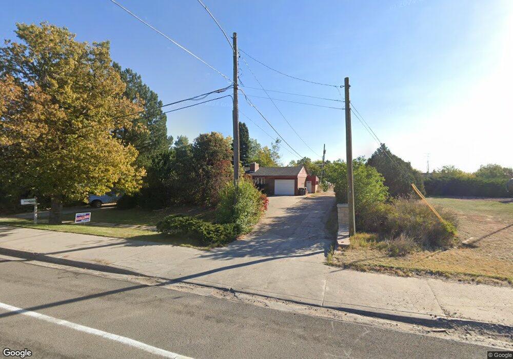
5015 Yellowstone Rd Cheyenne, WY 82009
Estimated Value: $384,000 - $424,000
--
Bed
--
Bath
1,608
Sq Ft
$253/Sq Ft
Est. Value
About This Home
This home is located at 5015 Yellowstone Rd, Cheyenne, WY 82009 and is currently estimated at $407,131, approximately $253 per square foot. 5015 Yellowstone Rd is a home located in Laramie County with nearby schools including Hobbs Elementary School, McCormick Junior High School, and Central High School.
Ownership History
Date
Name
Owned For
Owner Type
Purchase Details
Closed on
Sep 10, 2008
Sold by
Schroff John L and Michele Schroff M
Bought by
Pinther Ronald E
Current Estimated Value
Home Financials for this Owner
Home Financials are based on the most recent Mortgage that was taken out on this home.
Original Mortgage
$152,100
Interest Rate
6.54%
Mortgage Type
Balloon
Purchase Details
Closed on
Aug 4, 1999
Sold by
Larson Mary J Trte Mary J Larson Tr
Bought by
Schroff John L and Schroff Michele
Home Financials for this Owner
Home Financials are based on the most recent Mortgage that was taken out on this home.
Original Mortgage
$118,275
Interest Rate
7.63%
Create a Home Valuation Report for This Property
The Home Valuation Report is an in-depth analysis detailing your home's value as well as a comparison with similar homes in the area
Home Values in the Area
Average Home Value in this Area
Purchase History
| Date | Buyer | Sale Price | Title Company |
|---|---|---|---|
| Pinther Ronald E | -- | None Available | |
| Schroff John L | -- | -- |
Source: Public Records
Mortgage History
| Date | Status | Borrower | Loan Amount |
|---|---|---|---|
| Closed | Pinther Ronald E | $152,100 | |
| Previous Owner | Schroff John L | $118,275 |
Source: Public Records
Tax History Compared to Growth
Tax History
| Year | Tax Paid | Tax Assessment Tax Assessment Total Assessment is a certain percentage of the fair market value that is determined by local assessors to be the total taxable value of land and additions on the property. | Land | Improvement |
|---|---|---|---|---|
| 2025 | $2,497 | $19,848 | $2,162 | $17,686 |
| 2024 | $2,497 | $38,312 | $4,323 | $33,989 |
| 2023 | $2,405 | $37,005 | $4,323 | $32,682 |
| 2022 | $2,331 | $35,298 | $4,323 | $30,975 |
| 2021 | $1,997 | $30,599 | $4,323 | $26,276 |
| 2020 | $1,929 | $29,742 | $4,323 | $25,419 |
| 2019 | $1,687 | $26,365 | $4,323 | $22,042 |
| 2018 | $1,522 | $24,282 | $3,869 | $20,413 |
| 2017 | $1,516 | $24,005 | $3,869 | $20,136 |
| 2016 | $1,344 | $21,620 | $3,605 | $18,015 |
| 2015 | $1,278 | $20,700 | $3,605 | $17,095 |
| 2014 | $1,149 | $18,806 | $3,605 | $15,201 |
Source: Public Records
Map
Nearby Homes
- 5211 Fawn Pass
- 5211 Fishing Bridge
- 5404 Sunset Dr
- 249 Shoshoni St
- 245 Lakeshore Dr
- 5620 Sunset Dr
- 5413 Frederick Dr
- 485 Andra Ct
- 247 Miller Ln
- 5711 Townsend Place
- 234 Miller Ln Unit A
- 148 Kornegay Ct Unit 2
- Lot 8 Hynds Blvd
- Lot 12 Hynds Blvd
- 1462 Trent Ct
- 706 Mylar Park Dr
- 1502 Trent Ct Unit 9
- 707 Arapaho St
- 722 Mylar Park Dr
- 5907 Townsend Place
- 105 Carroll Ave
- 113 Carroll Ave
- 120 Dell Range Blvd
- 5101 Yellowstone Rd
- 127 Carroll Ave
- 2 Dell Range Blvd
- 120 Carroll Ave
- 128 Carroll Ave
- 132 Dell Range Blvd
- 5119 Yellowstone Rd
- 132 Carroll Ave
- 137 Carroll Ave
- 113 Hobbs Ave
- 138 Dell Range Blvd
- 119 Hobbs Ave
- 127 Hobbs Ave
- 145 Carroll Ave
- 146 Dell Range Blvd
- 131 Hobbs Ave
- 146 Carroll Ave