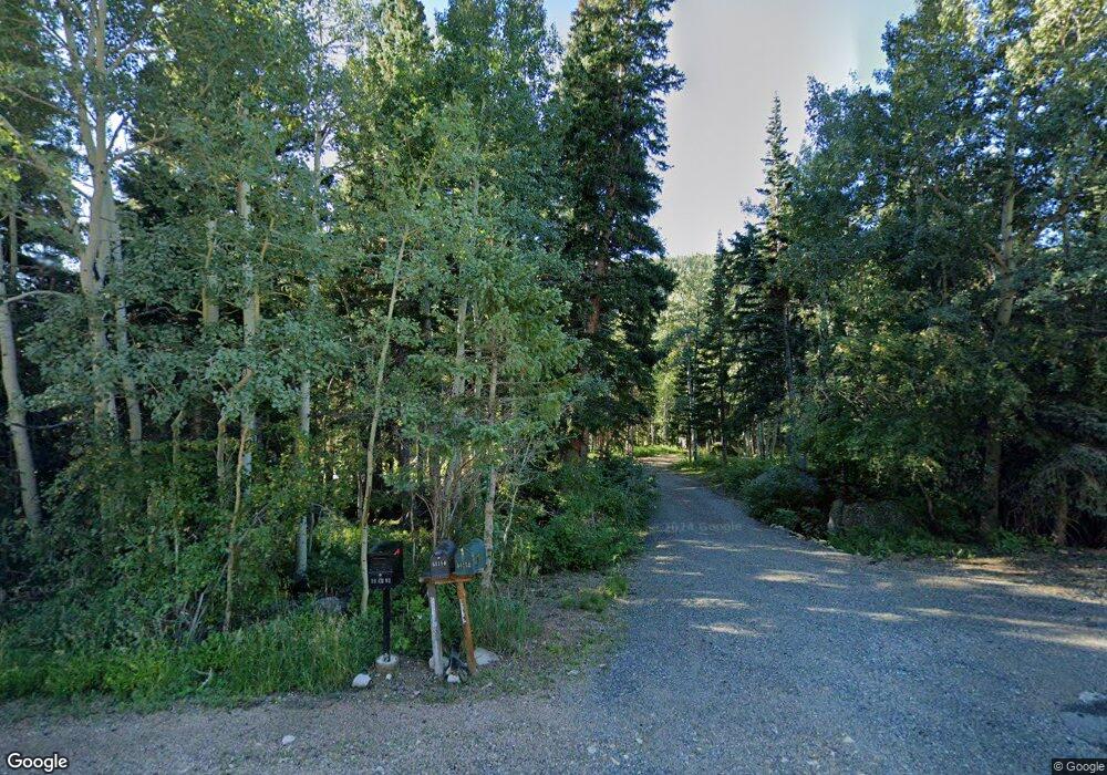
Estimated Value: $429,000 - $500,000
2
Beds
1
Bath
780
Sq Ft
$587/Sq Ft
Est. Value
About This Home
This home is located at 50150 State Highway 72, Lyons, CO 80540 and is currently estimated at $457,884, approximately $587 per square foot. 50150 State Highway 72 is a home with nearby schools including Lyons Elementary School and Lyons Middle/Senior High School.
Ownership History
Date
Name
Owned For
Owner Type
Purchase Details
Closed on
Mar 1, 2021
Sold by
Christoph James R and Christoph Maura M
Bought by
Christoph James R
Current Estimated Value
Purchase Details
Closed on
Dec 18, 1995
Sold by
Christoph James R and Christoph Maura M
Bought by
Christoph James R
Purchase Details
Closed on
Feb 4, 1992
Bought by
Christoph James R and Christoph Maura M
Purchase Details
Closed on
Dec 8, 1976
Bought by
Christoph James R and Christoph Maura M
Purchase Details
Closed on
Aug 23, 1972
Bought by
Christoph James R and Christoph Maura M
Create a Home Valuation Report for This Property
The Home Valuation Report is an in-depth analysis detailing your home's value as well as a comparison with similar homes in the area
Purchase History
| Date | Buyer | Sale Price | Title Company |
|---|---|---|---|
| Christoph James R | -- | None Available | |
| Christoph James R | -- | Land Title | |
| Christoph James R | $95,500 | -- | |
| Christoph James R | $48,500 | -- | |
| Christoph James R | -- | -- |
Source: Public Records
Tax History
| Year | Tax Paid | Tax Assessment Tax Assessment Total Assessment is a certain percentage of the fair market value that is determined by local assessors to be the total taxable value of land and additions on the property. | Land | Improvement |
|---|---|---|---|---|
| 2025 | $1,615 | $21,275 | $1,906 | $19,369 |
| 2024 | $1,615 | $21,275 | $1,906 | $19,369 |
| 2023 | $1,615 | $18,465 | $1,461 | $20,690 |
| 2022 | $1,802 | $19,579 | $1,731 | $17,848 |
| 2021 | $1,824 | $20,141 | $1,780 | $18,361 |
| 2020 | $1,606 | $17,790 | $2,503 | $15,287 |
| 2019 | $1,580 | $17,790 | $2,503 | $15,287 |
| 2018 | $1,498 | $17,006 | $2,664 | $14,342 |
| 2017 | $1,481 | $18,801 | $2,945 | $15,856 |
| 2016 | $1,184 | $13,349 | $3,184 | $10,165 |
| 2015 | $1,124 | $12,600 | $1,910 | $10,690 |
| 2014 | $1,090 | $12,600 | $1,910 | $10,690 |
Source: Public Records
Map
Nearby Homes
- 0 Pine Cone Cir Unit REC9444416
- 0 Pine Cone Cir Unit RECIR1037889
- 3154 Riverside Dr
- 187 Lynx Dr
- 2248 Riverside Dr
- 172 Saint Vrain Trail
- 24 Hickok Trail
- 190 Hard Way
- 189 Hard Way Rd
- 398 Overland Dr
- 148 Hickok Trail
- 254 Arrowood Dr
- 357 Big John Rd
- 212 Valley Rd
- 57 Nelson St
- 104 Utica St
- 993 Colorado 7 Business
- 18673 Colorado 7
- 18673 State Highway 7
- 223 Taylor Rd
- 50148 State Highway 72
- 50153 State Highway 72
- 50152 State Highway 72
- 103 Peaceful Valley Rd
- 83 Peaceful Valley Rd
- 50108 State Highway 72
- 111 Peaceful Valley Rd
- 50093 State Highway 72
- 50093 Peak To Peak Hwy
- 25 Peaceful Valley Rd
- 155 Peaceful Valley Rd
- 110 Peaceful Valley Rd
- 78 Peaceful Valley Rd
- 52 Peaceful Valley Rd
- 185 Peaceful Valley Rd
- 32 Peaceful Valley Rd
- 50091 State Highway 72
- 60 Kansas Hill Rd
- 30 Kansas Hill Rd
- 58 Kansas Hill Rd
Your Personal Tour Guide
Ask me questions while you tour the home.
