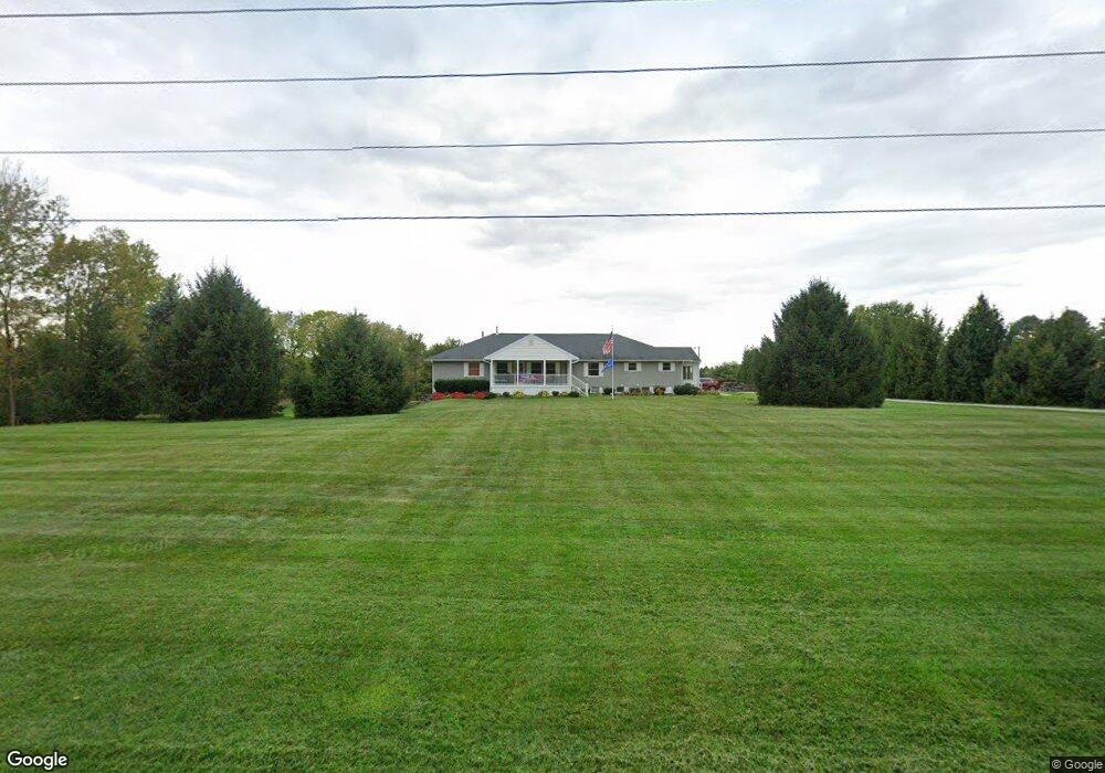
5019 State Route 257 Radnor, OH 43066
Thompson NeighborhoodEstimated Value: $508,000 - $562,000
4
Beds
4
Baths
2,880
Sq Ft
$184/Sq Ft
Est. Value
About This Home
This home is located at 5019 State Route 257, Radnor, OH 43066 and is currently estimated at $531,104, approximately $184 per square foot. 5019 State Route 257 is a home located in Delaware County with nearby schools including Elgin Elementary School, Elgin Middle School, and Elgin High School.
Ownership History
Date
Name
Owned For
Owner Type
Purchase Details
Closed on
Jul 3, 2024
Sold by
Potter Family Trust and Potter Gordon W
Bought by
Potter Asset Protection Trust and Potter
Current Estimated Value
Purchase Details
Closed on
Aug 12, 2013
Sold by
Potter Gordon W and Myers Cynthia I
Bought by
Potter Gordon W and Potter Cynthia I
Purchase Details
Closed on
Dec 3, 2001
Sold by
Hesson Frank W
Bought by
Vansweringen James G
Home Financials for this Owner
Home Financials are based on the most recent Mortgage that was taken out on this home.
Original Mortgage
$194,940
Interest Rate
6.64%
Mortgage Type
FHA
Purchase Details
Closed on
Aug 14, 1996
Sold by
Marcum Donald J
Bought by
Hesson Frank W and Hesson Tami K
Home Financials for this Owner
Home Financials are based on the most recent Mortgage that was taken out on this home.
Original Mortgage
$75,000
Interest Rate
7.69%
Mortgage Type
New Conventional
Create a Home Valuation Report for This Property
The Home Valuation Report is an in-depth analysis detailing your home's value as well as a comparison with similar homes in the area
Home Values in the Area
Average Home Value in this Area
Purchase History
| Date | Buyer | Sale Price | Title Company |
|---|---|---|---|
| Potter Asset Protection Trust | -- | Crown Search Box | |
| Potter Gordon W | -- | None Available | |
| Vansweringen James G | $198,000 | -- | |
| Hesson Frank W | $152,000 | -- |
Source: Public Records
Mortgage History
| Date | Status | Borrower | Loan Amount |
|---|---|---|---|
| Previous Owner | Vansweringen James G | $194,940 | |
| Previous Owner | Hesson Frank W | $75,000 |
Source: Public Records
Tax History Compared to Growth
Tax History
| Year | Tax Paid | Tax Assessment Tax Assessment Total Assessment is a certain percentage of the fair market value that is determined by local assessors to be the total taxable value of land and additions on the property. | Land | Improvement |
|---|---|---|---|---|
| 2024 | $5,315 | $142,980 | $15,930 | $127,050 |
| 2023 | $5,315 | $142,980 | $15,930 | $127,050 |
| 2022 | $4,642 | $119,250 | $12,390 | $106,860 |
| 2021 | $4,869 | $119,250 | $12,390 | $106,860 |
| 2020 | $4,881 | $119,250 | $12,390 | $106,860 |
| 2019 | $3,845 | $92,760 | $9,910 | $82,850 |
| 2018 | $3,673 | $92,760 | $9,910 | $82,850 |
| 2017 | $3,695 | $73,540 | $8,190 | $65,350 |
| 2016 | $2,947 | $73,540 | $8,190 | $65,350 |
| 2015 | $2,994 | $73,540 | $8,190 | $65,350 |
| 2014 | $3,043 | $73,540 | $8,190 | $65,350 |
| 2013 | $3,237 | $76,970 | $8,190 | $68,780 |
Source: Public Records
Map
Nearby Homes
- 4518 State Route 257
- 4093 State Route 257
- 6343 State Route 4
- 4525 Norton Rd
- 7186 Prospect Dublin Rd
- 0 Fulton Creek Rd
- 0 Prospect-Dublin Rd
- 206 S East St
- 1859 State Route 257 N
- 0 Marsh Rd Unit 225031436
- 300 N East St
- 2390 Penry Rd
- 0 Norton Rd
- 6434 Hughes Rd
- 6405 Hughes Rd
- 6323 Hughes Rd
- 2217 Radnor Rd
- 3935 N Section Line Rd
- 184 May St
- 11403 State Route 47
- 5019 Ohio 257
- 5039 State Route 257
- 5059 Ohio 257
- 5059 State Route 257
- 4994 Ohio 257
- 4994 State Route 257
- 6775 Taway Rd
- 5060 State Route 257
- 6901 Taway Rd
- 4843 State Route 257
- 7017 Taway Rd
- 5200 State Route 257
- 5246 State Route 257
- 7065 Taway Rd
- 4751 State Route 257
- 5378 State Route 257
- 7233 Taway Rd
- 5383 State Route 257
- 7246 Taway Rd
- 4581 State Route 257