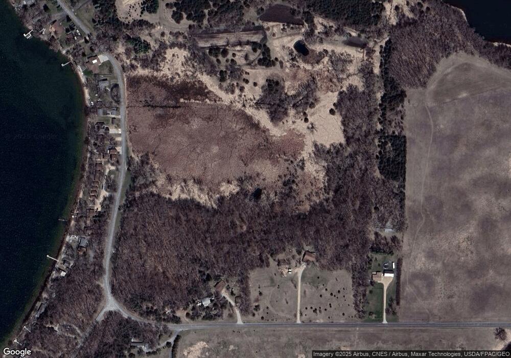
502 131st Ave NE Spicer, MN 56288
Estimated Value: $381,887 - $522,000
--
Bed
1
Bath
1,454
Sq Ft
$288/Sq Ft
Est. Value
About This Home
This home is located at 502 131st Ave NE, Spicer, MN 56288 and is currently estimated at $418,722, approximately $287 per square foot. 502 131st Ave NE is a home located in Kandiyohi County with nearby schools including Prairie Woods Elementary School, New London-Spicer Middle School, and New London-Spicer Senior High School.
Ownership History
Date
Name
Owned For
Owner Type
Purchase Details
Closed on
Sep 18, 2020
Sold by
Steele Roger and Anderle-Steele Betty
Bought by
Steele Roger and Anderle-Steele Betty
Current Estimated Value
Purchase Details
Closed on
Sep 9, 2020
Sold by
Steele Roger and Steele Betty Anderle
Bought by
Steele Jason R
Purchase Details
Closed on
Jan 15, 2010
Sold by
Steele Roger K
Bought by
Steele Roger and Anderle Steele Betty
Home Financials for this Owner
Home Financials are based on the most recent Mortgage that was taken out on this home.
Original Mortgage
$50,500
Interest Rate
5.01%
Mortgage Type
Credit Line Revolving
Purchase Details
Closed on
Oct 6, 2005
Sold by
Steele Roger K and Anderle Steele Betty A
Bought by
Steele Jason R and Steele Kari A
Create a Home Valuation Report for This Property
The Home Valuation Report is an in-depth analysis detailing your home's value as well as a comparison with similar homes in the area
Home Values in the Area
Average Home Value in this Area
Purchase History
| Date | Buyer | Sale Price | Title Company |
|---|---|---|---|
| Steele Roger | -- | None Available | |
| Steele Jason R | -- | None Available | |
| Steele Roger | -- | First American Title Insuran | |
| Steele Jason R | $160,000 | None Available |
Source: Public Records
Mortgage History
| Date | Status | Borrower | Loan Amount |
|---|---|---|---|
| Previous Owner | Steele Roger | $50,500 |
Source: Public Records
Tax History Compared to Growth
Tax History
| Year | Tax Paid | Tax Assessment Tax Assessment Total Assessment is a certain percentage of the fair market value that is determined by local assessors to be the total taxable value of land and additions on the property. | Land | Improvement |
|---|---|---|---|---|
| 2025 | $3,158 | $328,800 | $55,800 | $273,000 |
| 2024 | $2,908 | $321,800 | $48,100 | $273,700 |
| 2023 | $2,640 | $295,400 | $48,100 | $247,300 |
| 2022 | $2,564 | $274,200 | $41,100 | $233,100 |
| 2021 | $2,086 | $231,500 | $38,700 | $192,800 |
| 2020 | $2,648 | $267,700 | $97,600 | $170,100 |
| 2019 | $2,602 | $266,400 | $97,100 | $169,300 |
| 2018 | $2,502 | $258,300 | $97,100 | $161,200 |
| 2017 | $2,546 | $252,300 | $97,100 | $155,200 |
| 2016 | $2,466 | $2,343 | $0 | $0 |
| 2015 | -- | $0 | $0 | $0 |
| 2014 | -- | $0 | $0 | $0 |
Source: Public Records
Map
Nearby Homes
- 13112 2nd St NE
- 311 131st Ave NE
- 1245 137th Ave NW
- 10957 Highway 71 NE
- 4316 133rd Ave NE
- 4539 141st Ave NE
- 4808 132nd Ave NE Unit 25
- 5078 132nd Ave NE
- 5288 132nd Ave NE Unit C7
- 5288 (R22) 53rd St NE
- 5288 (R24) 53rd St NE
- 5272 (R26) 53rd St NE
- 5288 (R19) 53rd St NE
- 13205 (R17) 53rd St NE
- 5288 (R23) 53rd St NE
- 870 S Andrew Dr NE
- 1122 S Andrew Dr NE
- 7641 Long Lake Rd
- TBD Lot E Co Rd 40
- 6844 140th Ave NE
- 688 131st Ave NE
- 430 131st Ave NE
- 13152 2nd St NE
- 13194 2nd St NE
- 13132 2nd St NE
- 13050 2nd St NE
- 13318 2nd St NE
- 13340 2nd St NE
- 12956 2nd St NE
- 13360 2nd St NE
- 12966 2nd St NE
- 12936 2nd St NE
- 13400 2nd St NE
- 12924 2nd St NE
- 13422 2nd St NE
- 16502 10th St NE
- 12918 2nd St NE
- 12908 2nd St NE
- 13444 2nd St NE
- 13055 10th St NE
