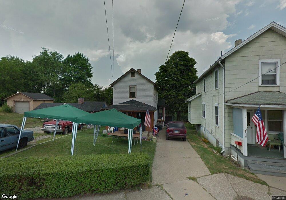
502 Alexander St Youngstown, OH 44502
Lower Gibson NeighborhoodEstimated Value: $42,000 - $60,000
2
Beds
1
Bath
1,174
Sq Ft
$41/Sq Ft
Est. Value
About This Home
This home is located at 502 Alexander St, Youngstown, OH 44502 and is currently estimated at $48,388, approximately $41 per square foot. 502 Alexander St is a home located in Mahoning County with nearby schools including Taft Elementary School, East High School, and South Side Academy.
Ownership History
Date
Name
Owned For
Owner Type
Purchase Details
Closed on
Apr 25, 2002
Sold by
Cambert Patricia K
Bought by
Randall Nicole
Current Estimated Value
Home Financials for this Owner
Home Financials are based on the most recent Mortgage that was taken out on this home.
Original Mortgage
$10,800
Interest Rate
6.64%
Purchase Details
Closed on
Sep 28, 2001
Sold by
Estate Of William Paul Getsy Sr
Bought by
Cambert Patricia K
Purchase Details
Closed on
Mar 15, 2001
Sold by
Estate Of Veronica M Getsy
Bought by
Getsy William Paul
Purchase Details
Closed on
Dec 6, 1993
Sold by
Getsy Andy
Bought by
Getsy Wm P and Getsy Veronica M
Create a Home Valuation Report for This Property
The Home Valuation Report is an in-depth analysis detailing your home's value as well as a comparison with similar homes in the area
Home Values in the Area
Average Home Value in this Area
Purchase History
| Date | Buyer | Sale Price | Title Company |
|---|---|---|---|
| Randall Nicole | $12,000 | -- | |
| Cambert Patricia K | -- | -- | |
| Getsy William Paul | -- | -- | |
| Getsy Wm P | $12,000 | -- |
Source: Public Records
Mortgage History
| Date | Status | Borrower | Loan Amount |
|---|---|---|---|
| Closed | Randall Nicole | $10,800 |
Source: Public Records
Tax History Compared to Growth
Tax History
| Year | Tax Paid | Tax Assessment Tax Assessment Total Assessment is a certain percentage of the fair market value that is determined by local assessors to be the total taxable value of land and additions on the property. | Land | Improvement |
|---|---|---|---|---|
| 2024 | $185 | $3,820 | $240 | $3,580 |
| 2023 | $183 | $3,820 | $240 | $3,580 |
| 2022 | $114 | $1,720 | $240 | $1,480 |
| 2021 | $108 | $1,720 | $240 | $1,480 |
| 2020 | $109 | $1,720 | $240 | $1,480 |
| 2019 | $124 | $1,720 | $240 | $1,480 |
| 2018 | $144 | $1,720 | $240 | $1,480 |
| 2017 | $122 | $1,720 | $240 | $1,480 |
| 2016 | $152 | $2,310 | $240 | $2,070 |
| 2015 | $148 | $2,310 | $240 | $2,070 |
| 2014 | $147 | $2,310 | $240 | $2,070 |
| 2013 | $145 | $2,310 | $240 | $2,070 |
Source: Public Records
Map
Nearby Homes
- 968 Cameron Ave
- 884 E Dewey Ave
- 941 E Dewey Ave
- 919 E Dewey Ave
- 708 Dickson St
- 834 Compton Ln
- 702 Dickson St
- 632 Samuel Ave
- 0 Tampa Ave Unit 4420178
- 537 Samuel Ave
- 724 E Laclede Ave
- 718 E Laclede Ave
- 525 Samuel Ave
- 2405 Shirley Rd
- 444 Emery Ave
- 427 Knox St
- 1313 Humbolt Ave
- 1447 Humbolt Ave
- 0000 S Ave
- 371 S Jackson St
- 426 Alexander St
- 422 Alexander St
- 510 Alexander St
- 514 Alexander St
- 507 Alexander St
- 421 Alexander St
- 511 Alexander St
- 413 Alexander St
- 556 Powersdale Ave
- 618 Powersdale Ave
- 620 Powersdale Ave
- 601 Powersdale Ave
- 609 Powersdale Ave
- 613 Powersdale Ave
- 617 Powersdale Ave
- 619 Powersdale Ave
- 325 Alexander St
- 317 Alexander St
- 57 Parnell St
- 42 Parnell St