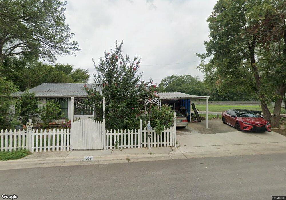
502 Eisenhower St San Marcos, TX 78666
Victory Gardens NeighborhoodEstimated Value: $200,330 - $242,000
--
Bed
--
Bath
1,120
Sq Ft
$203/Sq Ft
Est. Value
About This Home
This home is located at 502 Eisenhower St, San Marcos, TX 78666 and is currently estimated at $227,583, approximately $203 per square foot. 502 Eisenhower St is a home located in Hays County with nearby schools including Hernandez Elementary School, Dorris Miller Middle School, and San Marcos High School.
Ownership History
Date
Name
Owned For
Owner Type
Purchase Details
Closed on
Dec 24, 2008
Sold by
Wills Michael and Wills Elizabeth
Bought by
Moreno Agustin and Casas Moreno Elizabeth
Current Estimated Value
Home Financials for this Owner
Home Financials are based on the most recent Mortgage that was taken out on this home.
Original Mortgage
$35,800
Interest Rate
6.08%
Mortgage Type
Purchase Money Mortgage
Create a Home Valuation Report for This Property
The Home Valuation Report is an in-depth analysis detailing your home's value as well as a comparison with similar homes in the area
Home Values in the Area
Average Home Value in this Area
Purchase History
| Date | Buyer | Sale Price | Title Company |
|---|---|---|---|
| Moreno Agustin | -- | San Marcos Title |
Source: Public Records
Mortgage History
| Date | Status | Borrower | Loan Amount |
|---|---|---|---|
| Closed | Moreno Agustin | $35,800 |
Source: Public Records
Tax History Compared to Growth
Tax History
| Year | Tax Paid | Tax Assessment Tax Assessment Total Assessment is a certain percentage of the fair market value that is determined by local assessors to be the total taxable value of land and additions on the property. | Land | Improvement |
|---|---|---|---|---|
| 2025 | $3,377 | $169,340 | $60,210 | $109,130 |
| 2024 | $3,377 | $171,570 | $60,210 | $111,360 |
| 2023 | $3,394 | $178,450 | $57,630 | $120,820 |
| 2022 | $2,662 | $129,890 | $39,360 | $90,530 |
| 2021 | $1,885 | $85,500 | $32,070 | $53,430 |
| 2020 | $1,824 | $82,760 | $32,070 | $50,690 |
| 2019 | $1,928 | $78,320 | $30,610 | $47,710 |
| 2018 | $1,672 | $67,600 | $22,020 | $45,580 |
| 2017 | $1,501 | $62,450 | $18,740 | $43,710 |
| 2016 | $1,431 | $59,510 | $18,740 | $40,770 |
| 2015 | $1,205 | $57,120 | $18,740 | $38,380 |
Source: Public Records
Map
Nearby Homes
- 812 Gravel St
- 408 Railroad St
- 1011 Gravel St
- 328 Wavell St
- 216 Armstrong St
- 1010 Gravel St
- 203 S Mitchell St Unit 4
- 1128 Invasion St
- 214 Jackman St
- 722 S Lbj Dr
- 309 Ellis St
- 527 W San Antonio St
- 321 S L B J Dr
- 121 Scott St
- 421 W San Antonio St Unit I-3
- 421 W San Antonio St Unit E-4
- 506 W San Antonio St Unit 205
- 512 S Cm Allen Pkwy
- 833 Belvin St
- 1222 W Hopkins St
- 392 Railroad St
- 394 Railroad St
- 0 Tbd S Ih 35 Hwy Unit 1334132
- 0 Tbd S Ih 35 Hwy Unit 357266
- 0 Tbd S Ih 35 Hwy Unit 30082804
- 514 Patton St
- 510 Patton St
- 396 Railroad St
- 532 Eisenhower St
- 504 Patton St
- 422 Roosevelt St
- 518 Patton St
- 420 Roosevelt St
- 398 Railroad St
- 412 Roosevelt St
- 504 Alabama St
- 506 Alabama St
- 400 Railroad St
- 410 Roosevelt St
- 515 Patton St