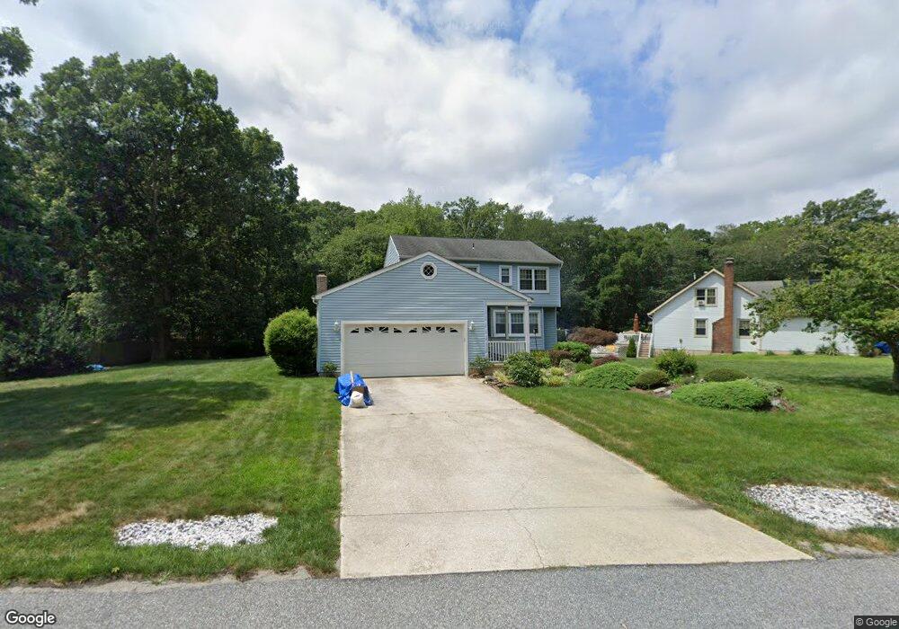
502 Forrest Brook Dr Galloway, NJ 08205
Estimated Value: $440,083 - $488,000
--
Bed
--
Bath
2,451
Sq Ft
$190/Sq Ft
Est. Value
About This Home
This home is located at 502 Forrest Brook Dr, Galloway, NJ 08205 and is currently estimated at $464,521, approximately $189 per square foot. 502 Forrest Brook Dr is a home located in Atlantic County with nearby schools including Absegami High School, Oakcrest High School, and Cedar Creek High School.
Ownership History
Date
Name
Owned For
Owner Type
Purchase Details
Closed on
Sep 26, 1994
Sold by
Hartwell Charles
Bought by
Maurino Josephine
Current Estimated Value
Home Financials for this Owner
Home Financials are based on the most recent Mortgage that was taken out on this home.
Original Mortgage
$33,000
Interest Rate
8.5%
Purchase Details
Closed on
Apr 23, 1987
Bought by
Eckel Charles T and Eckel Lynda
Create a Home Valuation Report for This Property
The Home Valuation Report is an in-depth analysis detailing your home's value as well as a comparison with similar homes in the area
Home Values in the Area
Average Home Value in this Area
Purchase History
| Date | Buyer | Sale Price | Title Company |
|---|---|---|---|
| Maurino Josephine | $42,000 | -- | |
| Eckel Charles T | $143,500 | -- |
Source: Public Records
Mortgage History
| Date | Status | Borrower | Loan Amount |
|---|---|---|---|
| Closed | Maurino Josephine | $33,000 |
Source: Public Records
Tax History Compared to Growth
Tax History
| Year | Tax Paid | Tax Assessment Tax Assessment Total Assessment is a certain percentage of the fair market value that is determined by local assessors to be the total taxable value of land and additions on the property. | Land | Improvement |
|---|---|---|---|---|
| 2025 | $7,614 | $228,100 | $54,700 | $173,400 |
| 2024 | $7,614 | $228,100 | $54,700 | $173,400 |
| 2023 | $7,324 | $228,100 | $54,700 | $173,400 |
| 2022 | $7,324 | $228,100 | $54,700 | $173,400 |
| 2021 | $7,178 | $228,100 | $54,700 | $173,400 |
| 2020 | $7,064 | $228,100 | $54,700 | $173,400 |
| 2019 | $6,934 | $228,100 | $54,700 | $173,400 |
| 2018 | $7,032 | $228,100 | $54,700 | $173,400 |
| 2017 | $7,032 | $228,100 | $54,700 | $173,400 |
| 2016 | $6,971 | $228,100 | $54,700 | $173,400 |
| 2015 | $6,939 | $228,100 | $54,700 | $173,400 |
| 2014 | $6,708 | $228,100 | $54,700 | $173,400 |
Source: Public Records
Map
Nearby Homes
- 506 E Forestbrook Dr
- 428 E Elm Ave
- 515 E Brook Ln
- 90 E Woodland Ave Unit E90
- 399 E Upland Ave
- 47 E Woodland Ave Unit C47
- 19 E Woodland Ave Unit E101
- 546 A E Brook Ln
- 503 S Seaview Ave
- 0 E Dickinson Ave
- 509 S Pitney Rd
- 611 S New York Rd
- 621 S New York Rd
- 134D Crestview Ave
- 613 S New York Rd
- 743 N Shore Rd
- 524 S 10th Ave
- 625 N Shore Rd
- 210 Coolidge Ave
- 615 N Shore Rd
- 504 Forrest Brook Dr
- 504 Forrest Brook Dr
- 500 Forrest Brook Dr
- 501 Forrest Brook Dr
- 552 S Seaview Ave
- 524 S Seaview Ave
- 526 S Seaview Ave
- 546 S Seaview Ave
- 506 Forrest Brook Dr
- 505 Forrest Brook Dr
- 523 Forrest Brook Dr
- 544 S Seaview Ave Unit 37H
- 508 Forrest Brook Dr
- 410 E Elm Ave
- 547 S Seaview Ave
- 501 Arbor Ct
- 556 S Seaview Ave
- 551 S Seaview Ave
- 507 Forrest Brook Dr
- 430 E Elm Ave