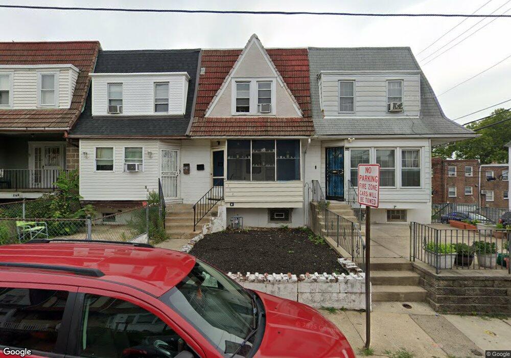
502 Hampden Rd Upper Darby, PA 19082
Estimated Value: $149,000 - $190,000
3
Beds
1
Bath
1,546
Sq Ft
$107/Sq Ft
Est. Value
About This Home
This home is located at 502 Hampden Rd, Upper Darby, PA 19082 and is currently estimated at $165,344, approximately $106 per square foot. 502 Hampden Rd is a home located in Delaware County with nearby schools including Upper Darby Kdg Center, Upper Darby High School, and Vision Academy Charter School.
Ownership History
Date
Name
Owned For
Owner Type
Purchase Details
Closed on
May 25, 2010
Sold by
Federal Home Loan Mortgage Corporation
Bought by
Graber Jeffrey G
Current Estimated Value
Purchase Details
Closed on
Dec 28, 2007
Sold by
Hanson Robert and Hanson Anne
Bought by
Clark Terrance
Home Financials for this Owner
Home Financials are based on the most recent Mortgage that was taken out on this home.
Original Mortgage
$115,576
Interest Rate
6.21%
Mortgage Type
Purchase Money Mortgage
Purchase Details
Closed on
Sep 19, 2007
Sold by
Collins Herbert M and Vetter Nancy
Bought by
Hanson Robert P and Hanson Anne D
Create a Home Valuation Report for This Property
The Home Valuation Report is an in-depth analysis detailing your home's value as well as a comparison with similar homes in the area
Home Values in the Area
Average Home Value in this Area
Purchase History
| Date | Buyer | Sale Price | Title Company |
|---|---|---|---|
| Graber Jeffrey G | $42,000 | Land Title Services | |
| Clark Terrance | $119,150 | None Available | |
| Hanson Robert P | $66,000 | None Available |
Source: Public Records
Mortgage History
| Date | Status | Borrower | Loan Amount |
|---|---|---|---|
| Previous Owner | Clark Terrance | $115,576 |
Source: Public Records
Tax History Compared to Growth
Tax History
| Year | Tax Paid | Tax Assessment Tax Assessment Total Assessment is a certain percentage of the fair market value that is determined by local assessors to be the total taxable value of land and additions on the property. | Land | Improvement |
|---|---|---|---|---|
| 2025 | $2,860 | $67,620 | $13,740 | $53,880 |
| 2024 | $2,860 | $67,620 | $13,740 | $53,880 |
| 2023 | $2,833 | $67,620 | $13,740 | $53,880 |
| 2022 | $2,757 | $67,620 | $13,740 | $53,880 |
| 2021 | $3,717 | $67,620 | $13,740 | $53,880 |
| 2020 | $2,067 | $31,955 | $12,490 | $19,465 |
| 2019 | $2,031 | $31,955 | $12,490 | $19,465 |
| 2018 | $2,932 | $46,670 | $0 | $0 |
| 2017 | $2,856 | $46,670 | $0 | $0 |
| 2016 | $256 | $46,670 | $0 | $0 |
| 2015 | $261 | $46,670 | $0 | $0 |
| 2014 | $261 | $46,670 | $0 | $0 |
Source: Public Records
Map
Nearby Homes
- 7139 Guilford Rd
- 607 Littlecroft Rd
- 346 Long Ln
- 404 Croyden Rd
- 669 Long Ln
- 504 Woodcliffe Rd
- 513 Woodcliffe Rd
- 418 Hampden Rd
- 424 Woodcliffe Rd
- 7155 Radbourne Rd
- 432 Grace Rd
- 7162 Radbourne Rd
- 6982 Clinton Rd
- 351 Long Ln
- 517 Wiltshire Rd
- 525 Wiltshire Rd
- 7114 Locust St
- 7265 Calvin Rd
- 7123 Seaford Rd
- 213 1/2 Melrose Ave
- 528 Hampden Rd
- 526 Hampden Rd
- 524 Hampden Rd
- 522 Hampden Rd
- 520 Hampden Rd
- 516 Hampden Rd
- 514 Hampden Rd Unit 7C
- 512 Hampden Rd
- 508 Hampden Rd
- 500 Hampden Rd
- 546 Hampden Rd
- 308 Richfield Rd
- 312 Richfield Rd
- 544 Hampden Rd
- 542 Hampden Rd
- 540 Hampden Rd
- 316 Richfield Rd
- 536 Hampden Rd
- 535 Hampden Rd
- 533 Hampden Rd