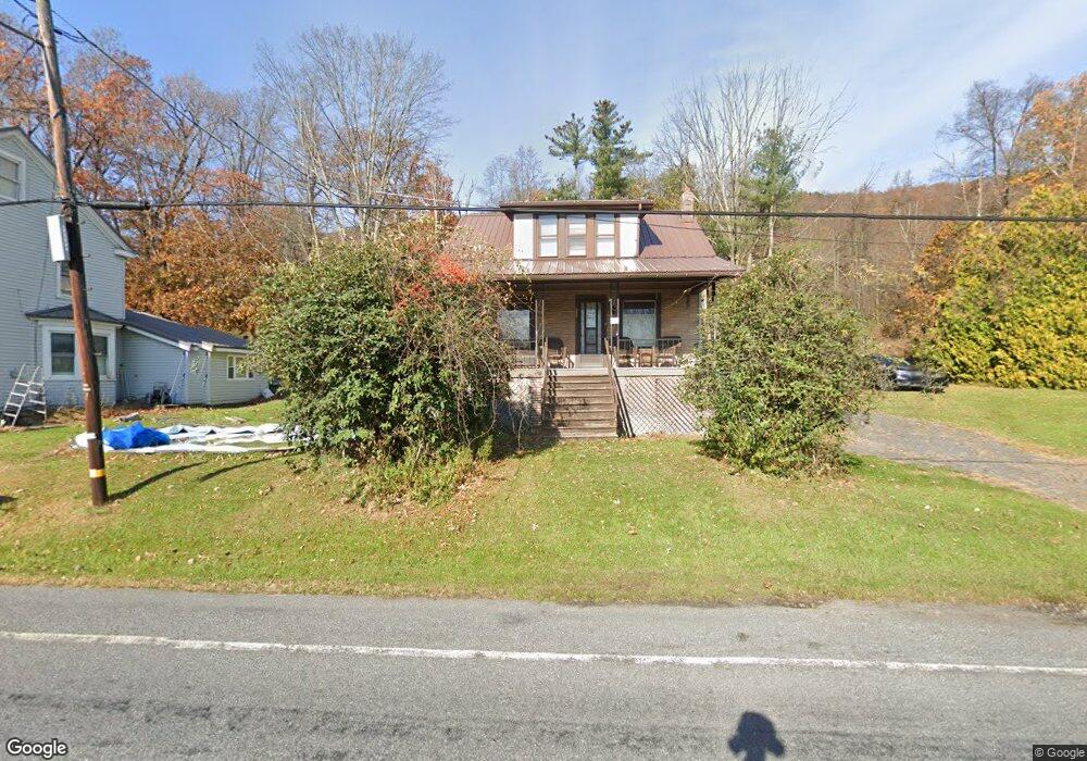
502 High Rd Ashland, PA 17921
Estimated Value: $100,861 - $171,000
2
Beds
1
Bath
1,172
Sq Ft
$123/Sq Ft
Est. Value
About This Home
This home is located at 502 High Rd, Ashland, PA 17921 and is currently estimated at $143,715, approximately $122 per square foot. 502 High Rd is a home located in Schuylkill County with nearby schools including North Schuylkill Elementary School and North Schuylkill Junior/Senior High School.
Ownership History
Date
Name
Owned For
Owner Type
Purchase Details
Closed on
Oct 30, 2017
Sold by
Overkott Diane and Estate Of Virginia Fetterolf
Bought by
Edwards Randall and Edwards Suzanne
Current Estimated Value
Home Financials for this Owner
Home Financials are based on the most recent Mortgage that was taken out on this home.
Original Mortgage
$54,000
Outstanding Balance
$29,604
Interest Rate
3.78%
Mortgage Type
New Conventional
Estimated Equity
$114,111
Purchase Details
Closed on
May 23, 2008
Sold by
Fetterolf Virginia
Bought by
Fetterolf Virginia
Create a Home Valuation Report for This Property
The Home Valuation Report is an in-depth analysis detailing your home's value as well as a comparison with similar homes in the area
Home Values in the Area
Average Home Value in this Area
Purchase History
| Date | Buyer | Sale Price | Title Company |
|---|---|---|---|
| Edwards Randall | $60,000 | None Available | |
| Fetterolf Virginia | -- | None Available |
Source: Public Records
Mortgage History
| Date | Status | Borrower | Loan Amount |
|---|---|---|---|
| Open | Edwards Randall | $54,000 |
Source: Public Records
Tax History Compared to Growth
Tax History
| Year | Tax Paid | Tax Assessment Tax Assessment Total Assessment is a certain percentage of the fair market value that is determined by local assessors to be the total taxable value of land and additions on the property. | Land | Improvement |
|---|---|---|---|---|
| 2025 | $1,214 | $15,625 | $5,000 | $10,625 |
| 2024 | $1,137 | $15,625 | $5,000 | $10,625 |
| 2023 | $1,137 | $15,625 | $5,000 | $10,625 |
| 2022 | $1,112 | $15,625 | $5,000 | $10,625 |
| 2021 | $1,098 | $15,625 | $5,000 | $10,625 |
| 2020 | $1,078 | $15,625 | $5,000 | $10,625 |
| 2018 | $1,040 | $15,625 | $5,000 | $10,625 |
| 2017 | $1,014 | $15,625 | $5,000 | $10,625 |
| 2015 | -- | $15,625 | $5,000 | $10,625 |
| 2011 | -- | $15,625 | $0 | $0 |
Source: Public Records
Map
Nearby Homes
- 0 W Side of Stein Rd
- 60 South St
- 6852 Upper Rd
- 331 S Maple St
- 329 S Maple St
- 334 W Butternut St
- 141 W 5th St
- 125 W 5th St
- 401 E 7th St
- 0 Airport Rd Unit PASK2024112
- 124 S Maple St
- 202 W 4th St
- 226 S Lemon St Unit 228
- 131 S Oak St
- 216 S Chestnut St
- 19 S Beech St
- 310 W 3rd St
- 501 W 3rd St
- 145 S Lemon St
- 447 W 3rd St
- 504 High Rd
- 496 High Rd
- 501 High Rd
- 508 High Rd
- 0 High Rd Unit 1007497098
- 0 High Rd Unit 1007231612
- 0 High Rd Unit 7149046
- 0 High Rd Unit 6114745
- 0 High Rd Unit 6830586
- 0 High Rd Unit PASK2014890
- 0 High Rd Unit PASK2005626
- 0 High Rd Unit PASK2001470
- 0 High Rd Unit 1000306622
- 487 High Rd
- 520 High Rd
- 542 High Rd
- 475 High Rd
- 490 High Rd
- 482 High Rd
- 540 High Rd