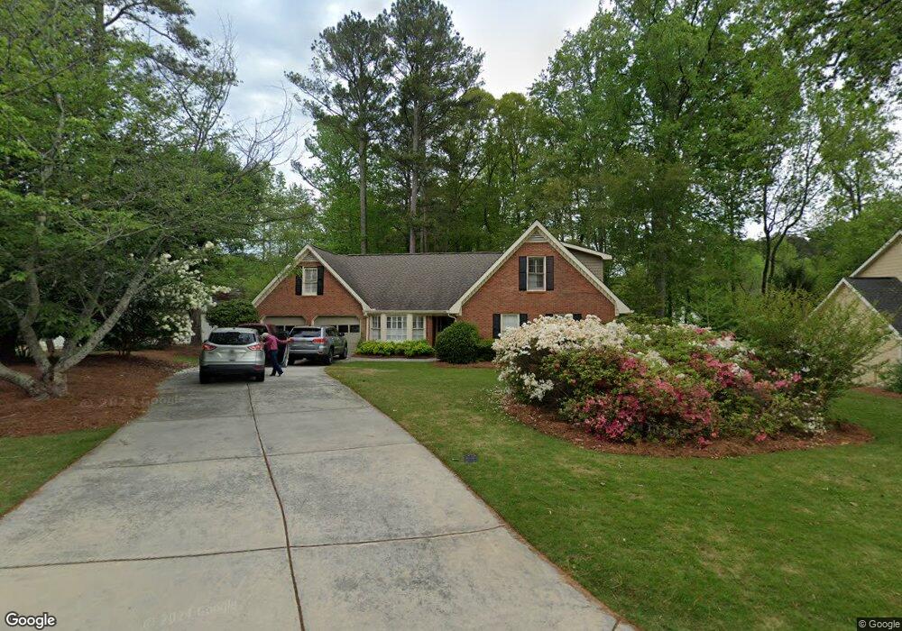
502 Lees Trace SW Marietta, GA 30064
Southwestern Marietta NeighborhoodEstimated Value: $584,309 - $636,000
4
Beds
3
Baths
2,837
Sq Ft
$213/Sq Ft
Est. Value
About This Home
This home is located at 502 Lees Trace SW, Marietta, GA 30064 and is currently estimated at $604,327, approximately $213 per square foot. 502 Lees Trace SW is a home located in Cobb County with nearby schools including A.L. Burruss Elementary School, Marietta Sixth Grade Academy, and Marietta Middle School.
Ownership History
Date
Name
Owned For
Owner Type
Purchase Details
Closed on
May 7, 2018
Sold by
Stills Sharon F
Bought by
Stills Kimberly Paige
Current Estimated Value
Purchase Details
Closed on
Aug 6, 1998
Sold by
Wilbanks Deborah S
Bought by
Stills Darvin B and Stills Sharon
Home Financials for this Owner
Home Financials are based on the most recent Mortgage that was taken out on this home.
Original Mortgage
$85,000
Interest Rate
6.91%
Mortgage Type
New Conventional
Create a Home Valuation Report for This Property
The Home Valuation Report is an in-depth analysis detailing your home's value as well as a comparison with similar homes in the area
Home Values in the Area
Average Home Value in this Area
Purchase History
| Date | Buyer | Sale Price | Title Company |
|---|---|---|---|
| Stills Kimberly Paige | $315,000 | -- | |
| Stills Darvin B | $165,000 | -- |
Source: Public Records
Mortgage History
| Date | Status | Borrower | Loan Amount |
|---|---|---|---|
| Previous Owner | Stills Darvin B | $85,000 |
Source: Public Records
Tax History Compared to Growth
Tax History
| Year | Tax Paid | Tax Assessment Tax Assessment Total Assessment is a certain percentage of the fair market value that is determined by local assessors to be the total taxable value of land and additions on the property. | Land | Improvement |
|---|---|---|---|---|
| 2025 | $886 | $239,068 | $52,000 | $187,068 |
| 2024 | $886 | $239,068 | $52,000 | $187,068 |
| 2023 | $734 | $184,668 | $46,000 | $138,668 |
| 2022 | $886 | $139,452 | $29,800 | $109,652 |
| 2021 | $904 | $139,452 | $29,800 | $109,652 |
| 2020 | $902 | $124,428 | $29,800 | $94,628 |
| 2019 | $902 | $124,428 | $29,800 | $94,628 |
| 2018 | $460 | $114,712 | $28,000 | $86,712 |
| 2017 | $371 | $114,712 | $28,000 | $86,712 |
| 2016 | $375 | $105,524 | $28,000 | $77,524 |
| 2015 | $406 | $94,612 | $32,300 | $62,312 |
| 2014 | $417 | $94,612 | $0 | $0 |
Source: Public Records
Map
Nearby Homes
- 1047 Chestnut Hill Cir SW
- 332 Rockmann Ln SW
- 1161 Rockmann Terrace SW
- 1198 Seminary Dr SW
- 988 Grantham Way SW
- 1211 Cliffpine Ct SW
- 560 Manning Rd SW
- 1121 Cannongate Crossing SW
- 1011 Cannongate Crossing SW
- 1017 Cannongate Crossing SW
- 652 Trailwood Ln SW
- 839 Manning Villas Ct SW
- 916 Cannon Gate Crossing
- 1410 Dallas Cir SW
- 916 Cannongate Crossing SW Unit 916
- The Bainbridge Plan at Highvale
- The Oxford Plan at Highvale
- The Thomson Plan at Highvale
- The Vinings Plan at Highvale
- The Brooks Plan at Highvale
- 496 Lees Trace SW
- 506 Lees Trace SW
- 1079 Foreststone Way SW
- 512 Lees Trace SW
- 1037 Chestnut Hill Cir SW
- 1033 Chestnut Hill Cir SW
- 1104 Cedar Branch Ct SW
- 1035 Chestnut Hill Cir SW
- 1039 Chestnut Hill Cir SW
- 485 Lees Trace SW
- 1078 Foreststone Way SW
- 1110 Cedar Branch Ct SW
- 1041 Chestnut Hill Cir SW
- 0 Lees Trace SW Unit 8826552
- 1073 Foreststone Way SW
- 515 Lees Trace SW
- 0 Foreststone Way
- 479 Lees Trace SW
- 1105 Cedar Branch Ct SW
- 1101 Cedar Branch Ct SW