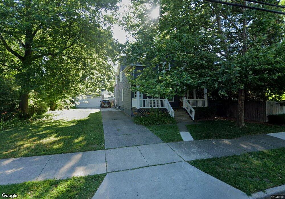
502 Notre Dame St Grosse Pointe, MI 48230
Estimated Value: $388,000 - $494,000
4
Beds
2
Baths
2,082
Sq Ft
$206/Sq Ft
Est. Value
About This Home
This home is located at 502 Notre Dame St, Grosse Pointe, MI 48230 and is currently estimated at $429,894, approximately $206 per square foot. 502 Notre Dame St is a home located in Wayne County with nearby schools including Lewis Maire Elementary School, Pierce Middle School, and Grosse Pointe South High School.
Ownership History
Date
Name
Owned For
Owner Type
Purchase Details
Closed on
Nov 21, 2017
Sold by
Allen Christine
Bought by
Allen Richard
Current Estimated Value
Purchase Details
Closed on
Sep 16, 2010
Sold by
Stonisch Rudolph T and Stonisch Mary Sue
Bought by
Allen Richard E and Allen Christine A
Purchase Details
Closed on
Jun 13, 1994
Sold by
Frances Z Cross Est
Bought by
Rudolph T Stonisch
Create a Home Valuation Report for This Property
The Home Valuation Report is an in-depth analysis detailing your home's value as well as a comparison with similar homes in the area
Home Values in the Area
Average Home Value in this Area
Purchase History
| Date | Buyer | Sale Price | Title Company |
|---|---|---|---|
| Allen Richard | -- | None Available | |
| Allen Richard E | $80,000 | Multiple | |
| Rudolph T Stonisch | $81,500 | -- |
Source: Public Records
Tax History Compared to Growth
Tax History
| Year | Tax Paid | Tax Assessment Tax Assessment Total Assessment is a certain percentage of the fair market value that is determined by local assessors to be the total taxable value of land and additions on the property. | Land | Improvement |
|---|---|---|---|---|
| 2025 | $3,023 | $170,700 | $0 | $0 |
| 2024 | $3,023 | $165,400 | $0 | $0 |
| 2023 | $2,883 | $161,100 | $0 | $0 |
| 2022 | $4,728 | $148,500 | $0 | $0 |
| 2021 | $4,550 | $139,900 | $0 | $0 |
| 2019 | $4,586 | $115,000 | $0 | $0 |
| 2018 | $2,502 | $98,300 | $0 | $0 |
| 2017 | $4,346 | $97,300 | $0 | $0 |
| 2016 | $4,585 | $92,800 | $0 | $0 |
| 2015 | $7,140 | $85,500 | $0 | $0 |
| 2013 | $6,917 | $73,200 | $0 | $0 |
| 2012 | -- | $61,400 | $0 | $0 |
Source: Public Records
Map
Nearby Homes
- 16935 Maumee Ave
- 43 Cranford Ln
- 25 Village Ln
- 497 Neff Rd
- 379 Lakeland St
- 386 Notre Dame St
- 616 Cadieux Rd
- 320 Neff Rd
- 425 Rivard Blvd
- 1036 Yorkshire Rd
- 1117 Bishop Rd
- 674 Neff Rd
- 296 Rivard Blvd
- 459 Washington Rd
- 355 Lincoln Rd
- 775 Notre Dame St
- 277 Lincoln Rd
- 17680 E Jefferson Ave
- 4 Cameron Place
- 1358 Harvard Rd
- 508 Notre Dame St
- 508 Notre Dame St
- 510 Notre Dame St
- 17015 Maumee Ave
- 475 Saint Clair St
- 475 Saint Clair St
- 516 Notre Dame St
- 479 Saint Clair St
- 485 Saint Clair St
- 520 Notre Dame St
- 489 Saint Clair St
- 58 Cranford Ln
- 507 Notre Dame St
- 469 Saint Clair St
- 469 St Clair
- 16935 Maumee Ave
- 493 Saint Clair St
- 524 Notre Dame St
- 529 Notre Dame St Unit 2
- 529 Notre Dame St Unit DAME