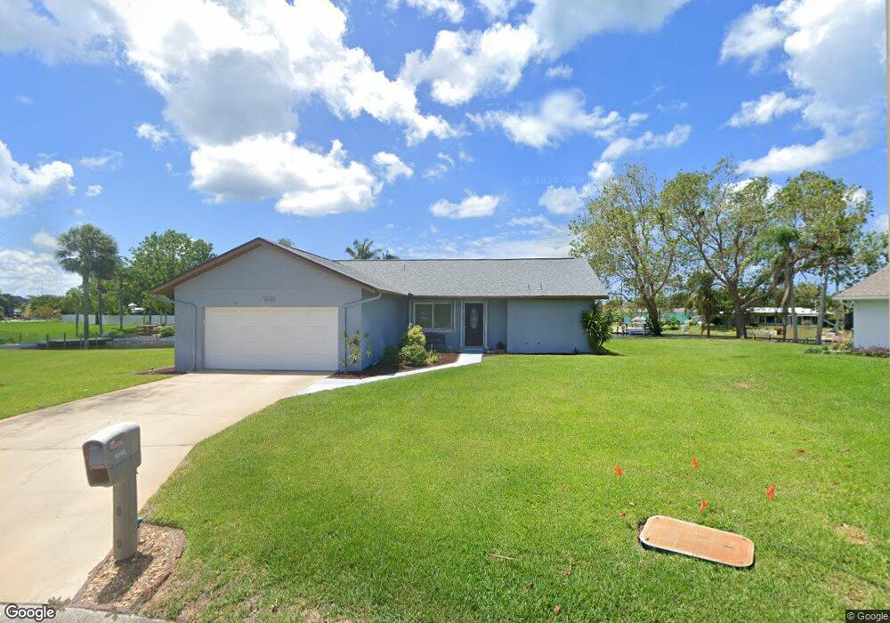
5020 Mangrove Point Rd Bradenton, FL 34210
Estimated Value: $546,432 - $763,000
3
Beds
2
Baths
1,667
Sq Ft
$399/Sq Ft
Est. Value
About This Home
This home is located at 5020 Mangrove Point Rd, Bradenton, FL 34210 and is currently estimated at $665,358, approximately $399 per square foot. 5020 Mangrove Point Rd is a home located in Manatee County with nearby schools including Sea Breeze Elementary School, W. D. Sugg Middle School, and Bayshore High School.
Ownership History
Date
Name
Owned For
Owner Type
Purchase Details
Closed on
Jun 4, 2018
Sold by
Miller Rosetta R and Miller Herbert E
Bought by
Miller Rosetta R
Current Estimated Value
Purchase Details
Closed on
Sep 12, 1997
Sold by
Bishop Michael M
Bought by
Miller Herbert E and Miller Rosetta R
Home Financials for this Owner
Home Financials are based on the most recent Mortgage that was taken out on this home.
Original Mortgage
$80,000
Interest Rate
7.39%
Create a Home Valuation Report for This Property
The Home Valuation Report is an in-depth analysis detailing your home's value as well as a comparison with similar homes in the area
Home Values in the Area
Average Home Value in this Area
Purchase History
| Date | Buyer | Sale Price | Title Company |
|---|---|---|---|
| Miller Rosetta R | -- | None Available | |
| Miller Herbert E | $140,000 | -- |
Source: Public Records
Mortgage History
| Date | Status | Borrower | Loan Amount |
|---|---|---|---|
| Previous Owner | Miller Herbert E | $80,000 |
Source: Public Records
Tax History Compared to Growth
Tax History
| Year | Tax Paid | Tax Assessment Tax Assessment Total Assessment is a certain percentage of the fair market value that is determined by local assessors to be the total taxable value of land and additions on the property. | Land | Improvement |
|---|---|---|---|---|
| 2025 | $2,639 | $217,261 | -- | -- |
| 2024 | $2,639 | $211,138 | -- | -- |
| 2023 | $2,583 | $204,988 | $0 | $0 |
| 2022 | $2,560 | $199,017 | $0 | $0 |
| 2021 | $2,458 | $193,220 | $0 | $0 |
| 2020 | $2,528 | $190,552 | $0 | $0 |
| 2019 | $2,486 | $186,268 | $0 | $0 |
| 2018 | $2,463 | $182,795 | $0 | $0 |
| 2017 | $2,288 | $179,035 | $0 | $0 |
| 2016 | $2,280 | $175,353 | $0 | $0 |
| 2015 | $2,255 | $174,134 | $0 | $0 |
| 2014 | $2,255 | $168,863 | $0 | $0 |
| 2013 | $2,242 | $166,367 | $53,100 | $113,267 |
Source: Public Records
Map
Nearby Homes
- 5207 Bimini Dr
- 4704 Coral Lake Dr
- 5219 Bimini Dr
- 8711 51st Ave W
- 5207 88th St W
- 8607 51st Ave W
- 5108 86th Street Ct W
- 8607 50th Ave W
- 5107 86th Street Ct W
- 4515 Mangrove Point Rd
- 5207 86th Street Ct W
- 4855 Independence Dr
- 4832 Independence Dr Unit 4832
- 4852 Independence Dr Unit 4852
- 4809 Independence Dr Unit 4809
- 9426 Andover Cir
- 4859 Independence Dr Unit 4859
- 4745 Independence Dr Unit 4745
- 8730 54th Ave W Unit 8730
- 4503 Coral Lake Dr
- 5016 Mangrove Point Rd
- 5015 Mangrove Point Rd
- 5012 Mangrove Point Rd
- 5008 Mangrove Point Rd
- 5104 Coral Lake Dr
- 5007 Mangrove Point Rd
- 5108 Coral Lake Dr
- 5016 Coral Lake Dr
- 5107 Coral Blvd
- 5010 Coral Lake Dr
- 5105 Coral Blvd
- 5205 Coral Blvd
- 5303 Coral Blvd
- 5209 Coral Blvd Unit 1
- 5104 89th St W
- 5004 Mangrove Point Rd
- 5011 Coral Blvd
- 5003 Mangrove Point Rd
- 5008 Coral Lake Dr
- 5307 Coral Blvd