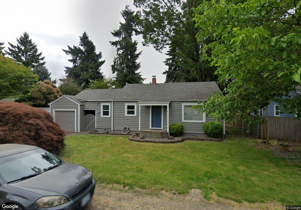
5020 Robindale Dr N Keizer, OR 97303
Estimated Value: $290,000 - $343,361
2
Beds
1
Bath
958
Sq Ft
$336/Sq Ft
Est. Value
About This Home
This home is located at 5020 Robindale Dr N, Keizer, OR 97303 and is currently estimated at $322,090, approximately $336 per square foot. 5020 Robindale Dr N is a home located in Marion County with nearby schools including Keizer Elementary School, Claggett Creek Middle School, and McNary High School.
Ownership History
Date
Name
Owned For
Owner Type
Purchase Details
Closed on
Jan 4, 2007
Sold by
Addicott Douglas J and Addicott Robin S
Bought by
Lamberton Dennis H
Current Estimated Value
Home Financials for this Owner
Home Financials are based on the most recent Mortgage that was taken out on this home.
Original Mortgage
$158,332
Outstanding Balance
$93,020
Interest Rate
6.09%
Mortgage Type
VA
Estimated Equity
$229,070
Purchase Details
Closed on
Jun 9, 2005
Sold by
Addicott Douglas J
Bought by
Kluesner Robin S and Addicott Douglas J
Purchase Details
Closed on
Sep 29, 2003
Sold by
Delong Kevin G and Delong Kelly A
Bought by
Addicott Douglas J
Home Financials for this Owner
Home Financials are based on the most recent Mortgage that was taken out on this home.
Original Mortgage
$80,250
Interest Rate
5.99%
Mortgage Type
Purchase Money Mortgage
Create a Home Valuation Report for This Property
The Home Valuation Report is an in-depth analysis detailing your home's value as well as a comparison with similar homes in the area
Home Values in the Area
Average Home Value in this Area
Purchase History
| Date | Buyer | Sale Price | Title Company |
|---|---|---|---|
| Lamberton Dennis H | $155,000 | Lawyers Title Ins | |
| Kluesner Robin S | -- | -- | |
| Addicott Douglas J | $107,000 | Ticor Title |
Source: Public Records
Mortgage History
| Date | Status | Borrower | Loan Amount |
|---|---|---|---|
| Open | Lamberton Dennis H | $158,332 | |
| Previous Owner | Addicott Douglas J | $80,250 | |
| Closed | Addicott Douglas J | $26,750 |
Source: Public Records
Tax History
| Year | Tax Paid | Tax Assessment Tax Assessment Total Assessment is a certain percentage of the fair market value that is determined by local assessors to be the total taxable value of land and additions on the property. | Land | Improvement |
|---|---|---|---|---|
| 2025 | $2,031 | $121,770 | -- | -- |
| 2024 | $2,031 | $118,230 | -- | -- |
| 2023 | $1,933 | $114,790 | $0 | $0 |
| 2022 | $1,815 | $111,450 | $0 | $0 |
| 2021 | $1,758 | $108,210 | $0 | $0 |
| 2020 | $1,712 | $105,060 | $0 | $0 |
| 2019 | $1,646 | $102,000 | $0 | $0 |
| 2018 | $1,674 | $0 | $0 | $0 |
| 2017 | $1,504 | $0 | $0 | $0 |
| 2016 | $1,442 | $0 | $0 | $0 |
| 2015 | $1,453 | $0 | $0 | $0 |
| 2014 | $1,414 | $0 | $0 | $0 |
Source: Public Records
Map
Nearby Homes
- 521 Chemawa Rd N
- 459 Churchdale Ave N
- 724 Lost Ln N
- 4875 Crater Ave N
- 4937 Chehalis Ct N
- 5355 River (#60) Rd N Unit 60
- 5355 River Rd N
- 5355 River Rd N Unit 85
- 5355 River Rd N Unit 78
- 5355 River Rd N Unit 126
- 5355 River Rd N Unit 60
- 931 Orchard St N
- 507 Lakefair Place N
- 672 Lakefair Place N
- 997 Julie St N
- 1055 Lockhaven Dr N
- 4976 Trade Wind Ave N
- 5425 Bundy Ave N
- 896 Moneda Ave N
- 641 Dietz Ave NE
- 5010 Robindale Dr N
- 5040 Robindale Dr N
- 5029 4th Place N
- 5050 Robindale Dr N
- 5049 4th Place N
- 5015 Robindale Dr N
- 444 Chemawa Way N
- 471 Chemawa Rd N
- 5004 Robindale Dr N
- 5025 Robindale Dr N
- 441 Chemawa Rd N
- 5035 Robindale Dr N
- 431 Chemawa Rd N Unit 437
- 431 Chemawa Rd N
- 5059 4th Place N
- 5045 Robindale Dr N
- 5060 Robindale Dr N
- 434 Chemawa Way N
- 5055 Robindale Dr N
- 531 Chemawa Rd N
Your Personal Tour Guide
Ask me questions while you tour the home.