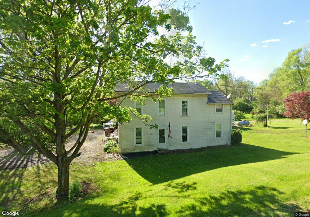
5020 State Route 201 Tipp City, OH 45371
Estimated Value: $157,000 - $254,000
3
Beds
1
Bath
1,672
Sq Ft
$128/Sq Ft
Est. Value
About This Home
This home is located at 5020 State Route 201, Tipp City, OH 45371 and is currently estimated at $213,608, approximately $127 per square foot. 5020 State Route 201 is a home located in Miami County with nearby schools including Bethel Elementary School, Bethel Middle School, and Bethel High School.
Ownership History
Date
Name
Owned For
Owner Type
Purchase Details
Closed on
Jul 9, 2021
Sold by
David Long And Cynthia Long Revocable Li
Bought by
Landes Tyler and Dungan Sara
Current Estimated Value
Purchase Details
Closed on
Feb 21, 2020
Sold by
Lang Donna May and Lang Donna Mae
Bought by
Landes Tyler and Dungan Sara
Home Financials for this Owner
Home Financials are based on the most recent Mortgage that was taken out on this home.
Original Mortgage
$65,000
Interest Rate
3.2%
Mortgage Type
New Conventional
Purchase Details
Closed on
Jan 18, 2011
Sold by
Lang Donna May and Lang Donna Mae
Bought by
Lang William Darrell and Lang Donna May
Purchase Details
Closed on
Aug 1, 1984
Bought by
Lang Donna Mae
Create a Home Valuation Report for This Property
The Home Valuation Report is an in-depth analysis detailing your home's value as well as a comparison with similar homes in the area
Home Values in the Area
Average Home Value in this Area
Purchase History
| Date | Buyer | Sale Price | Title Company |
|---|---|---|---|
| Landes Tyler | -- | None Listed On Document | |
| Landes Tyler | $130,000 | Wave Title Agency Inc | |
| Lang William Darrell | -- | -- | |
| Lang Donna Mae | -- | -- |
Source: Public Records
Mortgage History
| Date | Status | Borrower | Loan Amount |
|---|---|---|---|
| Previous Owner | Landes Tyler | $65,000 |
Source: Public Records
Tax History Compared to Growth
Tax History
| Year | Tax Paid | Tax Assessment Tax Assessment Total Assessment is a certain percentage of the fair market value that is determined by local assessors to be the total taxable value of land and additions on the property. | Land | Improvement |
|---|---|---|---|---|
| 2024 | $1,653 | $34,650 | $11,620 | $23,030 |
| 2023 | $1,653 | $34,650 | $11,620 | $23,030 |
| 2022 | $1,635 | $34,650 | $11,620 | $23,030 |
| 2021 | $1,464 | $28,880 | $9,700 | $19,180 |
| 2020 | $1,485 | $28,880 | $9,700 | $19,180 |
| 2019 | $1,502 | $28,880 | $9,700 | $19,180 |
| 2018 | $1,483 | $26,680 | $8,090 | $18,590 |
| 2017 | $1,485 | $26,680 | $8,090 | $18,590 |
| 2016 | $881 | $26,680 | $8,090 | $18,590 |
| 2015 | $860 | $25,660 | $7,770 | $17,890 |
| 2014 | $860 | $25,660 | $7,770 | $17,890 |
| 2013 | $730 | $25,660 | $7,770 | $17,890 |
Source: Public Records
Map
Nearby Homes
- 7715 E New Carlisle Rd
- 0 Ohio 201
- 7817 Ohio 201
- 5315 E State Route 571
- 605 Fenview Dr
- 7540 Agenbroad Rd
- 930 Firwood Dr
- 907 White Pine St
- 7032 Honeylocust St
- 1101 Cambridge Ct Unit 1103
- 6570 S Tipp Cowl Rd
- 2656 Addison New Carlisle Rd
- 210 Zimmerman St
- 315 Fenwick Dr
- 12490 Stafford Rd
- 224 Orth Dr
- 302 N Smith St
- 222 Rawson Dr
- 5035 State Route 201
- 5015 State Route 201
- 5015 Ohio 201
- 4930 State Route 201
- 1 St Rt 201 Rd
- 4980 State Route 201
- 5038S State Route 201
- 7105 E New Carlisle Rd
- 7135 E New Carlisle Rd
- 4910 State Route 201
- 5250 State Route 201
- 7269 E New Carlisle Rd
- 5275 State Route 201
- 5290 State Route 201
- B S East St
- 7250 E New Carlisle Rd
- 5495 State Route 201
- 5495 State Route 201
- 7415 E New Carlisle Rd
- 4605 State Route 201