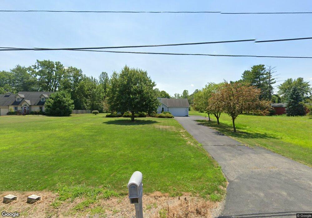
5020 State Route 305 Fowler, OH 44418
Estimated Value: $144,000 - $300,000
3
Beds
2
Baths
1,345
Sq Ft
$170/Sq Ft
Est. Value
About This Home
This home is located at 5020 State Route 305, Fowler, OH 44418 and is currently estimated at $228,411, approximately $169 per square foot. 5020 State Route 305 is a home located in Trumbull County with nearby schools including Currie Elementary School, Baker Elementary School, and Mathews High School.
Ownership History
Date
Name
Owned For
Owner Type
Purchase Details
Closed on
Oct 7, 2003
Sold by
Fisher Eugene A and Fisher Debra J
Bought by
Laurenzi Timothy M and Laurenzi Bernadette B
Current Estimated Value
Create a Home Valuation Report for This Property
The Home Valuation Report is an in-depth analysis detailing your home's value as well as a comparison with similar homes in the area
Home Values in the Area
Average Home Value in this Area
Purchase History
| Date | Buyer | Sale Price | Title Company |
|---|---|---|---|
| Laurenzi Timothy M | $128,000 | -- |
Source: Public Records
Mortgage History
| Date | Status | Borrower | Loan Amount |
|---|---|---|---|
| Closed | Laurenzi Timothy M | -- |
Source: Public Records
Tax History Compared to Growth
Tax History
| Year | Tax Paid | Tax Assessment Tax Assessment Total Assessment is a certain percentage of the fair market value that is determined by local assessors to be the total taxable value of land and additions on the property. | Land | Improvement |
|---|---|---|---|---|
| 2024 | $2,313 | $54,890 | $3,890 | $51,000 |
| 2023 | $2,313 | $54,890 | $3,890 | $51,000 |
| 2022 | $2,350 | $45,190 | $3,570 | $41,620 |
| 2021 | $2,355 | $45,190 | $3,570 | $41,620 |
| 2020 | $2,363 | $45,190 | $3,570 | $41,620 |
| 2019 | $2,255 | $39,480 | $3,290 | $36,190 |
| 2018 | $2,197 | $39,480 | $3,290 | $36,190 |
| 2017 | $2,190 | $39,480 | $3,290 | $36,190 |
| 2016 | $2,060 | $36,440 | $3,290 | $33,150 |
| 2015 | $1,403 | $36,440 | $3,290 | $33,150 |
| 2014 | $1,403 | $36,440 | $3,290 | $33,150 |
| 2013 | $1,519 | $38,540 | $3,290 | $35,250 |
Source: Public Records
Map
Nearby Homes
- 2728 Sodom Hutchings Rd
- 4875 Cadwallader-Sonk Rd
- 2486 Waynewood Dr NE
- 4274 Cadwallader-Sonk Rd
- 5871 Everett Hull Rd
- 3740 Wilson Sharpsville Rd
- 2009 Sodom Hutchings Rd NE
- 3804 Ridge Rd
- 40 Bradley Brownlee Rd
- 10 Bradley Brownlee Rd
- 20 Rd
- 1565 Sodom Hutchings Rd NE
- 1555 Sodom Hutchings Rd NE
- 1440 Youngstown Kingsville Rd
- 3164 Ohio 7
- 232 Bayview Dr Unit 232
- 19 Spring Creek Dr
- 0 Youngstown Kingsville Rd
- 130 Topaz Trail Unit 130
- 111 Emerald Ln
- 5032 State Route 305
- 5037 State Route 305
- 5037 Wilson Sharpsville Rd Unit 4
- 5037 Wilson Sharpsville Rd Unit 1
- 5037 Wilson Sharpsville Rd Unit 5
- 5037 Wilson Sharpsville Rd Unit 2
- 5037 State Route 305 Unit 5
- 5037 Wilson Sharpsville Rd
- 5037 St Rt 305 (Wilson Sharpvville)
- 5050 State Route 305
- 5049 State Route 305
- 5053 State Route 305
- 5057 State Route 305
- 5058 State Route 305
- 3395 Sodom Hutchings Rd
- 3329 Sodom Hutchings Rd
- 2 Sodom Hutchings Rd
- 3321 Sodom Hutchings Rd
- 4946 State Route 305
- 4946 Wilson Sharpsville Rd