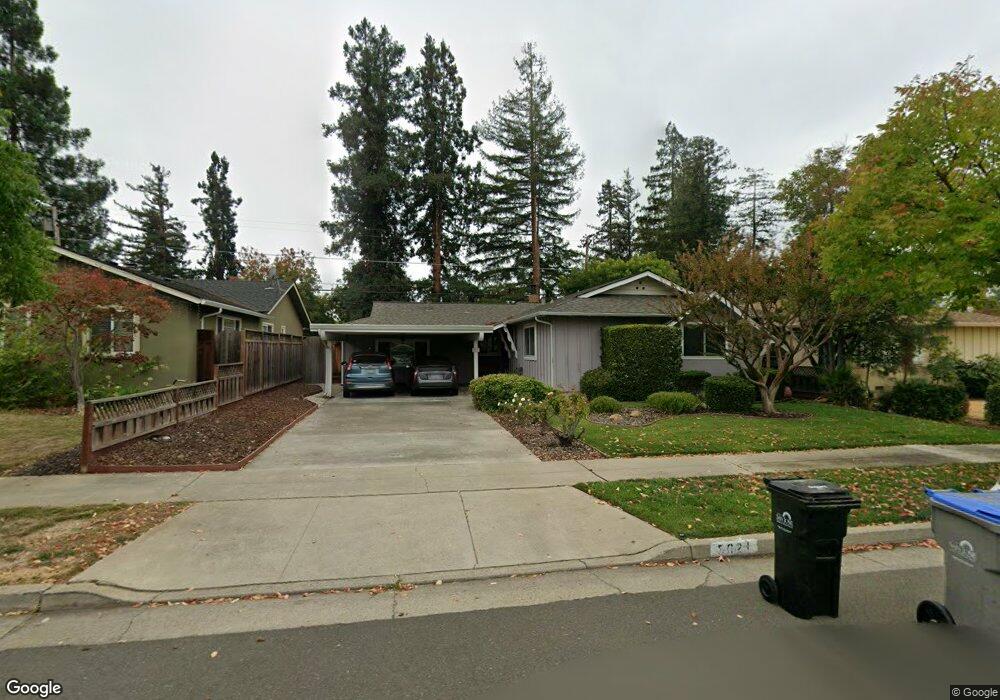
5021 Rafton Dr San Jose, CA 95124
De Voss-Leigh NeighborhoodEstimated Value: $1,784,000 - $2,126,000
4
Beds
2
Baths
1,396
Sq Ft
$1,381/Sq Ft
Est. Value
About This Home
This home is located at 5021 Rafton Dr, San Jose, CA 95124 and is currently estimated at $1,927,791, approximately $1,380 per square foot. 5021 Rafton Dr is a home located in Santa Clara County with nearby schools including Lietz Elementary School, Noddin Elementary School, and Union Middle School.
Ownership History
Date
Name
Owned For
Owner Type
Purchase Details
Closed on
Dec 12, 2024
Sold by
Kazarian Peter John and Kazarian Victoria Lynn
Bought by
Kazarian Peter John and Kazarian Victoria
Current Estimated Value
Purchase Details
Closed on
Apr 3, 2000
Sold by
Atkins Mary E Trustee
Bought by
Kazarian Peter John and Kazarian Victoria Lynn
Home Financials for this Owner
Home Financials are based on the most recent Mortgage that was taken out on this home.
Original Mortgage
$392,000
Interest Rate
8.3%
Purchase Details
Closed on
Nov 10, 1994
Sold by
Atkins Mary E
Bought by
Atkins Mary E
Create a Home Valuation Report for This Property
The Home Valuation Report is an in-depth analysis detailing your home's value as well as a comparison with similar homes in the area
Home Values in the Area
Average Home Value in this Area
Purchase History
| Date | Buyer | Sale Price | Title Company |
|---|---|---|---|
| Kazarian Peter John | -- | None Listed On Document | |
| Peter Kazarian And Victoria Kazarian Trust | -- | None Listed On Document | |
| Kazarian Peter John | -- | None Listed On Document | |
| Kazarian Peter John | $490,000 | North American Title Co | |
| Atkins Mary E | -- | -- |
Source: Public Records
Mortgage History
| Date | Status | Borrower | Loan Amount |
|---|---|---|---|
| Previous Owner | Kazarian Peter John | $392,000 |
Source: Public Records
Tax History Compared to Growth
Tax History
| Year | Tax Paid | Tax Assessment Tax Assessment Total Assessment is a certain percentage of the fair market value that is determined by local assessors to be the total taxable value of land and additions on the property. | Land | Improvement |
|---|---|---|---|---|
| 2025 | $10,945 | $753,104 | $445,716 | $307,388 |
| 2024 | $10,945 | $738,338 | $436,977 | $301,361 |
| 2023 | $10,711 | $723,861 | $428,409 | $295,452 |
| 2022 | $10,498 | $709,668 | $420,009 | $289,659 |
| 2021 | $10,278 | $695,754 | $411,774 | $283,980 |
| 2020 | $10,053 | $688,621 | $407,552 | $281,069 |
| 2019 | $9,871 | $675,119 | $399,561 | $275,558 |
| 2018 | $9,627 | $661,882 | $391,727 | $270,155 |
| 2017 | $9,500 | $648,905 | $384,047 | $264,858 |
| 2016 | $9,057 | $636,182 | $376,517 | $259,665 |
| 2015 | $8,911 | $626,627 | $370,862 | $255,765 |
| 2014 | $8,360 | $614,353 | $363,598 | $250,755 |
Source: Public Records
Map
Nearby Homes
- 5066 Carter Ave
- 1668 Nora Way
- 0000 Harwood Rd
- 1772 Conrad Ave
- 4843 Pepperwood Way
- 1721 Ross Cir
- 1719 Ross Cir
- 1742 Del Paso Ave
- 1684 Tupolo Dr
- 1638 Branham Ln Unit D
- 1796 Chevalier Dr
- 4927 Leigh Ave
- 1543 Rose Anna Dr
- 4216 Camden Ave
- 4848 Anna Dr
- 1515 Dentona Place
- 4867 Anna Dr
- 3942 Paladin Dr
- 1503 Love Ct
- 14510 Blossom Hill Rd