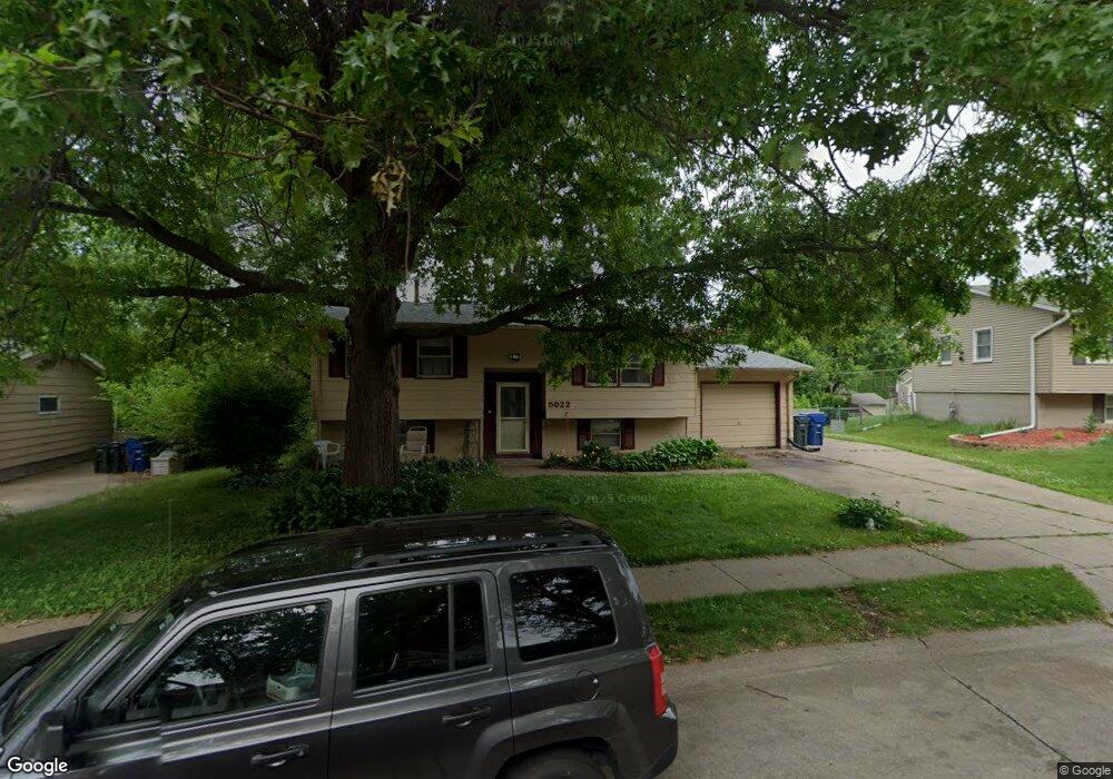
5022 Warren St Davenport, IA 52806
North Side NeighborhoodEstimated Value: $170,000 - $216,000
4
Beds
1
Bath
996
Sq Ft
$192/Sq Ft
Est. Value
About This Home
This home is located at 5022 Warren St, Davenport, IA 52806 and is currently estimated at $190,831, approximately $191 per square foot. 5022 Warren St is a home located in Scott County with nearby schools including Cumberland Hall School, Harrison Elementary School, and Academy Of Continuing Education.
Ownership History
Date
Name
Owned For
Owner Type
Purchase Details
Closed on
Jun 9, 2005
Sold by
Sarvestaney Cyrus F and Sarvestaney Lisa
Bought by
Sarvestaney Lisa A
Current Estimated Value
Home Financials for this Owner
Home Financials are based on the most recent Mortgage that was taken out on this home.
Original Mortgage
$111,122
Outstanding Balance
$58,200
Interest Rate
5.91%
Mortgage Type
FHA
Estimated Equity
$132,631
Purchase Details
Closed on
May 19, 2005
Sold by
Garlough L Dean and Garlough Denise Jansma
Bought by
Sarvestaney Lisa and Sarvestaney Cyrus F
Home Financials for this Owner
Home Financials are based on the most recent Mortgage that was taken out on this home.
Original Mortgage
$111,122
Outstanding Balance
$58,200
Interest Rate
5.91%
Mortgage Type
FHA
Estimated Equity
$132,631
Create a Home Valuation Report for This Property
The Home Valuation Report is an in-depth analysis detailing your home's value as well as a comparison with similar homes in the area
Home Values in the Area
Average Home Value in this Area
Purchase History
| Date | Buyer | Sale Price | Title Company |
|---|---|---|---|
| Sarvestaney Lisa A | -- | None Available | |
| Sarvestaney Lisa | $112,000 | None Available |
Source: Public Records
Mortgage History
| Date | Status | Borrower | Loan Amount |
|---|---|---|---|
| Open | Sarvestaney Lisa | $111,122 |
Source: Public Records
Tax History Compared to Growth
Tax History
| Year | Tax Paid | Tax Assessment Tax Assessment Total Assessment is a certain percentage of the fair market value that is determined by local assessors to be the total taxable value of land and additions on the property. | Land | Improvement |
|---|---|---|---|---|
| 2025 | $2,546 | $175,500 | $37,140 | $138,360 |
| 2024 | $2,480 | $152,710 | $37,140 | $115,570 |
| 2023 | $2,806 | $152,710 | $37,140 | $115,570 |
| 2022 | $2,905 | $140,220 | $27,010 | $113,210 |
| 2021 | $2,718 | $135,620 | $27,010 | $108,610 |
| 2020 | $2,636 | $130,100 | $27,010 | $103,090 |
| 2019 | $2,584 | $123,660 | $27,010 | $96,650 |
| 2018 | $2,424 | $123,660 | $27,010 | $96,650 |
| 2017 | $662 | $119,050 | $27,010 | $92,040 |
| 2016 | $2,416 | $119,050 | $0 | $0 |
| 2015 | $2,416 | $121,480 | $0 | $0 |
| 2014 | $2,504 | $121,480 | $0 | $0 |
| 2013 | $2,456 | $0 | $0 | $0 |
| 2012 | -- | $115,160 | $33,870 | $81,290 |
Source: Public Records
Map
Nearby Homes
- 4942 Brown St
- 825 Northbrook Dr
- 4804 Northwest Blvd
- 710 Northbrook Dr
- 4757 Willow Cir
- 4743 Willow Cir
- 611 Northbrook Dr
- 4612 Warren St Unit 5
- 4449 Royal Oaks Dr
- 315 Colony Dr
- 7 Vista Ct
- 1005 W 58th St
- 1033 W 58th St
- 4610 N Ripley St
- 4717 N Harrison St
- 5721 Taylor St
- 4618 Fillmore Ln
- 5804 Lillie Ave
- 405 Westerfield Rd
- 5735 Taylor St
- 5028 Warren St
- 5016 Warren St
- 925 Northbrook Dr
- 933 Northbrook Dr
- 917 Northbrook Dr
- 5106 Warren St
- 5103 Vine St
- 5015 Warren St
- 5025 Warren St
- 5008 Warren St
- 5105 Vine St
- 907 Northbrook Dr
- 5007 Warren St
- 5110 Warren St
- 5105 Warren St
- 5111 Vine St
- 934 Northbrook Dr
- 5111 Warren St
- 5012 Brown St
- 5206 Warren St