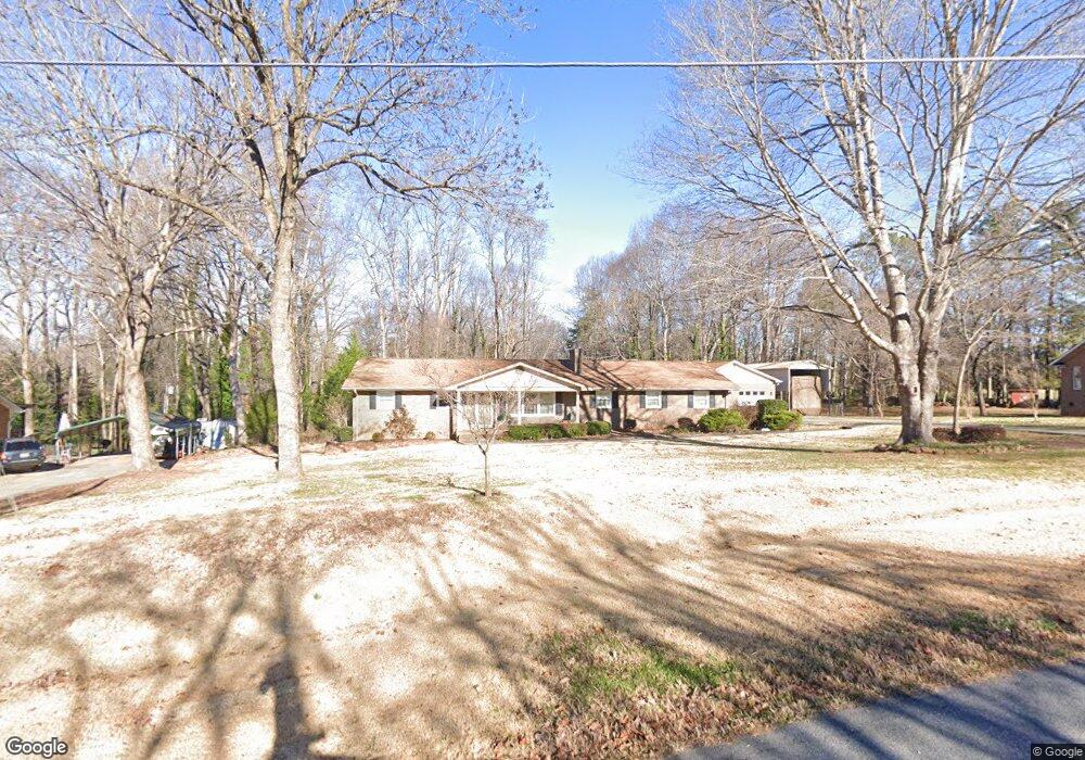
5027 Kittredge Rd Mint Hill, NC 28227
Estimated Value: $405,000 - $506,000
4
Beds
2
Baths
2,220
Sq Ft
$207/Sq Ft
Est. Value
About This Home
This home is located at 5027 Kittredge Rd, Mint Hill, NC 28227 and is currently estimated at $459,410, approximately $206 per square foot. 5027 Kittredge Rd is a home located in Mecklenburg County with nearby schools including Bain Elementary, Mint Hill Middle School, and Independence High.
Ownership History
Date
Name
Owned For
Owner Type
Purchase Details
Closed on
Aug 2, 2004
Sold by
Arnold Alton N and Arnold Phyllis S
Bought by
Dungan Ellis G and Dungan Joyce A
Current Estimated Value
Home Financials for this Owner
Home Financials are based on the most recent Mortgage that was taken out on this home.
Original Mortgage
$159,300
Interest Rate
4.75%
Mortgage Type
New Conventional
Create a Home Valuation Report for This Property
The Home Valuation Report is an in-depth analysis detailing your home's value as well as a comparison with similar homes in the area
Home Values in the Area
Average Home Value in this Area
Purchase History
| Date | Buyer | Sale Price | Title Company |
|---|---|---|---|
| Dungan Ellis G | $177,000 | Chicago Title |
Source: Public Records
Mortgage History
| Date | Status | Borrower | Loan Amount |
|---|---|---|---|
| Previous Owner | Dungan Ellis G | $159,300 |
Source: Public Records
Tax History Compared to Growth
Tax History
| Year | Tax Paid | Tax Assessment Tax Assessment Total Assessment is a certain percentage of the fair market value that is determined by local assessors to be the total taxable value of land and additions on the property. | Land | Improvement |
|---|---|---|---|---|
| 2025 | $2,973 | $412,900 | $94,500 | $318,400 |
| 2024 | $2,973 | $412,900 | $94,500 | $318,400 |
| 2023 | $2,927 | $412,900 | $94,500 | $318,400 |
| 2022 | $2,428 | $273,900 | $60,000 | $213,900 |
| 2021 | $2,428 | $273,900 | $60,000 | $213,900 |
| 2020 | $2,428 | $273,900 | $60,000 | $213,900 |
| 2019 | $2,422 | $273,900 | $60,000 | $213,900 |
| 2018 | $2,356 | $213,000 | $36,000 | $177,000 |
| 2017 | $2,337 | $213,000 | $36,000 | $177,000 |
| 2016 | $2,333 | $198,600 | $36,000 | $162,600 |
| 2015 | $2,173 | $198,600 | $36,000 | $162,600 |
| 2014 | $2,171 | $198,600 | $36,000 | $162,600 |
Source: Public Records
Map
Nearby Homes
- 4401 Quail Ridge Dr
- 4027 Mintwood Dr
- 6525 Robin Hollow Dr
- 5918 Foxcrest Dr
- 8237 Franklin Trail St
- 8245 Franklin Trail St
- 8233 Franklin Trail St
- 7113 Short Stirrup Ln
- 8234 Franklin Trail St
- 4123 Roe Creek Dr
- Banks Plan at Alton Creek
- Woodwright Plan at Alton Creek
- Henderson Plan at Alton Creek
- Allen Plan at Alton Creek
- Maxwell Plan at Alton Creek
- 4119 Roe Creek Dr
- 2141 Moss Bluff Dr
- 6545 Old Magnolia Ln
- 7023 Short Stirrup Ln
- 7019 Short Stirrup Ln
- 5035 Kittredge Rd
- 5019 Kittredge Rd
- 4801 Carving Tree Dr
- 5026 Kittredge Rd
- 4743 Carving Tree Dr
- 4610 Shea Ln
- 5005 Kittredge Rd
- 5043 Kittredge Rd
- 4518 Shea Ln
- 4624 Shea Ln
- 4733 Carving Tree Dr
- 5036 Kittredge Rd
- 4510 Shea Ln
- 4723 Carving Tree Dr
- 4800 Carving Tree Dr
- 5100 Kittredge Rd
- 5101 Kittredge Rd
- 4605 Shea Ln Unit 6
- 4605 Shea Ln
- 4814 Carving Tree Dr