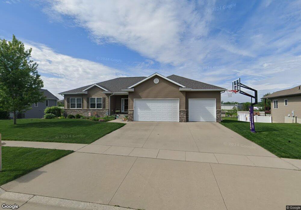
5027 Nordic Ridge Dr Cedar Falls, IA 50613
Estimated Value: $493,496 - $560,000
4
Beds
5
Baths
1,758
Sq Ft
$292/Sq Ft
Est. Value
About This Home
This home is located at 5027 Nordic Ridge Dr, Cedar Falls, IA 50613 and is currently estimated at $512,874, approximately $291 per square foot. 5027 Nordic Ridge Dr is a home with nearby schools including Southdale Elementary School, Peet Junior High School, and Cedar Falls High School.
Ownership History
Date
Name
Owned For
Owner Type
Purchase Details
Closed on
Aug 29, 2012
Sold by
Hoss Builders Llc
Bought by
Irwin Scott and Irwin Kayla
Current Estimated Value
Home Financials for this Owner
Home Financials are based on the most recent Mortgage that was taken out on this home.
Original Mortgage
$268,000
Outstanding Balance
$185,007
Interest Rate
3.52%
Mortgage Type
New Conventional
Estimated Equity
$327,867
Purchase Details
Closed on
Mar 16, 2012
Sold by
K & K Development Inc
Bought by
Hoss Builders Llc
Create a Home Valuation Report for This Property
The Home Valuation Report is an in-depth analysis detailing your home's value as well as a comparison with similar homes in the area
Home Values in the Area
Average Home Value in this Area
Purchase History
| Date | Buyer | Sale Price | Title Company |
|---|---|---|---|
| Irwin Scott | $339,000 | None Available | |
| Hoss Builders Llc | $54,000 | None Available |
Source: Public Records
Mortgage History
| Date | Status | Borrower | Loan Amount |
|---|---|---|---|
| Open | Irwin Scott | $268,000 |
Source: Public Records
Tax History Compared to Growth
Tax History
| Year | Tax Paid | Tax Assessment Tax Assessment Total Assessment is a certain percentage of the fair market value that is determined by local assessors to be the total taxable value of land and additions on the property. | Land | Improvement |
|---|---|---|---|---|
| 2024 | $6,358 | $405,350 | $76,930 | $328,420 |
| 2023 | $6,444 | $405,350 | $76,930 | $328,420 |
| 2022 | $6,522 | $357,990 | $76,930 | $281,060 |
| 2021 | $5,998 | $357,990 | $76,930 | $281,060 |
| 2020 | $5,876 | $330,690 | $49,630 | $281,060 |
| 2019 | $5,876 | $330,690 | $49,630 | $281,060 |
| 2018 | $5,924 | $330,690 | $49,630 | $281,060 |
| 2017 | $6,054 | $329,230 | $49,630 | $279,600 |
| 2016 | $5,664 | $329,230 | $49,630 | $279,600 |
| 2015 | $5,664 | $329,230 | $49,630 | $279,600 |
| 2014 | $5,502 | $316,520 | $49,630 | $266,890 |
Source: Public Records
Map
Nearby Homes
- 5004 Quesada Ave
- 219 Cordoba Ave
- 430 Balboa Ave
- 4902 Algonquin Dr Unit 1
- 5405 Celtic Ct
- 4805 Algonquin Dr Unit 3
- 1255 Loren Dr
- 4208 James Dr
- 1117 Loren Dr
- 211 Spruce Hills Dr
- 4.1 Acres Pinnacle Prairie Trail
- 3.99 Acres Pinnacle Prairie Trail
- 17.7 Acres Pinnacle Prairie Trail
- 1502 Algonquin Dr
- Lot 2b Brandilynn Blvd
- 419 Heritage Rd
- 2.2 Acres Bluegrass Cir
- 4328 Spruce Creek Dr
- 0.6 Acres Bluegrass Cir
- 1.7 Acres Bluegrass Cir
- 5023 Nordic Ridge Dr
- 5029 Nordic Ridge Dr
- 5024 Nordic Ridge Dr
- 5031 Nordic Ridge Dr
- 5021 Nordic Ridge Dr
- 5027 Kael Trail
- 5032 Nordic Ridge Dr
- 5031 Kael Trail
- 5035 Nordic Ridge Dr
- 5035 Kael Trail
- 5036 Nordic Ridge Dr
- 5039 Nordic Ridge Dr
- 5039 Kael Trail
- 5040 Nordic Ridge Dr
- 5019 Nordic Ridge Dr
- 5045 Kael Trail
- 5024 Kael Trail
- 5030 Kael Trail
- 5043 Nordic Ridge Dr
- 5044 Nordic Ridge Dr