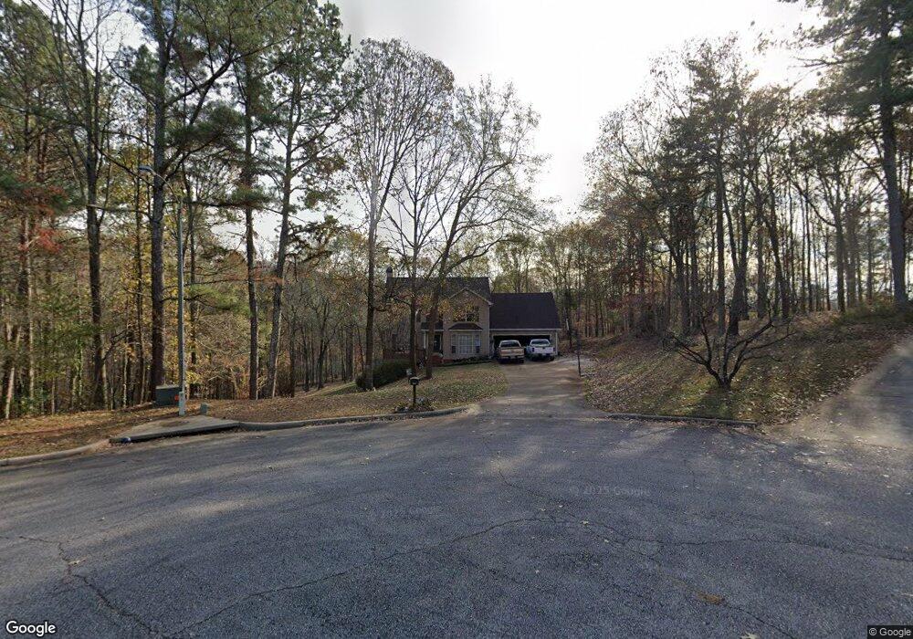
5028 Farmbrook Ln Gainesville, GA 30507
Southeast Gainesville NeighborhoodEstimated Value: $385,000 - $443,000
3
Beds
3
Baths
2,257
Sq Ft
$180/Sq Ft
Est. Value
About This Home
This home is located at 5028 Farmbrook Ln, Gainesville, GA 30507 and is currently estimated at $406,985, approximately $180 per square foot. 5028 Farmbrook Ln is a home located in Hall County with nearby schools including Myers Elementary School, Cherokee Bluff Middle School, and Cherokee Bluff High School.
Ownership History
Date
Name
Owned For
Owner Type
Purchase Details
Closed on
May 18, 1999
Sold by
Hill Michael Wayne and Hill Carrie H
Bought by
Gabriel Kenneth P and Gabriel Marlen
Current Estimated Value
Home Financials for this Owner
Home Financials are based on the most recent Mortgage that was taken out on this home.
Original Mortgage
$107,000
Outstanding Balance
$26,162
Interest Rate
6.87%
Mortgage Type
New Conventional
Estimated Equity
$380,823
Purchase Details
Closed on
Feb 15, 1996
Sold by
Reed Timothy H Edwina I
Bought by
Hill Michael W Carrie N
Purchase Details
Closed on
Aug 15, 1994
Sold by
The Hopper Ptnrshp
Bought by
Reed Timothy Edwina
Home Financials for this Owner
Home Financials are based on the most recent Mortgage that was taken out on this home.
Original Mortgage
$105,450
Interest Rate
8.53%
Create a Home Valuation Report for This Property
The Home Valuation Report is an in-depth analysis detailing your home's value as well as a comparison with similar homes in the area
Home Values in the Area
Average Home Value in this Area
Purchase History
| Date | Buyer | Sale Price | Title Company |
|---|---|---|---|
| Gabriel Kenneth P | $133,900 | -- | |
| Hill Michael W Carrie N | $124,900 | -- | |
| Reed Timothy Edwina | $111,000 | -- |
Source: Public Records
Mortgage History
| Date | Status | Borrower | Loan Amount |
|---|---|---|---|
| Open | Gabriel Kenneth P | $107,000 | |
| Previous Owner | Reed Timothy Edwina | $105,450 | |
| Closed | Hill Michael W Carrie N | $0 |
Source: Public Records
Tax History
| Year | Tax Paid | Tax Assessment Tax Assessment Total Assessment is a certain percentage of the fair market value that is determined by local assessors to be the total taxable value of land and additions on the property. | Land | Improvement |
|---|---|---|---|---|
| 2025 | $1,166 | $157,400 | $31,840 | $125,560 |
| 2024 | $3,562 | $140,520 | $31,200 | $109,320 |
| 2023 | $3,034 | $134,800 | $31,200 | $103,600 |
| 2022 | $3,028 | $114,080 | $31,200 | $82,880 |
| 2021 | $2,318 | $84,920 | $5,680 | $79,240 |
| 2020 | $2,263 | $80,520 | $5,680 | $74,840 |
| 2019 | $2,159 | $76,040 | $5,680 | $70,360 |
| 2018 | $2,113 | $72,000 | $5,680 | $66,320 |
| 2017 | $1,535 | $52,072 | $4,240 | $47,832 |
| 2016 | $1,501 | $52,072 | $4,240 | $47,832 |
| 2015 | $1,509 | $52,072 | $4,240 | $47,832 |
| 2014 | $1,509 | $52,072 | $4,240 | $47,832 |
Source: Public Records
Map
Nearby Homes
- 6064 Cane Crossing Dr
- 5074 Peach Mountain Cir
- 5109 Peach Mountain Cir
- 4947 Weaver Rd
- 2741 Glendale Dr
- 2805 Glendale Dr
- 2445 Silverwood Dr
- 01 Candler Rd
- 3255 Tanners Mill Rd
- 4715 Creek Wood Dr
- 3845 Chase Dr
- 3263 Tanners Mill Rd
- 3325 Tanners Mill Rd
- 4745 Shady Lake Cir
- 4609 Hunters Ct
- 1 Cooper Bridge Rd
- 3 Cooper Bridge Rd
- 6 Cooper Bridge Rd
- 14.4 ACRES Roy Parks Rd
- 9.3 ACRES Roy Parks Rd
- 5024 Farmbrook Ln
- 5027 Farmbrook Ln
- 4984 Poplar Springs Cir
- 5102 Big Spruce Trail
- 4990 Poplar Springs Cir
- 5020 Farmbrook Ln
- 5106 Big Spruce Trail
- 4991 Poplar Springs Cir
- 5016 Farmbrook Ln
- 5019 Farmbrook Ln
- 4980 Poplar Springs Cir
- 5110 Big Spruce Trail
- 4985 Poplar Springs Cir
- 5109 Big Spruce Trail
- 5015 Farmbrook Ln
- 5012 Farmbrook Ln
- 4981 Poplar Springs Cir
- 5114 Big Spruce Trail
- 5117 Big Spruce Trail
- 5011 Farmbrook Ln