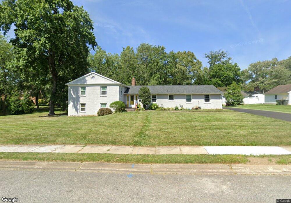
503 Briar Ln Newark, DE 19711
Estimated Value: $554,000 - $602,000
3
Beds
3
Baths
1,820
Sq Ft
$319/Sq Ft
Est. Value
About This Home
This home is located at 503 Briar Ln, Newark, DE 19711 and is currently estimated at $581,113, approximately $319 per square foot. 503 Briar Ln is a home located in New Castle County with nearby schools including Downes (John R.) Elementary School, Shue-Medill Middle School, and Newark High School.
Ownership History
Date
Name
Owned For
Owner Type
Purchase Details
Closed on
Aug 27, 2004
Sold by
Cruz Jesus and Schmidt Cruz Cynthia
Bought by
Baur Michael P and Baur Jennifer J
Current Estimated Value
Home Financials for this Owner
Home Financials are based on the most recent Mortgage that was taken out on this home.
Original Mortgage
$263,200
Outstanding Balance
$130,283
Interest Rate
6.08%
Mortgage Type
Purchase Money Mortgage
Estimated Equity
$450,830
Create a Home Valuation Report for This Property
The Home Valuation Report is an in-depth analysis detailing your home's value as well as a comparison with similar homes in the area
Home Values in the Area
Average Home Value in this Area
Purchase History
| Date | Buyer | Sale Price | Title Company |
|---|---|---|---|
| Baur Michael P | $329,000 | -- |
Source: Public Records
Mortgage History
| Date | Status | Borrower | Loan Amount |
|---|---|---|---|
| Open | Baur Michael P | $263,200 | |
| Closed | Baur Michael P | $32,900 |
Source: Public Records
Tax History
| Year | Tax Paid | Tax Assessment Tax Assessment Total Assessment is a certain percentage of the fair market value that is determined by local assessors to be the total taxable value of land and additions on the property. | Land | Improvement |
|---|---|---|---|---|
| 2024 | $1,107 | $104,900 | $38,500 | $66,400 |
| 2023 | $3,793 | $104,900 | $38,500 | $66,400 |
| 2022 | $3,753 | $104,900 | $38,500 | $66,400 |
| 2021 | $3,657 | $104,900 | $38,500 | $66,400 |
| 2020 | $3,551 | $104,900 | $38,500 | $66,400 |
| 2019 | $3,113 | $104,900 | $38,500 | $66,400 |
| 2018 | $3,041 | $104,900 | $38,500 | $66,400 |
| 2017 | $2,951 | $104,900 | $38,500 | $66,400 |
| 2016 | $2,942 | $104,900 | $38,500 | $66,400 |
| 2015 | $2,638 | $104,900 | $38,500 | $66,400 |
| 2014 | $2,637 | $104,900 | $38,500 | $66,400 |
Source: Public Records
Map
Nearby Homes
- 512 Briar Ln
- 117 Madison Dr
- 105 Tanglewood Ln
- 8 Sue Ln
- 930 Quail Ln
- 30 Julie Ln
- 306 Willa Rd
- 126 Manns Ave
- 153 King William St Unit 153
- 313 Chickory Way
- 57 W Park Place
- 104 Country Club Dr
- 102 Joshua (6 Building Lots) Ln
- 7 E Galloway Ct
- 2 Leahy Dr
- 3 Leahy Dr
- 0001 Leahy Dr
- 1002 Dixon Dr
- 117 W Shetland Ct
- 507 Leahy Dr
Your Personal Tour Guide
Ask me questions while you tour the home.