503 Dune Crest Dr Westport, WA 98595
Estimated Value: $659,000 - $1,029,000
--
Bed
--
Bath
2,806
Sq Ft
$275/Sq Ft
Est. Value
About This Home
This home is located at 503 Dune Crest Dr, Westport, WA 98595 and is currently estimated at $772,037, approximately $275 per square foot. 503 Dune Crest Dr is a home with nearby schools including Ocosta Elementary School and Ocosta Junior/Senior High School.
Ownership History
Date
Name
Owned For
Owner Type
Purchase Details
Closed on
Dec 9, 2011
Sold by
Sanft Adolph
Bought by
Sanft Louie
Current Estimated Value
Home Financials for this Owner
Home Financials are based on the most recent Mortgage that was taken out on this home.
Original Mortgage
$1,300,000
Outstanding Balance
$901,971
Interest Rate
3.93%
Mortgage Type
Seller Take Back
Estimated Equity
-$129,934
Create a Home Valuation Report for This Property
The Home Valuation Report is an in-depth analysis detailing your home's value as well as a comparison with similar homes in the area
Home Values in the Area
Average Home Value in this Area
Purchase History
| Date | Buyer | Sale Price | Title Company |
|---|---|---|---|
| Sanft Louie | $500,000 | Grays Harbor Title |
Source: Public Records
Mortgage History
| Date | Status | Borrower | Loan Amount |
|---|---|---|---|
| Open | Sanft Louie | $1,300,000 |
Source: Public Records
Tax History Compared to Growth
Tax History
| Year | Tax Paid | Tax Assessment Tax Assessment Total Assessment is a certain percentage of the fair market value that is determined by local assessors to be the total taxable value of land and additions on the property. | Land | Improvement |
|---|---|---|---|---|
| 2025 | $6,250 | $734,305 | $312,864 | $421,441 |
| 2023 | $6,083 | $680,148 | $278,070 | $402,078 |
| 2022 | $5,984 | $519,715 | $142,600 | $377,115 |
| 2021 | $5,897 | $519,715 | $142,600 | $377,115 |
| 2020 | $6,024 | $468,201 | $142,600 | $325,601 |
| 2019 | $5,480 | $458,166 | $124,000 | $334,166 |
| 2018 | $5,963 | $427,788 | $124,000 | $303,788 |
| 2017 | $4,326 | $415,636 | $124,000 | $291,636 |
| 2016 | $4,757 | $367,030 | $124,000 | $243,030 |
| 2014 | -- | $381,710 | $124,000 | $257,710 |
| 2013 | -- | $504,220 | $223,200 | $281,020 |
Source: Public Records
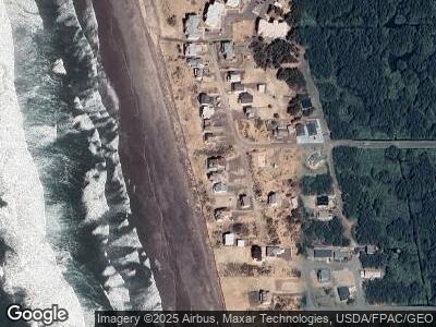
Map
Nearby Homes
- 0 Dunecrest Dr Unit NWM2264403
- 0 S Gold St Unit NWM2367586
- 1600 W Ocean Ave Unit 421
- 1600 W Ocean Ave Unit 1218
- 1600 W Ocean Ave Unit 920
- 1600 W Ocean Ave Unit 1215
- 1600 W Ocean Ave Unit 423
- 1600 W Ocean Ave Unit 1211
- 1600 W Ocean Ave Unit 925
- 1600 W Ocean Ave Unit 915
- 1600 W Ocean Ave Unit 233
- 926 Pheasant Run
- 0 Surf St Unit NWM2338986
- 0 Sunset Beach Ct Unit NWM2333278
- 921 Pheasant Run Dr
- 1210 Hancock Ave
- 530 S Surf St
- 0 XX Starr St
- 0 XX Surf St
- 710 S Hancock Ave Unit 422
- 503 Dune Crest Dr
- 505 Dune Crest Dr
- 419 Dune Crest Dr
- 417 Dune Crest Dr
- 508 Dunecrest Dr
- 507 Dune Crest Dr
- 509 Dunecrest Dr
- 0 Dunecrest Dr Unit 1941450
- 513 Dune Crest Dr
- 415 Dune Crest Dr
- 6 Dune Crest Dr
- 502 Dune Crest Dr
- 4 Dune Crest Dr
- 1 Dune Crest Dr
- 0 Dune Crest Unit 28080196
- 0 Dune Crest Unit 1609807
- 1402 S Shore Ave
- 413 Dune Crest Dr
- 999 Dune Dr
- 1400 S Shore Ave