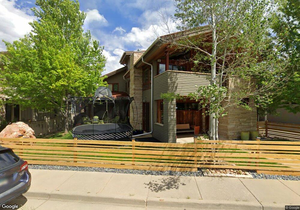
5030 2nd St Boulder, CO 80304
North Boulder NeighborhoodEstimated Value: $1,664,000 - $2,654,000
5
Beds
3
Baths
3,219
Sq Ft
$684/Sq Ft
Est. Value
About This Home
This home is located at 5030 2nd St, Boulder, CO 80304 and is currently estimated at $2,202,037, approximately $684 per square foot. 5030 2nd St is a home located in Boulder County with nearby schools including Foothill Elementary School, Centennial Middle School, and Boulder High School.
Ownership History
Date
Name
Owned For
Owner Type
Purchase Details
Closed on
Aug 27, 2008
Sold by
G E M Holdings Llc
Bought by
Soucheray Diane J
Current Estimated Value
Purchase Details
Closed on
Jan 26, 2007
Sold by
Dakota Ridge Village Llc
Bought by
G E M Holdings
Create a Home Valuation Report for This Property
The Home Valuation Report is an in-depth analysis detailing your home's value as well as a comparison with similar homes in the area
Home Values in the Area
Average Home Value in this Area
Purchase History
| Date | Buyer | Sale Price | Title Company |
|---|---|---|---|
| Soucheray Diane J | $420,000 | Fahtco | |
| G E M Holdings | -- | None Available |
Source: Public Records
Tax History
| Year | Tax Paid | Tax Assessment Tax Assessment Total Assessment is a certain percentage of the fair market value that is determined by local assessors to be the total taxable value of land and additions on the property. | Land | Improvement |
|---|---|---|---|---|
| 2025 | $15,186 | $144,763 | $55,913 | $88,850 |
| 2024 | $15,186 | $144,763 | $55,913 | $88,850 |
| 2023 | $14,922 | $172,793 | $60,796 | $115,682 |
| 2022 | $12,862 | $138,506 | $47,378 | $91,128 |
| 2021 | $12,265 | $142,493 | $48,742 | $93,751 |
| 2020 | $10,102 | $116,059 | $46,404 | $69,655 |
| 2019 | $9,948 | $116,059 | $46,404 | $69,655 |
| 2018 | $8,554 | $98,662 | $39,456 | $59,206 |
| 2017 | $8,286 | $109,076 | $43,621 | $65,455 |
| 2016 | $8,028 | $92,734 | $37,094 | $55,640 |
| 2015 | $7,602 | $77,793 | $20,696 | $57,097 |
| 2014 | $6,541 | $77,793 | $20,696 | $57,097 |
Source: Public Records
Map
Nearby Homes
- 350 Laramie Blvd
- 5057 5th St
- 335 Lee Hill Dr
- 5318 5th St Unit D
- 650 Terrace Ave Unit E
- 4840 6th St
- 4818 6th St
- 4796 6th St
- 901 Terrace Cir S
- 1033 Laramie Blvd Unit A
- 1065 Laramie Blvd Unit B
- 1065 Laramie Blvd Unit F
- 789 Zamia Ave
- 1045 Laramie Blvd Unit 3-F
- 1045 Laramie Blvd Unit B
- 1095 Terrace Cir S
- 835 Yellow Pine Ave
- 1460 Lee Hill Dr Unit 3
- 4730 Holiday Dr Unit 101
- 1280 N Cedar Brook Rd
Your Personal Tour Guide
Ask me questions while you tour the home.