
Seller's Agent in 2026
Breanne Collins
Howard Hanna
(440) 787-3079
9 in this area
63 Total Sales
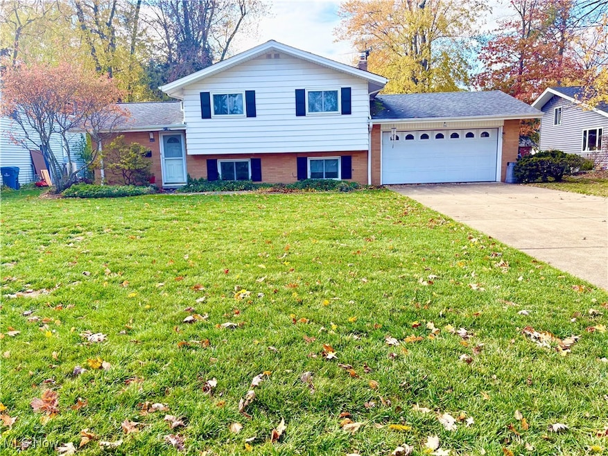
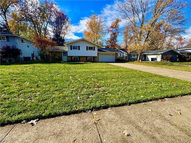
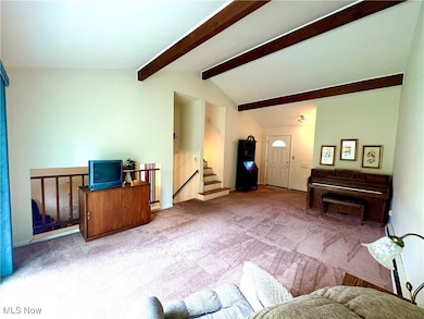
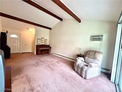
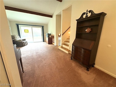
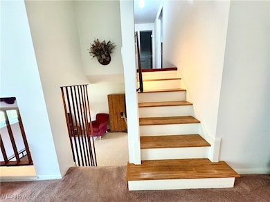
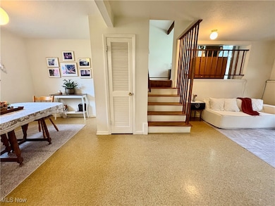
Fabulous condition split level located in the desired Forest Ridge development in North Olmsted. This home has been lovely cared for, for almost five decades and pride of home ownership shows throughout. Offering Three Bedrooms and One and a half baths. Step inside to a bright and airy living room showcasing the vaulted beam ceiling, newer carpeting and large patio doors that fill the space with natural light and provide a peaceful view of the back yard. Upstairs you will find Three spacious bedrooms and Full bath. The lower level is truly the heart of the home, featuring the kitchen with abundance of cabinet space and is opened up into the dining room making the perfect layout for entertaining. The family room Half bath and ideal laundry room complete the lower level. Sitting on a quarter of an acre, the backyard offers endless possibilities! whether its hosting summer barbecues, gardening, or simply enjoying nature. Updates in recent years include all New Windows, Hot water tank (2023), all new appliances, majority of through wall AC units giving you peace of mind. Homes like this with long-term care don't come around often. Schedule your private showing today!
Last Agent to Sell the Property
Howard Hanna Brokerage Email: breannecollins@howardhanna.com, 440-787-3079 License #2021001500 Listed on: 11/03/2025
| Date | Type | Sale Price | Title Company |
|---|---|---|---|
| Interfamily Deed Transfer | -- | Attorney | |
| Deed | $42,000 | -- | |
| Deed | -- | -- |
| Date | Event | Price | List to Sale | Price per Sq Ft |
|---|---|---|---|---|
| 01/30/2026 01/30/26 | Sold | $240,000 | -7.3% | $149 / Sq Ft |
| 01/02/2026 01/02/26 | Pending | -- | -- | -- |
| 11/03/2025 11/03/25 | For Sale | $259,000 | -- | $161 / Sq Ft |
| Year | Tax Paid | Tax Assessment Tax Assessment Total Assessment is a certain percentage of the fair market value that is determined by local assessors to be the total taxable value of land and additions on the property. | Land | Improvement |
|---|---|---|---|---|
| 2025 | $4,278 | $73,255 | $17,885 | $55,370 |
| 2024 | $4,349 | $73,255 | $17,885 | $55,370 |
| 2023 | $3,860 | $56,430 | $14,040 | $42,390 |
| 2022 | $3,874 | $56,420 | $14,040 | $42,390 |
| 2021 | $3,506 | $56,420 | $14,040 | $42,390 |
| 2020 | $3,278 | $48,230 | $12,010 | $36,230 |
| 2019 | $3,190 | $137,800 | $34,300 | $103,500 |
| 2018 | $3,235 | $48,230 | $12,010 | $36,230 |
| 2017 | $3,028 | $42,770 | $9,870 | $32,900 |
| 2016 | $3,001 | $42,770 | $9,870 | $32,900 |
| 2015 | $2,907 | $42,770 | $9,870 | $32,900 |
| 2014 | $2,907 | $41,510 | $9,590 | $31,920 |
Seller's Agent in 2026
Breanne Collins
Howard Hanna
(440) 787-3079
9 in this area
63 Total Sales
Buyer's Agent in 2026
Eyman Mohamed
Howard Hanna
(216) 673-2999
5 in this area
67 Total Sales
Source: MLS Now (Howard Hanna)
MLS Number: 5169381
APN: 233-27-076
Disclaimer: Certain information contained herein is derived from information provided by parties other than Homes.com. All information provided is deemed reliable, but is not guaranteed to be accurate and should be independently verified.
![]() Certain information contained herein is derived from information provided by parties other than Homes.com. All information provided is deemed reliable, but is not guaranteed to be accurate and should be independently verified.
Certain information contained herein is derived from information provided by parties other than Homes.com. All information provided is deemed reliable, but is not guaranteed to be accurate and should be independently verified.
Ask me questions while you tour the home.