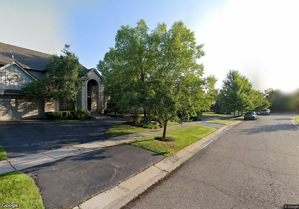
5034 Village Commons Dr West Bloomfield, MI 48322
Estimated Value: $587,153 - $684,000
4
Beds
3
Baths
3,402
Sq Ft
$184/Sq Ft
Est. Value
About This Home
This home is located at 5034 Village Commons Dr, West Bloomfield, MI 48322 and is currently estimated at $626,538, approximately $184 per square foot. 5034 Village Commons Dr is a home located in Oakland County with nearby schools including Sheiko Elementary School, West Bloomfield Middle School, and Maria Montessori Center.
Ownership History
Date
Name
Owned For
Owner Type
Purchase Details
Closed on
May 11, 2022
Sold by
Sabri Aisha A
Bought by
Abbas Fahad and Azam Alsha Ihsan
Current Estimated Value
Home Financials for this Owner
Home Financials are based on the most recent Mortgage that was taken out on this home.
Original Mortgage
$392,000
Outstanding Balance
$324,713
Interest Rate
4.17%
Mortgage Type
New Conventional
Estimated Equity
$301,825
Purchase Details
Closed on
Jul 14, 2017
Sold by
Sabri Sabir H
Bought by
Sabri Aisha A
Home Financials for this Owner
Home Financials are based on the most recent Mortgage that was taken out on this home.
Original Mortgage
$190,000
Interest Rate
3.89%
Mortgage Type
New Conventional
Purchase Details
Closed on
Mar 5, 1999
Sold by
Village Square Ltd Ptr
Bought by
Simwood Company
Create a Home Valuation Report for This Property
The Home Valuation Report is an in-depth analysis detailing your home's value as well as a comparison with similar homes in the area
Home Values in the Area
Average Home Value in this Area
Purchase History
| Date | Buyer | Sale Price | Title Company |
|---|---|---|---|
| Abbas Fahad | $490,000 | Vanguard Title | |
| Sabri Aisha A | -- | None Available | |
| Simwood Company | -- | -- |
Source: Public Records
Mortgage History
| Date | Status | Borrower | Loan Amount |
|---|---|---|---|
| Open | Abbas Fahad | $392,000 | |
| Previous Owner | Sabri Aisha A | $190,000 |
Source: Public Records
Tax History Compared to Growth
Tax History
| Year | Tax Paid | Tax Assessment Tax Assessment Total Assessment is a certain percentage of the fair market value that is determined by local assessors to be the total taxable value of land and additions on the property. | Land | Improvement |
|---|---|---|---|---|
| 2024 | $6,049 | $255,710 | $0 | $0 |
| 2022 | $5,508 | $217,740 | $25,530 | $192,210 |
| 2021 | $6,802 | $211,430 | $0 | $0 |
| 2020 | $4,546 | $199,350 | $25,530 | $173,820 |
| 2018 | $6,779 | $187,910 | $25,530 | $162,380 |
| 2015 | -- | $184,910 | $0 | $0 |
| 2014 | -- | $173,140 | $0 | $0 |
| 2011 | -- | $158,760 | $0 | $0 |
Source: Public Records
Map
Nearby Homes
- Lot 110 W 14 Mile Rd
- 7277 Simsbury Dr
- 7288 Simsbury Dr Unit 24
- 31009 Heritage Hills Dr
- 7663 Danbury Cir
- 30935 Perrys Crossing
- 31017 Carriage Hill Rd
- 7006 Bridge Way
- 7273 Creeks Bend Ct Unit 88
- 7159 Creeks Crossing Unit 47
- 7208 Creeks Bend Dr Unit 77
- 31079 Oak Valley Dr
- 7118 Pebble Park Dr
- 7406 Pebble Point
- 7411 Pebble Point Unit 20
- 7187 Pebble Park Dr
- 7103 Pebble Park Dr
- 7114 Pebble Park Dr
- 7494 Pebble Ln Unit 118
- 7345 Verona Dr
- 5026 Village Commons Dr
- 5042 Village Commons Dr
- 5023 Village Square Cir
- 5020 Village Square Cir
- 5018 Village Commons Dr
- 7434 Village Square Dr
- 5050 Village Commons Dr
- 5029 Village Commons Dr
- 5037 Village Commons Dr
- 5031 Village Square Cir
- 7426 Village Square Dr
- 5028 Village Square Cir
- 5010 Village Commons Dr
- 5019 Silverwood Ct
- 5045 Village Commons Dr
- 5021 Village Commons Dr
- 5039 Village Square Cir
- 5013 Village Commons Dr
- 5017 Village Commons Dr
- 5017 Village