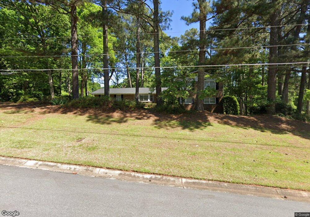
5036 Mountclaire Rd Stone Mountain, GA 30087
Estimated Value: $507,000 - $565,000
4
Beds
3
Baths
2,978
Sq Ft
$178/Sq Ft
Est. Value
About This Home
This home is located at 5036 Mountclaire Rd, Stone Mountain, GA 30087 and is currently estimated at $530,657, approximately $178 per square foot. 5036 Mountclaire Rd is a home located in DeKalb County with nearby schools including Smoke Rise Elementary School, Tucker Middle School, and Tucker High School.
Ownership History
Date
Name
Owned For
Owner Type
Purchase Details
Closed on
Apr 20, 1999
Sold by
Jaugstetter John K
Bought by
Jaugstetter John K and Jaugstetter Kandy
Current Estimated Value
Home Financials for this Owner
Home Financials are based on the most recent Mortgage that was taken out on this home.
Original Mortgage
$135,100
Outstanding Balance
$34,267
Interest Rate
7.06%
Mortgage Type
New Conventional
Estimated Equity
$496,390
Purchase Details
Closed on
Oct 14, 1994
Sold by
Dunn Robert D
Bought by
Prince Michael J
Home Financials for this Owner
Home Financials are based on the most recent Mortgage that was taken out on this home.
Original Mortgage
$105,000
Interest Rate
8.48%
Create a Home Valuation Report for This Property
The Home Valuation Report is an in-depth analysis detailing your home's value as well as a comparison with similar homes in the area
Home Values in the Area
Average Home Value in this Area
Purchase History
| Date | Buyer | Sale Price | Title Company |
|---|---|---|---|
| Jaugstetter John K | -- | -- | |
| Jaugstetter John K | $193,000 | -- | |
| Prince Michael J | $153,500 | -- |
Source: Public Records
Mortgage History
| Date | Status | Borrower | Loan Amount |
|---|---|---|---|
| Open | Jaugstetter John K | $135,100 | |
| Previous Owner | Prince Michael J | $105,000 |
Source: Public Records
Tax History Compared to Growth
Tax History
| Year | Tax Paid | Tax Assessment Tax Assessment Total Assessment is a certain percentage of the fair market value that is determined by local assessors to be the total taxable value of land and additions on the property. | Land | Improvement |
|---|---|---|---|---|
| 2025 | $5,196 | $173,720 | $36,800 | $136,920 |
| 2024 | $5,125 | $166,160 | $36,800 | $129,360 |
| 2023 | $5,125 | $134,960 | $36,800 | $98,160 |
| 2022 | $3,965 | $120,360 | $35,440 | $84,920 |
| 2021 | $3,519 | $100,040 | $25,000 | $75,040 |
| 2020 | $3,793 | $112,240 | $17,920 | $94,320 |
| 2019 | $4,082 | $126,680 | $17,920 | $108,760 |
| 2018 | $3,317 | $114,040 | $17,920 | $96,120 |
| 2017 | $3,767 | $105,480 | $17,920 | $87,560 |
| 2016 | $3,018 | $85,800 | $17,920 | $67,880 |
| 2014 | $2,192 | $62,240 | $17,800 | $44,440 |
Source: Public Records
Map
Nearby Homes
- 4956 Mountclaire Rd
- 2174 Deer Ridge Dr
- 4999 Antebellum Dr
- 5169 Oxbow Rd
- 4924 Hugh Howell Rd
- 2207 Forestglade Dr
- 4891 Forestglade Ct Unit 6
- 5211 Hugh Howell Rd
- 2037 Stoneleigh Dr
- 2023 Stoneleigh Dr
- 1887 Chedworth Ct
- 2350 Oxbow Cir
- 5363 Rosser Rd
- 5401 Smoke Rise Dr
- 127 Roe Hampton Ln
- 1722 Kanawha Trail
- 164 Thorncrest Ct
- 2298 Mccurdy Rd
- 5037 Mountclaire Rd
- 5020 Mountclaire Rd
- 0 Mountclaire Rd NE
- 2289 Mccurdy Rd
- 5019 Mountclaire Rd
- 5057 Hugh Howell Rd
- 5041 Hugh Howell Rd
- 2279 Mccurdy Rd
- 2288 Mccurdy Rd
- 5029 Hugh Howell Rd
- 5004 Mountclaire Rd
- 2299 Mccurdy Rd
- 5003 Mountclaire Rd
- 2882 Mccurdy Rd
- 2269 Mccurdy Rd
- 5015 Hugh Howell Rd
- 2278 Mccurdy Rd
- 4988 Mountclaire Rd
- 5023 Forestglade Ct