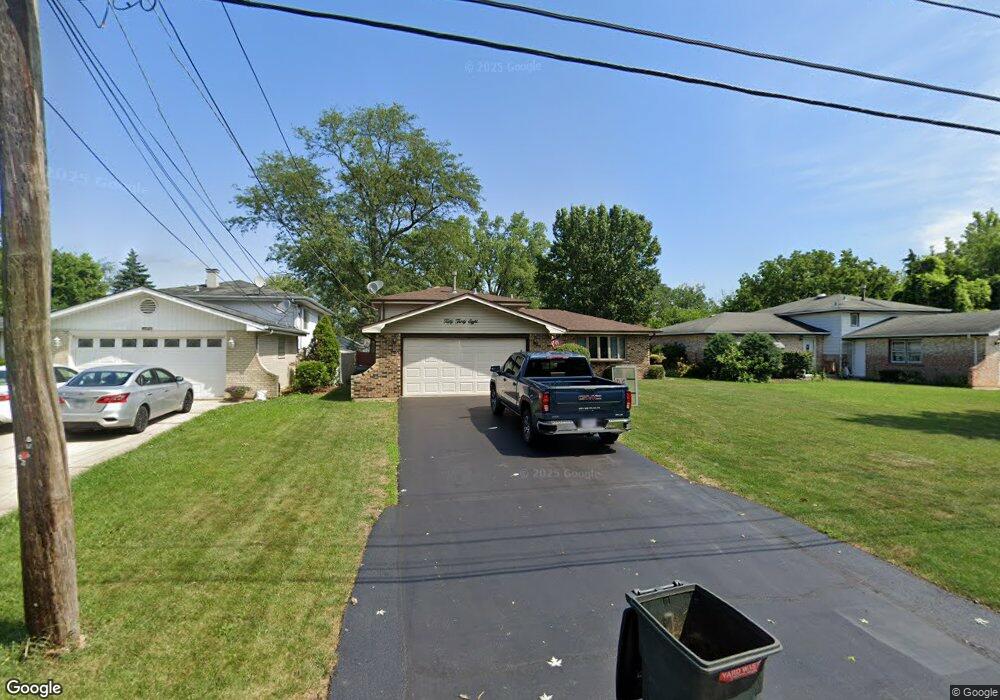
5038 157th St Oak Forest, IL 60452
Estimated Value: $292,000 - $376,000
3
Beds
2
Baths
1,375
Sq Ft
$233/Sq Ft
Est. Value
About This Home
This home is located at 5038 157th St, Oak Forest, IL 60452 and is currently estimated at $320,595, approximately $233 per square foot. 5038 157th St is a home located in Cook County with nearby schools including Kimberly Heights Elementary School, Scarlet Oak Elementary School, and Arbor Park Middle School.
Ownership History
Date
Name
Owned For
Owner Type
Purchase Details
Closed on
Jun 18, 2007
Sold by
Sosnowski Brian S and Sosnowski Terri L
Bought by
Sosnowski Brian S and Sosnowski Terri L
Current Estimated Value
Purchase Details
Closed on
Sep 19, 2001
Sold by
Racine Joseph R and Racine Gail A
Bought by
Sosnowski Brian S and Caponigro Terri L
Home Financials for this Owner
Home Financials are based on the most recent Mortgage that was taken out on this home.
Original Mortgage
$153,900
Outstanding Balance
$60,319
Interest Rate
7.06%
Estimated Equity
$260,276
Create a Home Valuation Report for This Property
The Home Valuation Report is an in-depth analysis detailing your home's value as well as a comparison with similar homes in the area
Home Values in the Area
Average Home Value in this Area
Purchase History
| Date | Buyer | Sale Price | Title Company |
|---|---|---|---|
| Sosnowski Brian S | -- | None Available | |
| Sosnowski Brian S | $162,000 | -- |
Source: Public Records
Mortgage History
| Date | Status | Borrower | Loan Amount |
|---|---|---|---|
| Open | Sosnowski Brian S | $153,900 |
Source: Public Records
Tax History Compared to Growth
Tax History
| Year | Tax Paid | Tax Assessment Tax Assessment Total Assessment is a certain percentage of the fair market value that is determined by local assessors to be the total taxable value of land and additions on the property. | Land | Improvement |
|---|---|---|---|---|
| 2024 | $7,842 | $25,000 | $2,880 | $22,120 |
| 2023 | $5,904 | $25,000 | $2,880 | $22,120 |
| 2022 | $5,904 | $16,095 | $2,520 | $13,575 |
| 2021 | $5,799 | $16,094 | $2,520 | $13,574 |
| 2020 | $5,691 | $16,094 | $2,520 | $13,574 |
| 2019 | $5,582 | $15,870 | $2,340 | $13,530 |
| 2018 | $5,457 | $15,870 | $2,340 | $13,530 |
| 2017 | $5,458 | $15,870 | $2,340 | $13,530 |
| 2016 | $5,512 | $14,644 | $1,980 | $12,664 |
| 2015 | $5,893 | $15,991 | $1,980 | $14,011 |
| 2014 | $5,771 | $15,991 | $1,980 | $14,011 |
| 2013 | $5,318 | $16,514 | $1,980 | $14,534 |
Source: Public Records
Map
Nearby Homes
- 5028 156th St
- 15641 Laramie Ave
- 15601 Latrobe Ave
- 15804 Laramie Ave Unit 4
- 5008 155th St
- 17301 Lockwood Ave
- 5310 159th St
- 5117 154th St
- 5237 Diamond Dr Unit B
- 5137 160th St
- 15240 S Cicero Ave
- 15921 Long Ave
- 5140 Shadow Creek Dr Unit 1
- 5150 Shadow Creek Dr Unit 4
- 5218 Laramie Ct
- 15240 Laporte Ave
- 16352 169 Lot #15 Place
- 16352 169 Lot #13 Place
- 16352 169 Lot #14 Place
- 16352 Place
- 5034 157th St
- 5042 157th St
- 15633 Le Claire Ave
- 5028 157th St
- 5031 157th St
- 15627 Le Claire Ave
- 5037 157th St
- 5029 157th St
- 15623 Le Claire Ave
- 5100 157th St
- 5025 157th St
- 5020 157th St
- 15707 Leclaire Ave
- 15619 Le Claire Ave
- 15707 Le Claire Ave
- 5021 157th St
- 15700 Le Claire Ave
- 5112 157th St
- 5012 157th St