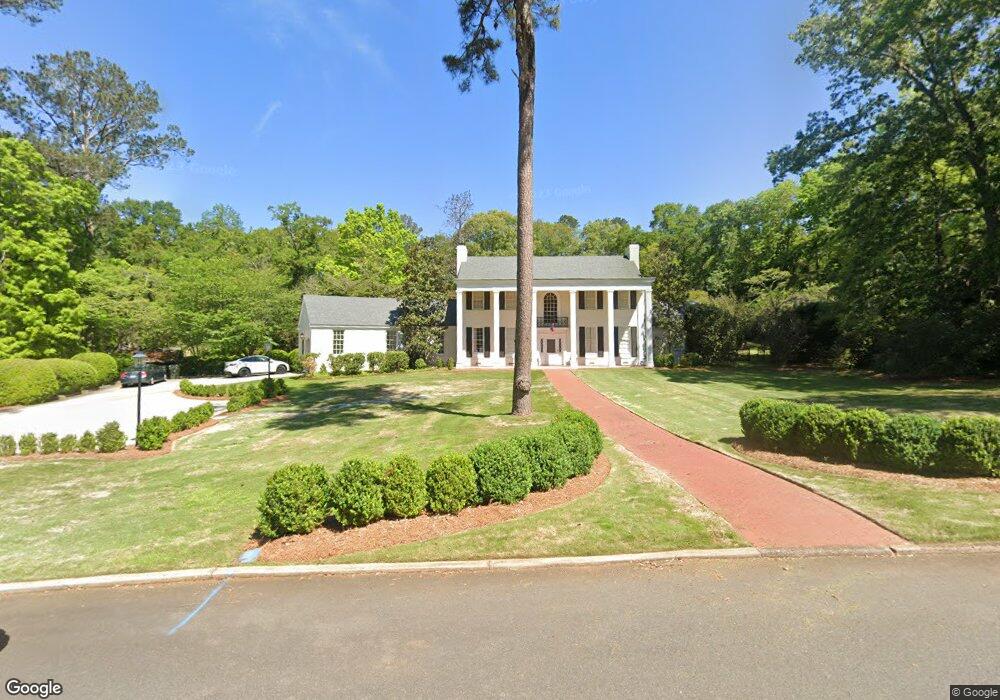
504 Avalon Rd Thomaston, GA 30286
Estimated Value: $369,000 - $534,871
4
Beds
4
Baths
4,041
Sq Ft
$117/Sq Ft
Est. Value
About This Home
This home is located at 504 Avalon Rd, Thomaston, GA 30286 and is currently estimated at $473,968, approximately $117 per square foot. 504 Avalon Rd is a home located in Upson County with nearby schools including Upson-Lee South Elementary School, Upson-Lee North Elementary School, and Upson-Lee Middle School.
Ownership History
Date
Name
Owned For
Owner Type
Purchase Details
Closed on
Dec 13, 2023
Sold by
Deen Jessica J
Bought by
Deen Jessica J Trust and Deen Jessica J Tr
Current Estimated Value
Purchase Details
Closed on
May 6, 2005
Sold by
Hightower George H
Bought by
Deen Kenneth Murray and Deen Jessica S
Home Financials for this Owner
Home Financials are based on the most recent Mortgage that was taken out on this home.
Original Mortgage
$220,000
Interest Rate
5.88%
Mortgage Type
New Conventional
Create a Home Valuation Report for This Property
The Home Valuation Report is an in-depth analysis detailing your home's value as well as a comparison with similar homes in the area
Home Values in the Area
Average Home Value in this Area
Purchase History
| Date | Buyer | Sale Price | Title Company |
|---|---|---|---|
| Deen Jessica J Trust | -- | -- | |
| Deen Kenneth Murray | $275,000 | -- |
Source: Public Records
Mortgage History
| Date | Status | Borrower | Loan Amount |
|---|---|---|---|
| Previous Owner | Deen Kenneth Murray | $220,000 |
Source: Public Records
Tax History Compared to Growth
Tax History
| Year | Tax Paid | Tax Assessment Tax Assessment Total Assessment is a certain percentage of the fair market value that is determined by local assessors to be the total taxable value of land and additions on the property. | Land | Improvement |
|---|---|---|---|---|
| 2024 | $5,631 | $191,537 | $36,375 | $155,162 |
| 2023 | $5,631 | $191,537 | $37,299 | $154,238 |
| 2022 | $4,781 | $173,416 | $37,299 | $136,117 |
| 2021 | $4,495 | $159,175 | $30,656 | $128,519 |
| 2020 | $4,300 | $142,620 | $20,438 | $122,182 |
| 2019 | $4,333 | $137,912 | $20,438 | $117,474 |
| 2018 | $4,216 | $134,120 | $20,438 | $113,682 |
| 2017 | $4,403 | $127,403 | $15,328 | $112,075 |
| 2016 | $3,821 | $108,906 | $16,620 | $92,286 |
| 2015 | $3,745 | $107,614 | $15,328 | $92,286 |
| 2014 | $3,707 | $106,334 | $15,328 | $91,006 |
Source: Public Records
Map
Nearby Homes
- 404 Thurston Ave
- 622 S Green St
- 422 Jackson Ave
- 710 Avalon Rd
- 105 Upson Ave
- 710 Hill St
- 417 Howell St
- 120 Glenview Way Unit LOT 15
- 314 Cherokee Rd
- 209 Upson Ave
- 328 S Green St
- 313 Johnston Dr
- 720 S Church St
- 105 Slayden Dr
- 400 S Center St
- 0 Veterans Dr Unit 10303890
- 100 Hightower Rd
- 309 W Thompson St
- 107 Shasta Dr
- 206 Charles Ave
- 505 Avalon Rd
- 414 Thurston Ave
- 500 Thurston Ave
- 0 Logtown Rd Kendall Dr Unit 7206983
- 0 Joe White Unit 7479877
- 6455 Highway 74 W
- 0 Joe White Unit 7479835
- 0 Joe White Unit 7479865
- 510 Avalon Rd
- 509 Avalon Rd
- 412 Thurston Ave
- 408 Thurston Ave
- 625 Kingston Rd
- 701 Avalon Rd
- 627 Kingston Rd
- 602 Thurston Ave
- 507 Thurston Ave
- 501 Thurston Ave
- 703 Avalon Rd
- 702 Avalon Rd