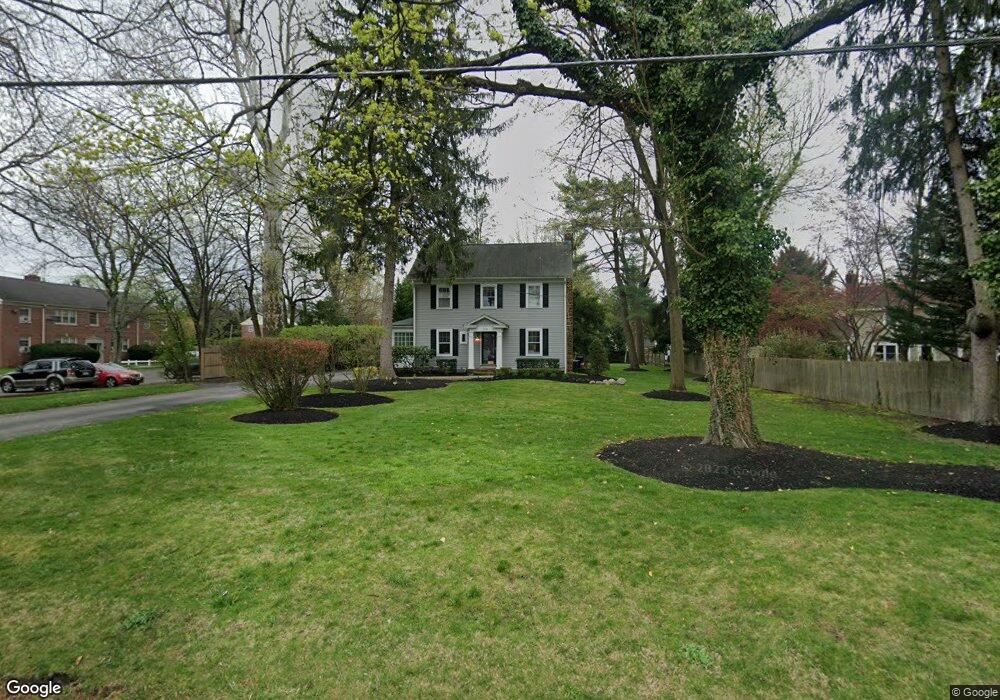
504 E Camden Ave Moorestown, NJ 08057
Estimated Value: $606,772 - $787,000
Studio
--
Bath
2,233
Sq Ft
$322/Sq Ft
Est. Value
About This Home
This home is located at 504 E Camden Ave, Moorestown, NJ 08057 and is currently estimated at $719,193, approximately $322 per square foot. 504 E Camden Ave is a home located in Burlington County with nearby schools including Mary E. Roberts Elementary School, Moorestown Upper Elementary School, and William Allen Middle School.
Ownership History
Date
Name
Owned For
Owner Type
Purchase Details
Closed on
Jul 14, 1994
Sold by
Zeuch Robert N and Zeuch Carolyn M
Bought by
Lucidi Gerard J and Lucidi Melissa L
Current Estimated Value
Create a Home Valuation Report for This Property
The Home Valuation Report is an in-depth analysis detailing your home's value as well as a comparison with similar homes in the area
Home Values in the Area
Average Home Value in this Area
Purchase History
| Date | Buyer | Sale Price | Title Company |
|---|---|---|---|
| Lucidi Gerard J | $222,500 | -- |
Source: Public Records
Tax History
| Year | Tax Paid | Tax Assessment Tax Assessment Total Assessment is a certain percentage of the fair market value that is determined by local assessors to be the total taxable value of land and additions on the property. | Land | Improvement |
|---|---|---|---|---|
| 2025 | $9,887 | $348,500 | $169,600 | $178,900 |
| 2024 | $9,587 | $348,500 | $169,600 | $178,900 |
| 2023 | $9,587 | $348,500 | $169,600 | $178,900 |
| 2022 | $9,490 | $348,500 | $169,600 | $178,900 |
| 2021 | $9,364 | $348,500 | $169,600 | $178,900 |
| 2020 | $9,305 | $348,500 | $169,600 | $178,900 |
| 2019 | $9,141 | $348,500 | $169,600 | $178,900 |
| 2018 | $8,894 | $348,500 | $169,600 | $178,900 |
| 2017 | $8,970 | $348,500 | $169,600 | $178,900 |
| 2016 | $8,939 | $348,500 | $169,600 | $178,900 |
| 2015 | $8,831 | $348,500 | $169,600 | $178,900 |
| 2014 | $8,385 | $334,000 | $169,600 | $164,400 |
Source: Public Records
Map
Nearby Homes
- 15 Circle Dr
- 531 Covington Terrace
- 601 Stratford Dr
- 401 W 3rd St
- 444 Shady Ln
- 206 E Camden Ave
- 316 Farmdale Rd
- 308 Farmdale Rd
- 44 Eraser Rd
- 311 Highland Ave
- 149 Chalkboard Ct
- 20 -22 New Albany Rd
- 117 Domenica Dr
- 33 Vincent Way
- 9 N Lenola Rd
- 543 Bethel Ave
- 21 N Lenola Rd
- 15 W Close Unit 15
- 11 Errickson Ave
- 8 S Close Unit 8
- 3 Circle Dr
- 5 Circle Dr
- 7 Circle Dr
- 9 Circle Dr
- 501 E Camden Ave
- 501A E Camden Ave
- 503 E Camden Ave Unit A
- 503 E Camden Ave
- 450 E Camden Ave
- 512 E Camden Ave
- 10 Circle Dr
- 11 Circle Dr
- 505 E Camden Ave
- 448 E Camden Ave
- 12 Circle Dr
- 8 Circle Dr
- 469 E Camden Ave
- 507 E Camden Ave
- 586 E Camden Ave
- 106 Flynn Ave