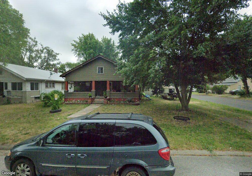
504 E Wood St Brookfield, MO 64628
Estimated Value: $85,000 - $104,000
2
Beds
1
Bath
1,164
Sq Ft
$81/Sq Ft
Est. Value
About This Home
This home is located at 504 E Wood St, Brookfield, MO 64628 and is currently estimated at $94,039, approximately $80 per square foot. 504 E Wood St is a home with nearby schools including Brookfield Elementary School, Brookfield Middle School, and Brookfield High School.
Ownership History
Date
Name
Owned For
Owner Type
Purchase Details
Closed on
Oct 2, 2017
Sold by
Head Charles K
Bought by
Mccune Angela and Guilford Ralph
Current Estimated Value
Home Financials for this Owner
Home Financials are based on the most recent Mortgage that was taken out on this home.
Original Mortgage
$22,950
Outstanding Balance
$12,244
Interest Rate
3.89%
Mortgage Type
New Conventional
Estimated Equity
$81,795
Purchase Details
Closed on
Feb 9, 2006
Bought by
Head Charles K and Palmer Crystal
Create a Home Valuation Report for This Property
The Home Valuation Report is an in-depth analysis detailing your home's value as well as a comparison with similar homes in the area
Home Values in the Area
Average Home Value in this Area
Purchase History
| Date | Buyer | Sale Price | Title Company |
|---|---|---|---|
| Mccune Angela | $28,687 | Professional Land Title Co | |
| Head Charles K | $31,500 | -- |
Source: Public Records
Mortgage History
| Date | Status | Borrower | Loan Amount |
|---|---|---|---|
| Open | Mccune Angela | $22,950 |
Source: Public Records
Tax History
| Year | Tax Paid | Tax Assessment Tax Assessment Total Assessment is a certain percentage of the fair market value that is determined by local assessors to be the total taxable value of land and additions on the property. | Land | Improvement |
|---|---|---|---|---|
| 2025 | -- | $5,491 | $1,121 | $4,370 |
| 2024 | $3 | $5,282 | $1,121 | $4,161 |
| 2023 | $330 | $5,282 | $1,121 | $4,161 |
| 2022 | $305 | $4,864 | $1,121 | $3,743 |
| 2021 | $0 | $4,864 | $1,121 | $3,743 |
| 2020 | $305 | $4,864 | $1,121 | $3,743 |
| 2019 | $305 | $4,864 | $1,121 | $3,743 |
| 2018 | $309 | $4,940 | $1,121 | $3,819 |
| 2015 | -- | $5,111 | $1,121 | $3,990 |
| 2011 | -- | $26,900 | $5,100 | $21,800 |
Source: Public Records
Map
Nearby Homes
Your Personal Tour Guide
Ask me questions while you tour the home.