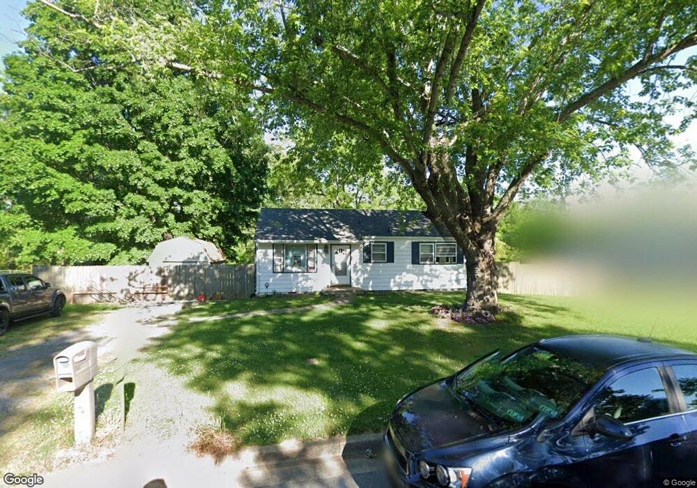
504 High Point Rd Clarksville, TN 37042
Estimated Value: $151,000 - $186,977
Studio
1
Bath
950
Sq Ft
$171/Sq Ft
Est. Value
About This Home
This home is located at 504 High Point Rd, Clarksville, TN 37042 and is currently estimated at $162,494, approximately $171 per square foot. 504 High Point Rd is a home located in Montgomery County with nearby schools including Liberty Elementary School, New Providence Middle School, and Northwest High School.
Ownership History
Date
Name
Owned For
Owner Type
Purchase Details
Closed on
Sep 28, 2012
Sold by
Drugmand Louis A
Bought by
Wieczorek Betty M
Current Estimated Value
Home Financials for this Owner
Home Financials are based on the most recent Mortgage that was taken out on this home.
Original Mortgage
$66,276
Outstanding Balance
$44,882
Interest Rate
3.5%
Mortgage Type
FHA
Estimated Equity
$117,612
Purchase Details
Closed on
Apr 15, 2004
Sold by
Douglas Pectol
Bought by
Drugmand Louis A
Purchase Details
Closed on
Apr 12, 2004
Sold by
Douglas Pectol
Bought by
Drugmand Louis A
Create a Home Valuation Report for This Property
The Home Valuation Report is an in-depth analysis detailing your home's value as well as a comparison with similar homes in the area
Purchase History
| Date | Buyer | Sale Price | Title Company |
|---|---|---|---|
| Wieczorek Betty M | $67,500 | -- | |
| Drugmand Louis A | $50,000 | -- | |
| Drugmand Louis A | $50,000 | -- |
Source: Public Records
Mortgage History
| Date | Status | Borrower | Loan Amount |
|---|---|---|---|
| Open | Wieczorek Betty M | $66,276 |
Source: Public Records
Tax History
| Year | Tax Paid | Tax Assessment Tax Assessment Total Assessment is a certain percentage of the fair market value that is determined by local assessors to be the total taxable value of land and additions on the property. | Land | Improvement |
|---|---|---|---|---|
| 2024 | $1,100 | $36,450 | $0 | $0 |
| 2023 | $1,086 | $20,375 | $0 | $0 |
| 2022 | $860 | $20,375 | $0 | $0 |
| 2021 | $860 | $19,850 | $0 | $0 |
| 2020 | $798 | $19,850 | $0 | $0 |
| 2019 | $798 | $19,850 | $0 | $0 |
| 2018 | $755 | $12,675 | $0 | $0 |
| 2017 | $217 | $17,525 | $0 | $0 |
| 2016 | $538 | $17,525 | $0 | $0 |
| 2015 | $739 | $17,525 | $0 | $0 |
| 2014 | $729 | $17,525 | $0 | $0 |
| 2013 | $609 | $13,900 | $0 | $0 |
Source: Public Records
Map
Nearby Homes
- 173 Kentucky Ave
- 2015 Rosemary Dr
- 2079 Skyview Cir
- 577 Skyview Cir
- 583 Orman Dr
- 534 Dover Rd
- 586 Somerset Ln
- 617 Linda Ln
- 512 Aspen Dr
- 573 Somerset Ln
- 572 Cabot Cove
- 503 Aurelia Lynn Dr
- 579 Magnolia Dr
- 1 Dotsonville Rd
- 473 Woodtrace Dr
- 669 Wolfchase Ct
- 456 Woodtrace Dr
- 116 Woodtrace Ct
- 513 Aurelia Lynn Dr
- 664 Deer Ridge Dr
- 502 High Point Rd
- 506 High Point Rd
- 454 High Point Rd
- 508 High Point Rd
- 505 High Point Rd
- 503 High Point Rd
- 507 High Point Rd
- 2027 Laura Dr
- 501 High Point Rd
- 2026 Laura Dr
- 601 High Point Rd
- 2033 Laura Dr
- 501 Alabama Ave
- 620 High Point Rd
- 506 Kenney Dr
- 600 High Point Rd
- 508 Kenney Dr
- 2028 Laura Dr
- 504 Kenney Dr
- 2035 Laura Dr
Your Personal Tour Guide
Ask me questions while you tour the home.