
Seller's Agent in 2025
Stephanie Basile
Serhant Rhode Island
(401) 465-3975
14 in this area
229 Total Sales
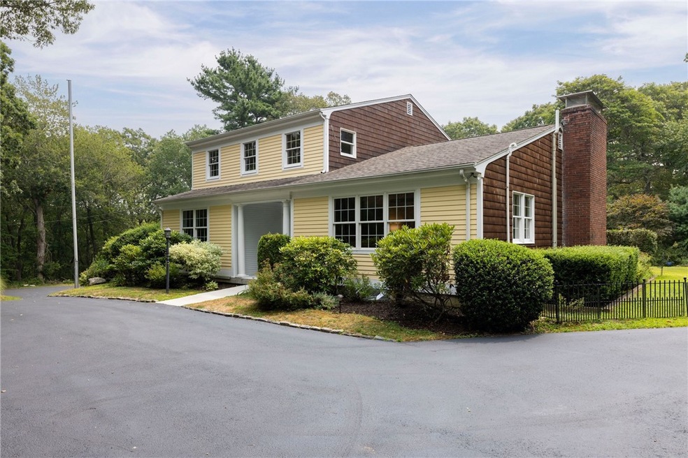
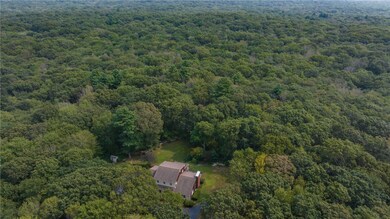
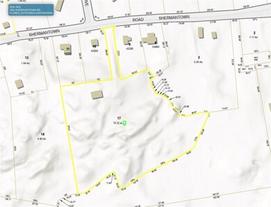
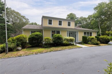
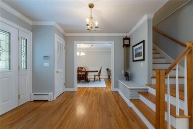
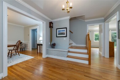
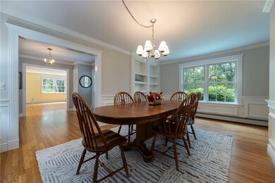
Discover your private oasis in Saunderstown, set on 10+ acres of serene land. This 5-bed, 3-bath home - located across from Quail Hollow and adjacent to Smith's Berry Farm - offers tranquility and community charm. Enjoy easy access to Rt 1, area beaches, dining, and a top-tier school system, with a quick drive to the commuter rail & airport. Inside you will find a fantastic layout and hardwood floors that span the generous rooms. The family room features a cozy wood-burning fireplace with an exposed brick wall. The open kitchen and dining area connect seamlessly to the living room, ideal for gatherings. Additional spaces include a formal living room, a beautiful dining room with built-in shelving and quiet sunroom with fabulous views. The first-floor primary suite provides privacy and convenience, and easy access to the laundry room, while the second floor offers four more bedrooms and a full bath. The fully finished basement offers versatility as a rec room or home office. Explore ADU possibilities on this expansive property, perfect for a private compound. Both the 5-bed septic system and the well have been inspected and passed -reports available. Recent updates include a re-sealed driveway, newer chimney cap, 200A electrical service & fresh interior paint. Thoughtful clearing of the land allows for quiet enjoyment yet space to do so much. It is like owning your own private nature preserve in an amazing location that cannot be beat. A truly unique and stunning property.
| Date | Type | Sale Price | Title Company |
|---|---|---|---|
| Warranty Deed | $890,000 | -- | |
| Deed | $330,000 | -- |
| Date | Status | Loan Amount | Loan Type |
|---|---|---|---|
| Open | $623,000 | New Conventional | |
| Previous Owner | $75,000 | No Value Available | |
| Previous Owner | $322,700 | No Value Available | |
| Previous Owner | $264,000 | Purchase Money Mortgage |
| Date | Event | Price | List to Sale | Price per Sq Ft |
|---|---|---|---|---|
| 09/25/2025 09/25/25 | Sold | $890,000 | -1.1% | $255 / Sq Ft |
| 09/03/2025 09/03/25 | Pending | -- | -- | -- |
| 08/12/2025 08/12/25 | For Sale | $899,999 | -- | $258 / Sq Ft |
| Year | Tax Paid | Tax Assessment Tax Assessment Total Assessment is a certain percentage of the fair market value that is determined by local assessors to be the total taxable value of land and additions on the property. | Land | Improvement |
|---|---|---|---|---|
| 2025 | $9,261 | $838,900 | $421,000 | $417,900 |
| 2024 | $8,575 | $598,000 | $291,300 | $306,700 |
| 2023 | $8,575 | $598,000 | $291,300 | $306,700 |
| 2022 | $8,408 | $598,000 | $291,300 | $306,700 |
| 2021 | $8,516 | $486,600 | $218,600 | $268,000 |
| 2020 | $8,316 | $486,600 | $218,600 | $268,000 |
| 2019 | $8,316 | $486,600 | $218,600 | $268,000 |
| 2018 | $8,345 | $439,900 | $204,000 | $235,900 |
| 2017 | $8,178 | $439,900 | $204,000 | $235,900 |
| 2016 | $7,945 | $439,900 | $204,000 | $235,900 |
| 2015 | $7,982 | $413,600 | $204,000 | $209,600 |
| 2014 | $7,821 | $413,600 | $204,000 | $209,600 |
Seller's Agent in 2025
Stephanie Basile
Serhant Rhode Island
(401) 465-3975
14 in this area
229 Total Sales
Buyer's Agent in 2025
Hanne Leblanc
Keller Williams Coastal
(401) 241-6306
1 in this area
38 Total Sales
Source: State-Wide MLS
MLS Number: 1391810
APN: NKIN-000025-000017
Disclaimer: Certain information contained herein is derived from information provided by parties other than Homes.com. All information provided is deemed reliable, but is not guaranteed to be accurate and should be independently verified.
![]() IDX information is provided exclusively for personal, non-commercial use, and may not be used for any purpose other than to identify prospective properties consumers may be interested in purchasing. Information is deemed reliable but not guaranteed.
IDX information is provided exclusively for personal, non-commercial use, and may not be used for any purpose other than to identify prospective properties consumers may be interested in purchasing. Information is deemed reliable but not guaranteed.
Copyright © 2025 State-Wide MLS, Inc. All rights reserved.