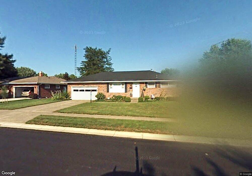
5042 Stoneridge Dr Springfield, OH 45503
Estimated Value: $240,233 - $286,000
3
Beds
2
Baths
1,611
Sq Ft
$167/Sq Ft
Est. Value
About This Home
This home is located at 5042 Stoneridge Dr, Springfield, OH 45503 and is currently estimated at $269,058, approximately $167 per square foot. 5042 Stoneridge Dr is a home located in Clark County with nearby schools including Rolling Hills Elementary School, Northridge Elementary School, and Northridge Middle School.
Ownership History
Date
Name
Owned For
Owner Type
Purchase Details
Closed on
Jun 29, 2015
Sold by
Reser Eileen A
Bought by
Williams Sean N
Current Estimated Value
Home Financials for this Owner
Home Financials are based on the most recent Mortgage that was taken out on this home.
Original Mortgage
$118,000
Outstanding Balance
$91,881
Interest Rate
3.82%
Mortgage Type
New Conventional
Estimated Equity
$177,177
Create a Home Valuation Report for This Property
The Home Valuation Report is an in-depth analysis detailing your home's value as well as a comparison with similar homes in the area
Home Values in the Area
Average Home Value in this Area
Purchase History
| Date | Buyer | Sale Price | Title Company |
|---|---|---|---|
| Williams Sean N | $126,000 | Attorney |
Source: Public Records
Mortgage History
| Date | Status | Borrower | Loan Amount |
|---|---|---|---|
| Open | Williams Sean N | $118,000 |
Source: Public Records
Tax History Compared to Growth
Tax History
| Year | Tax Paid | Tax Assessment Tax Assessment Total Assessment is a certain percentage of the fair market value that is determined by local assessors to be the total taxable value of land and additions on the property. | Land | Improvement |
|---|---|---|---|---|
| 2024 | $2,219 | $52,480 | $11,060 | $41,420 |
| 2023 | $2,219 | $52,480 | $11,060 | $41,420 |
| 2022 | $2,228 | $52,480 | $11,060 | $41,420 |
| 2021 | $2,392 | $47,760 | $8,710 | $39,050 |
| 2020 | $2,395 | $47,760 | $8,710 | $39,050 |
| 2019 | $2,440 | $47,760 | $8,710 | $39,050 |
| 2018 | $2,244 | $42,170 | $9,680 | $32,490 |
| 2017 | $1,923 | $42,165 | $9,678 | $32,487 |
| 2016 | $1,910 | $42,165 | $9,678 | $32,487 |
| 2015 | $1,460 | $42,165 | $9,678 | $32,487 |
| 2014 | $1,460 | $42,165 | $9,678 | $32,487 |
| 2013 | $1,426 | $42,165 | $9,678 | $32,487 |
Source: Public Records
Map
Nearby Homes
- 5127 Stoneridge Dr
- 5220 Ridgewood Rd E
- 5249 Taywell Dr
- 1709 Thomas Dr
- 4740 Merrimont Ave
- 4849 Ashley Dr
- 4622 W Ridgewood Rd
- 4712 Cullen Ave
- 4512 Ridgewood Rd E
- 4620 Eldora St
- 4620 Eldora Dr
- 4446 Ridgewood Rd E Unit 3
- 4438 Tacoma St
- 1461 Student Ave
- 880 Brendle Trace Unit 28
- 4644 Middle Urbana Rd
- 916 Sawmill Ct
- 970 Forest Edge Ave
- Pendleton Plan at Liberty Place
- Holcombe Plan at Liberty Place
- 5032 Stoneridge Dr
- 5046 Stoneridge Dr
- 5025 Ridgewood Rd E
- 5021 Ridgewood Rd E
- 5033 Ridgewood Rd E
- 5018 Stoneridge Dr
- 5114 Stoneridge Dr
- 5037 Stoneridge Dr
- 5043 Stoneridge Dr
- 5029 Stoneridge Dr
- 5016 Stoneridge Dr
- 5107 Ridgewood Rd E
- 5111 Stoneridge Dr
- 5122 Stoneridge Dr
- 5021 Stoneridge Dr
- 5113 Ridgewood Rd E
- 5015 Stoneridge Dr
- 5119 Stoneridge Dr
- 1440 Midland Place
- 5024 Ridgewood Rd E